
| 
| |
|
|
This page contains photographs of British Columbia's Highway 97 (Okanagan Highway), arranged by location from Penticton
northerly to Kelowna. All photographs displayed on this page were taken by the Webmaster (Cameron Bevers). To view photos of other British Columbia Highways, please
select a highway number listed on the British Columbia Photograph Index Page. Click on any
thumbnail to see a larger image!
Please note that all photographs displayed on this website are protected by copyright. These photographs must not be
reproduced, published, electronically stored or copied, distributed, or posted onto other websites without my written permission. If you want to use photos from this
website, please email me first for permission. Thank-you!
|
|---|
|
Page 2: BC Highway 97 (Okanagan Highway) Photographs: Penticton to Kelowna
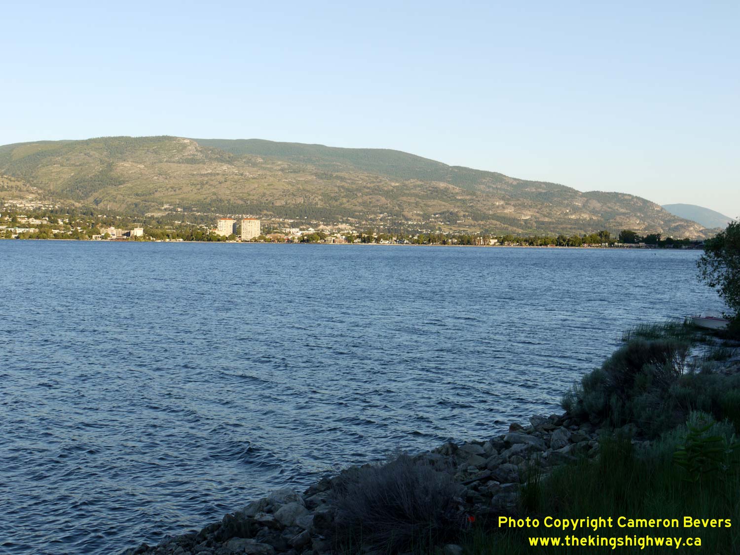

Left - View of Penticton across Okanagan Lake, facing southeast from Hwy 97. See an
Enlarged Photo Here. (Photograph taken on June 8, 2015 - © Cameron Bevers) Right - Facing north along Hwy 97 towards Kelowna about 2 km north of Penticton. Hwy 97 is an undivided four-lane highway between Penticton and Summerland. See an Enlarged Photo Here. (Photograph taken on June 8, 2015 - © Cameron Bevers) 

Left - Hwy 97 winds its way north along the eastern shores of Okanagan Lake, beneath these photogenic sandstone cliffs about 7 km north of Penticton. See an
Enlarged Photo Here. (Photograph taken on June 8, 2015 - © Cameron Bevers) Right - A late afternoon sun bathes the sandstone cliffs in this view of Hwy 97, facing south about 6 km south of Summerland. See an Enlarged Photo Here. (Photograph taken on June 8, 2015 - © Cameron Bevers) 
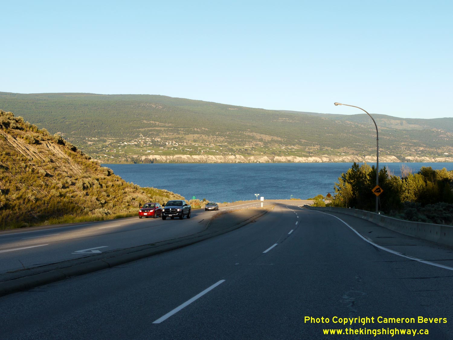
Left - Facing south along Hwy 97 towards Penticton, about 1 km south of Summerland. Sandwiched between the mountains and Okanagan Lake, Hwy 97 is actually the
only road which connects Summerland directly to Penticton. See an Enlarged Photo Here. (Photograph taken on June 8, 2015 - © Cameron Bevers) Right - This view of Okanagan Lake appears as Hwy 97 descends this grade out of Summerland. Penticton lies about 14 km ahead. See an Enlarged Photo Here. (Photograph taken on June 8, 2015 - © Cameron Bevers) 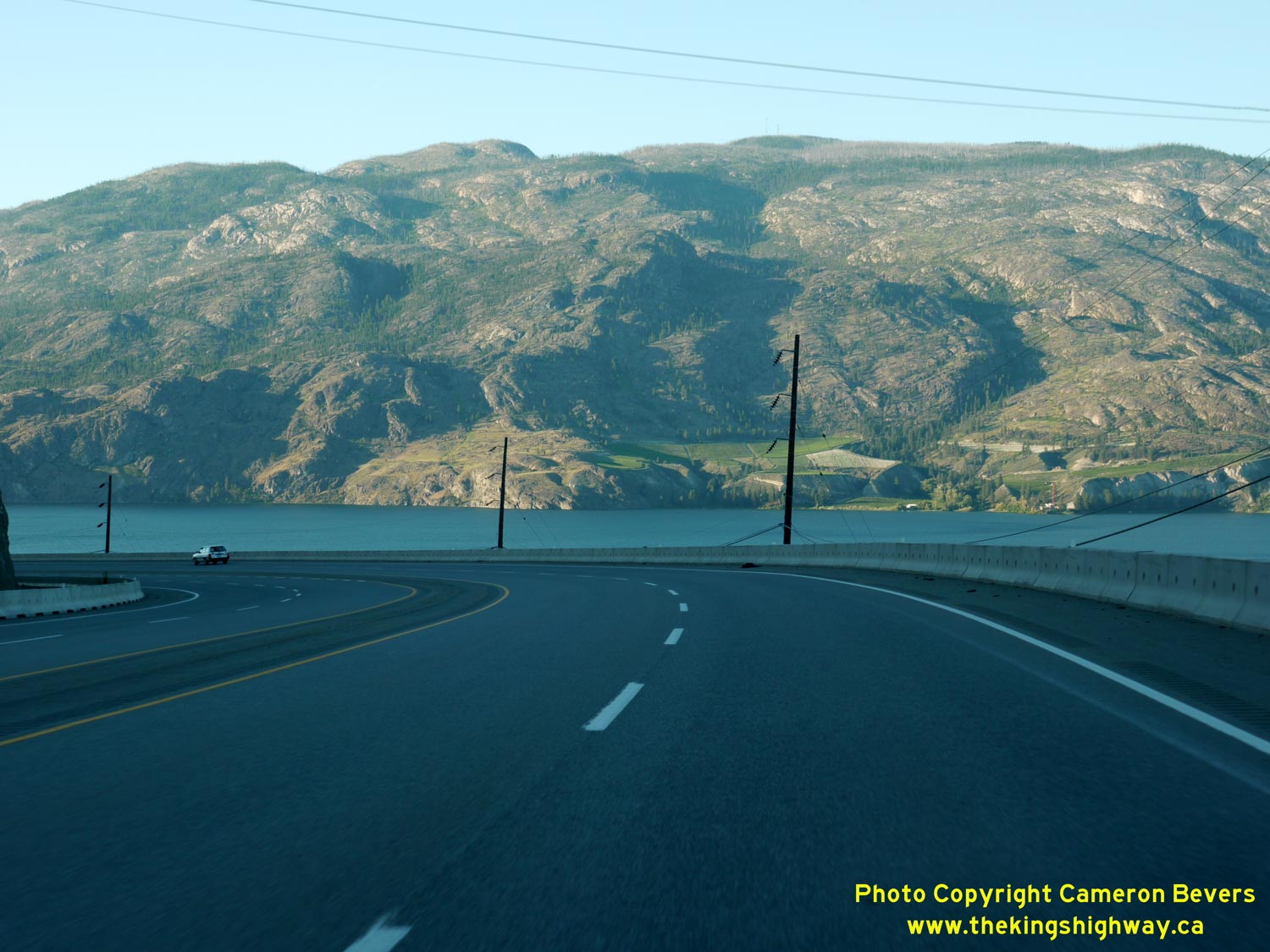

Left - Facing north along Hwy 97 towards Peachland, about 2 km north of Summerland. Okanagan Lake is approximately 4 km wide at this point. The eastern side of
Okanagan Lake is incredibly rugged and is largely uninhabited south of Kelowna, due to the lack of road access. See an
Enlarged Photo Here. (Photograph taken on June 8, 2015 - © Cameron Bevers) Right - This spectacular view of Okanagan Lake appears as Hwy 97 rounds this curve, about 2 km north of Summerland. See an Enlarged Photo Here. (Photograph taken on June 8, 2015 - © Cameron Bevers) 

Left - Facing north along Hwy 97 towards Peachland, about 4 km north of Summerland. See an
Enlarged Photo Here. (Photograph taken on June 8, 2015 - © Cameron Bevers) Right - Hwy 97 was recently expanded from two to four lanes in 2009-2010. A substantial section of this bluff north of Summerland had to be cut back in order to construct the platform for the new four-lane highway. See an Enlarged Photo Here. (Photograph taken on June 8, 2015 - © Cameron Bevers) 
Left - This roller-coaster view of Hwy 97 appears about 5 km north of Summerland. The curvilinear alignment, superelevated curves and spectacular vistas of
Okanagan Lake makes this section of Hwy 97 quite the exciting drive! See an
Enlarged Photo Here. (Photograph taken on June 8, 2015 - © Cameron Bevers) Right - Facing south along Hwy 97 towards Summerland from the Callan Road Junction. See an Enlarged Photo Here. (Photograph taken on June 8, 2015 - © Cameron Bevers) 

Left - View of Hwy 97, about 11 km south of Peachland. The mountains along the western shores of Okanagan Lake are so high, that the sun disappears behind the
mountains quite early in the evening. See an Enlarged Photo Here. (Photograph taken on June 8, 2015 - © Cameron Bevers) Right - Facing south along Hwy 97, about 10 km south of Peachland. See an Enlarged Photo Here. (Photograph taken on June 8, 2015 - © Cameron Bevers) 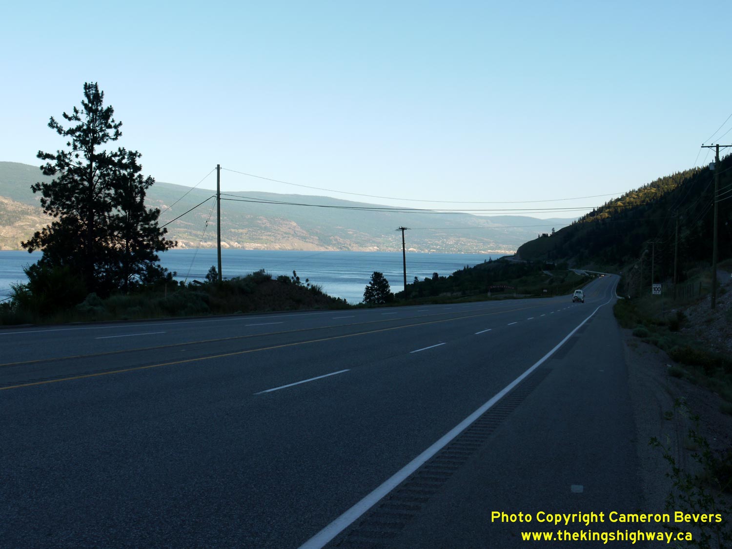

Left - Facing south along Hwy 97 near Okanagan Lake Provincial Park, located south of Peachland. See an
Enlarged Photo Here. (Photograph taken on June 8, 2015 - © Cameron Bevers) Right - Facing north along Hwy 97, about 6 km south of Peachland. Hwy 97 narrows from a four-lane highway to a two-lane highway between the Okanagan Provincial Park entrance and Peachland. From this point north to the Hwy 97C Interchange, Hwy 97 is a conventional two-lane highway. See an Enlarged Photo Here. (Photograph taken on June 8, 2015 - © Cameron Bevers) 

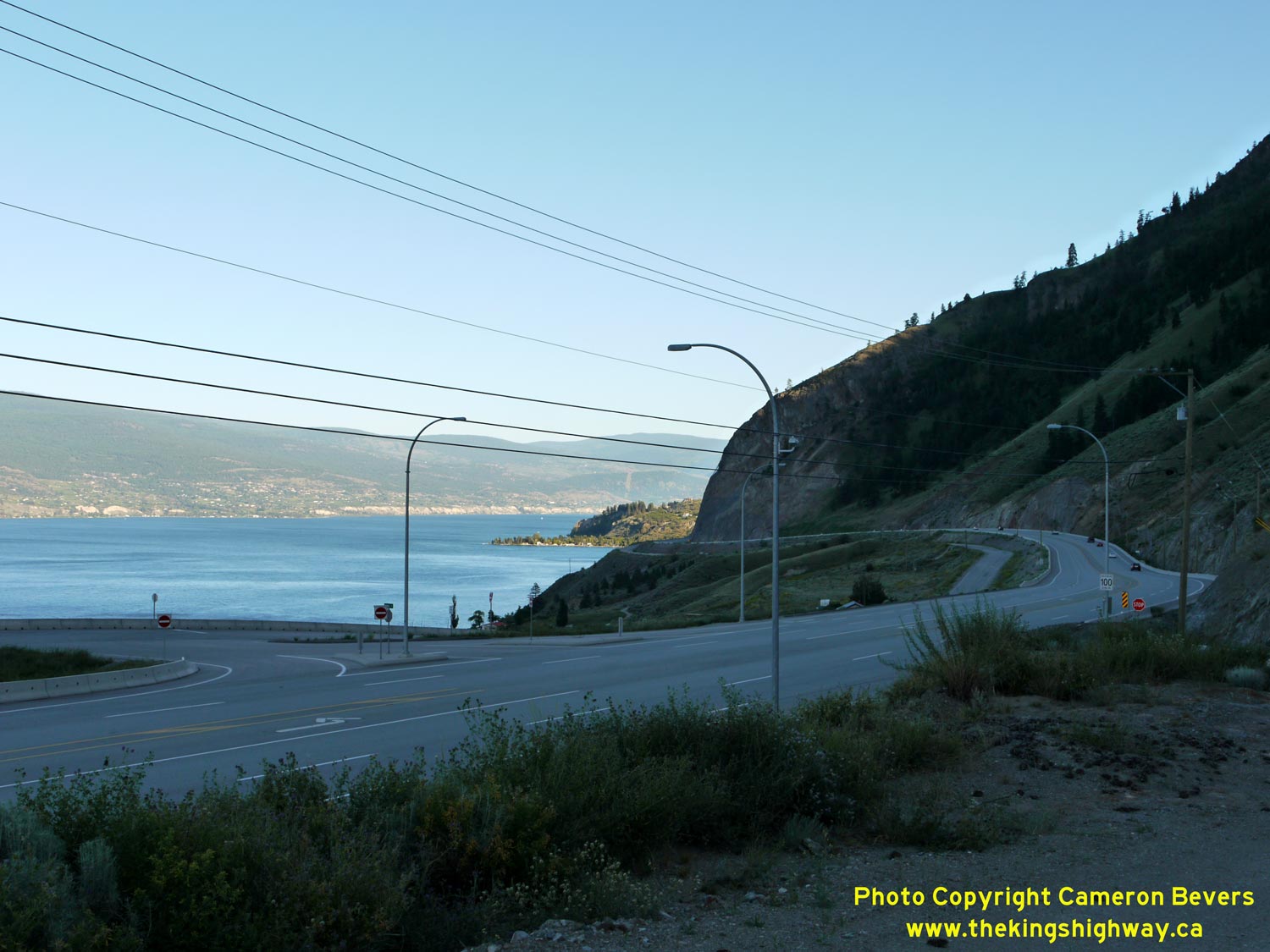
Left - Approaching Peachland on Hwy 97, facing north. The diagonal line across the mountain in the background is the route of Hwy 97C coming in from Merritt.
Hwy 97C joins into Hwy 97 just north of Peachland. See an Enlarged Photo Here. (Photograph taken on June 8, 2015 - © Cameron Bevers) Right - Facing south along Hwy 97 from Peachland towards Penticton. See an Enlarged Photo Here. (Photograph taken on June 8, 2015 - © Cameron Bevers) 

Left - Unlike many towns along the Okanagan Highway, Peachland is scattered along both sides of the highway rather than Hwy 97 serving as the town's main
street through a defined downtown area. Peachland's main commercial area lies along the beach strip, while the remainder of the town is perched on a cliff on the
western side of the highway overlooking Okanagan Lake. See an Enlarged Photo Here. (Photograph taken on June 8, 2015 - © Cameron Bevers) Right - From Peachland, Hwy 97 climbs a steep grade heading north towards the Hwy 97C Interchange. See an Enlarged Photo Here. (Photograph taken on June 8, 2015 - © Cameron Bevers) 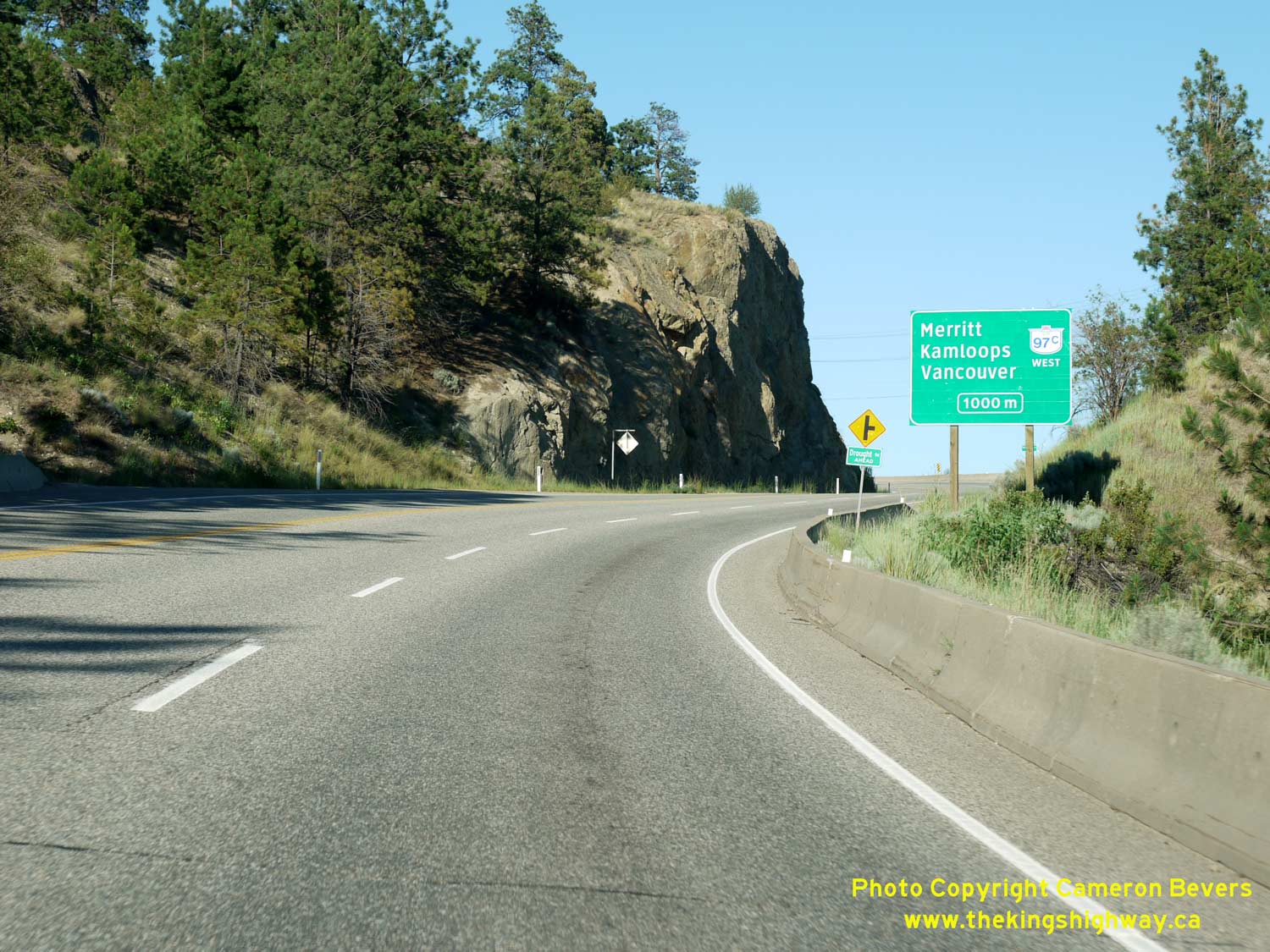

Left - Advance guide sign on northbound Hwy 97, indicating the major destinations accessible via Hwy 97C. Vancouver and Kamloops are not situated along Hwy 97C
itself, but can be accessed indirectly via Hwy 5 in the Merritt area. Motorists can also reach Kamloops by continuing north along Hwy 97 via Kelowna and Vernon,
although the travel time is substantially longer. See an Enlarged Photo Here. (Photograph taken on June 8, 2015 - © Cameron Bevers) Right - Approaching the Hwy 97C Interchange on Hwy 97, facing north. The ramps at the Hwy 97C Interchange are in a "trumpet" configuration. See an Enlarged Photo Here. (Photograph taken on June 8, 2015 - © Cameron Bevers) 

Left - Motorists are greeted with a spectacular view of Okanagan Lake as Hwy 97 departs from the Hwy 97C Interchange near Peachland. See an
Enlarged Photo Here. (Photograph taken on June 8, 2015 - © Cameron Bevers) Right - Just south of the Hwy 97C Interchange, Hwy 97 narrows down to a two-lane highway. The second northbound lane was extended slightly further to the south to allow slower trucks to move over to the right while ascending the steep grade. See an Enlarged Photo Here. (Photograph taken on June 8, 2015 - © Cameron Bevers) 

Left - Guide sign marking the exit ramp to Hwy 97C from northbound Hwy 97. There are actually four suffixed routes for Hwy 97 in British Columbia (Hwy 97A,
Hwy 97B, Hwy 97C & Hwy 97D). With a total length of nearly 225 km, Hwy 97C is by far the longest and most important of these suffixed routes. It is also the only
one that forms a true alternate route to Hwy 97, which connects to Hwy 97 at both termini. Hwy 97A is a spur route which does not loop back and return to Hwy 97,
while Hwy 97B and Hwy 97D are anomalies - these routes do not connect to Hwy 97 at all. See an
Enlarged Photo Here. (Photograph taken on June 8, 2015 - © Cameron Bevers) Right - Facing south along Hwy 97 towards the Hwy 97C Overpass between Peachland and West Kelowna. See an Enlarged Photo Here. (Photograph taken on June 8, 2015 - © Cameron Bevers) 

Left - The exit ramp to Hwy 97C from northbound Hwy 97 forms the loop ramp of the trumpet interchange, so that the predominant Merritt-to-Kelowna traffic
movement is served by the directional ramp. See an Enlarged Photo Here. (Photograph taken on June 8, 2015 - © Cameron Bevers) Right - Approaching the eastern terminus of Hwy 97C (Okanagan Connector) at Hwy 97 north of Peachland. See an Enlarged Photo Here. (Photograph taken on June 8, 2015 - © Cameron Bevers) 

Left - Overhead signs at the end of Hwy 97C near Peachland. From here, traffic can exit to the right and take Hwy 97 South to Penticton and Osoyoos or continue
straight ahead towards Kelowna and Vernon. The two-lane ramp narrows to a single lane just before the merge with Hwy 97 North. See an
Enlarged Photo Here. (Photograph taken on June 8, 2015 - © Cameron Bevers) Right - The ramp from Hwy 97C to Hwy 97 South splits into two ramps. The right fork leads to Hwy 97 South, while the left fork is a direct access ramp to Seclusion Bay Road which passes underneath Hwy 97. Note the yellow "Freeway Ends" sign marking the end of Hwy 97C. See an Enlarged Photo Here. (Photograph taken on June 8, 2015 - © Cameron Bevers) 

Left - Facing west along the Okanagan Connector (Hwy 97C) from the Hwy 97 Interchange in Peachland. The Okanagan Connector is one of British Columbia's newest
highways. Completed between Merritt and Peachland in the 1990s, the highway dramatically reduced the highway distance and travel time between Kelowna and Vancouver.
The overall highway distance between Kelowna and Vancouver was reduced by 67 km (42 miles) and travel times reduced by approximately 75 minutes. See an
Enlarged Photo Here. (Photograph taken on June 8, 2015 - © Cameron Bevers) Right - Facing south along Hwy 97 at the Hwy 97C Interchange. The left lane continues south as Hwy 97, while the right lane is forced off onto Hwy 97C West. The southbound exit ramp to Hwy 97C has an unusually long gore area between the ramp and Hwy 97, which suggests that the designers have staged this interchange to allow for the construction of a second southbound through lane in the future. See an Enlarged Photo Here. (Photograph taken on June 8, 2015 - © Cameron Bevers) 
Left - Approaching the Hwy 97C Interchange on Hwy 97, facing south. The exit is well-signed in advance, since the right lane is forced off onto Hwy 97C. See an
Enlarged Photo Here. (Photograph taken on June 8, 2015 - © Cameron Bevers) Right - Hwy 97 passes through a large rock cut just before the Hwy 97C Interchange. As a result, the force-off lane to Hwy 97C is not conspicuous to motorists. Based on the number of overhead guide signs on the approach and advance pavement markings, this lane arrangement has caused many last-minute lane changes. That said, the alternative would have been to drop the right lane beyond the exit, which likely would have been less desirable. The lane drop would have then occurred beyond a vertical crest curve and on a steep downhill grade. See an Enlarged Photo Here. (Photograph taken on June 8, 2015 - © Cameron Bevers) 
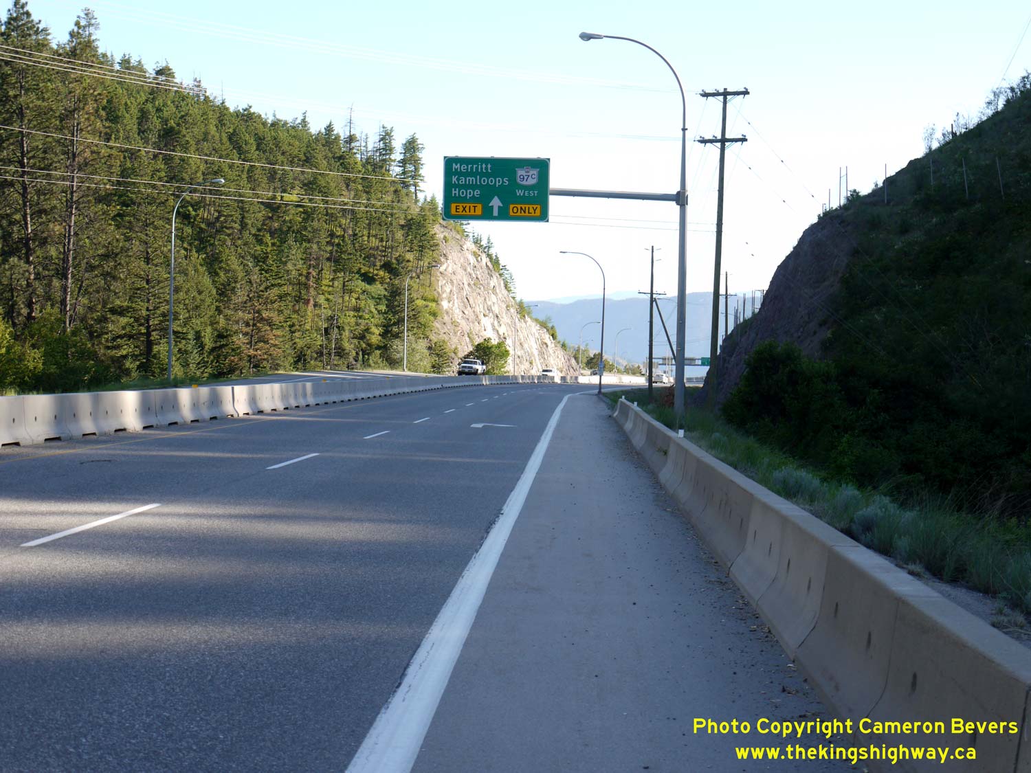
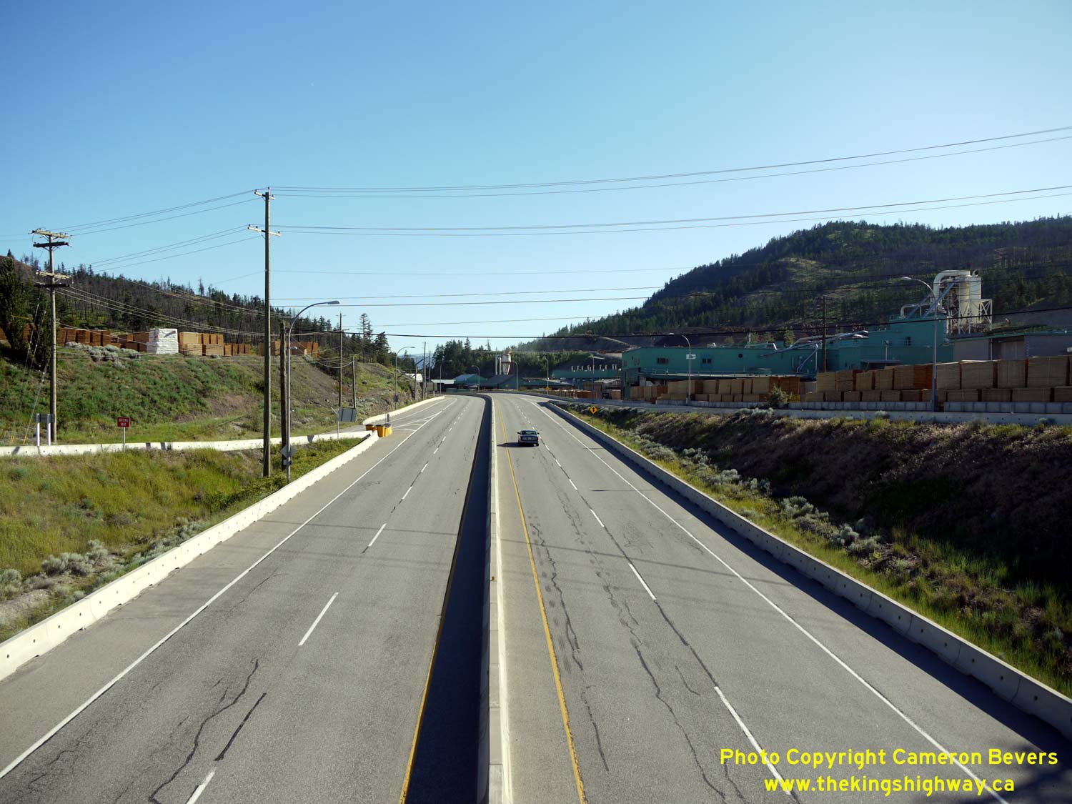
Left - North of the Hwy 97C Interchange, Hwy 97 widens into a four-lane divided highway. See an
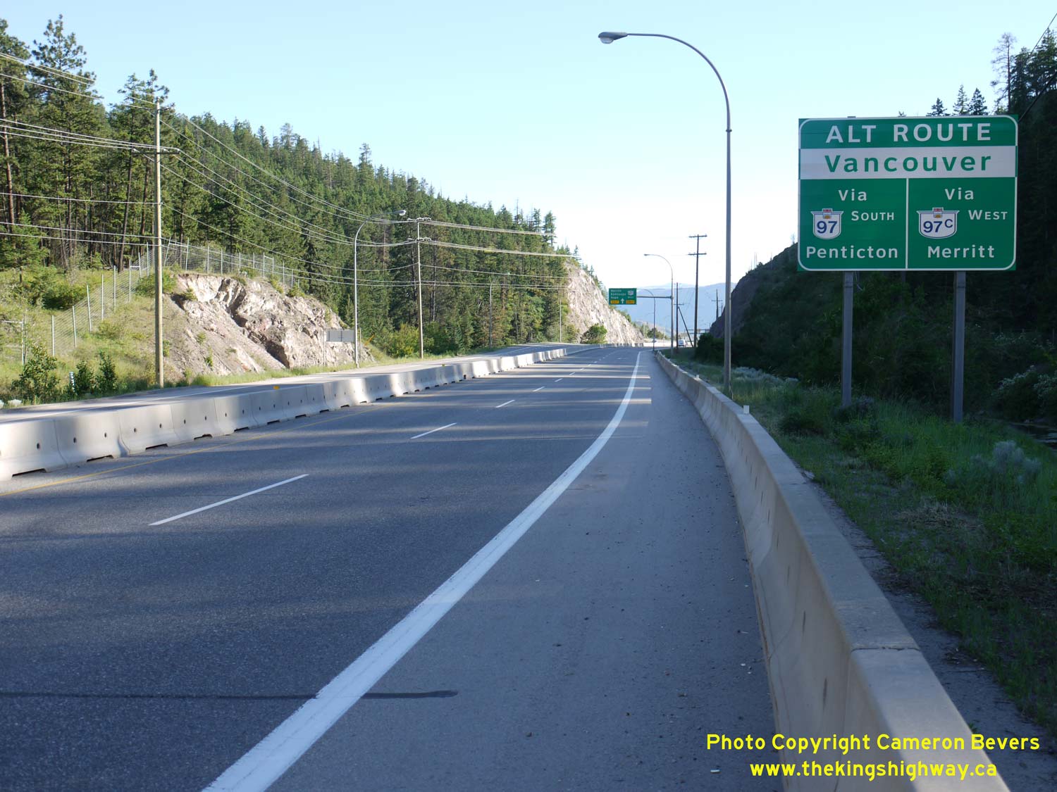
Enlarged Photo Here. (Photograph taken on June 8, 2015 - © Cameron Bevers) Right - Southbound motorists on Hwy 97 are presented with two options to reach Vancouver. The route via Penticton is substantially longer. Before the Okanagan Connector (Hwy 97C) was officially opened to traffic on October 1, 1990, all traffic bound for Vancouver had to pass through Penticton. See an Enlarged Photo Here. (Photograph taken on June 8, 2015 - © Cameron Bevers) 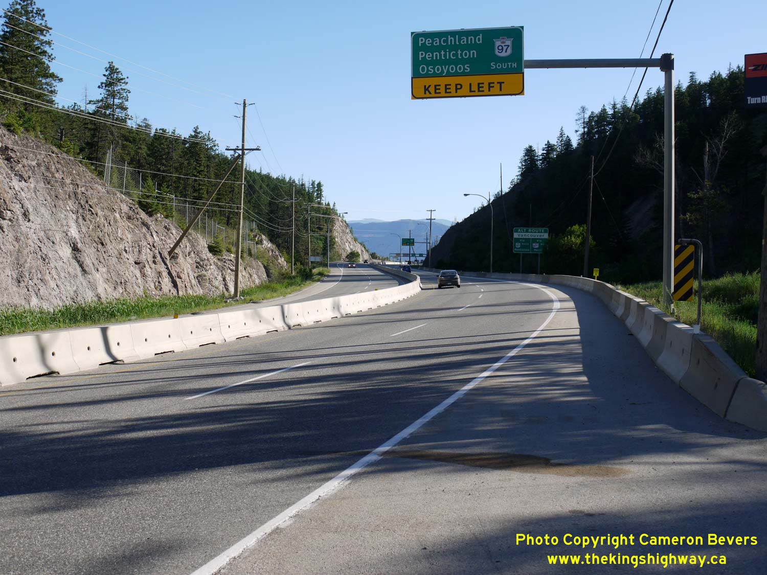
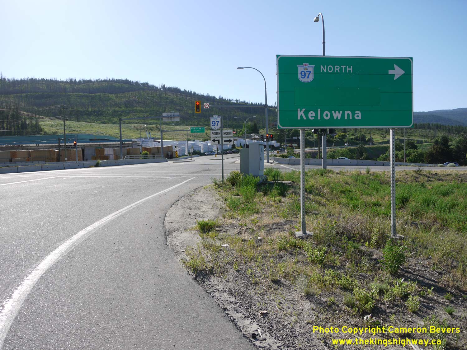
Left - Overhead sign advising motorists to stay left for Hwy 97 South. The right lane exits to Hwy 97C about 1 km ahead. See an
Enlarged Photo Here. (Photograph taken on June 8, 2015 - © Cameron Bevers) Right - Facing south along Hwy 97 from the Glenrosa Road Overpass near West Kelowna. See an Enlarged Photo Here. (Photograph taken on June 8, 2015 - © Cameron Bevers) 
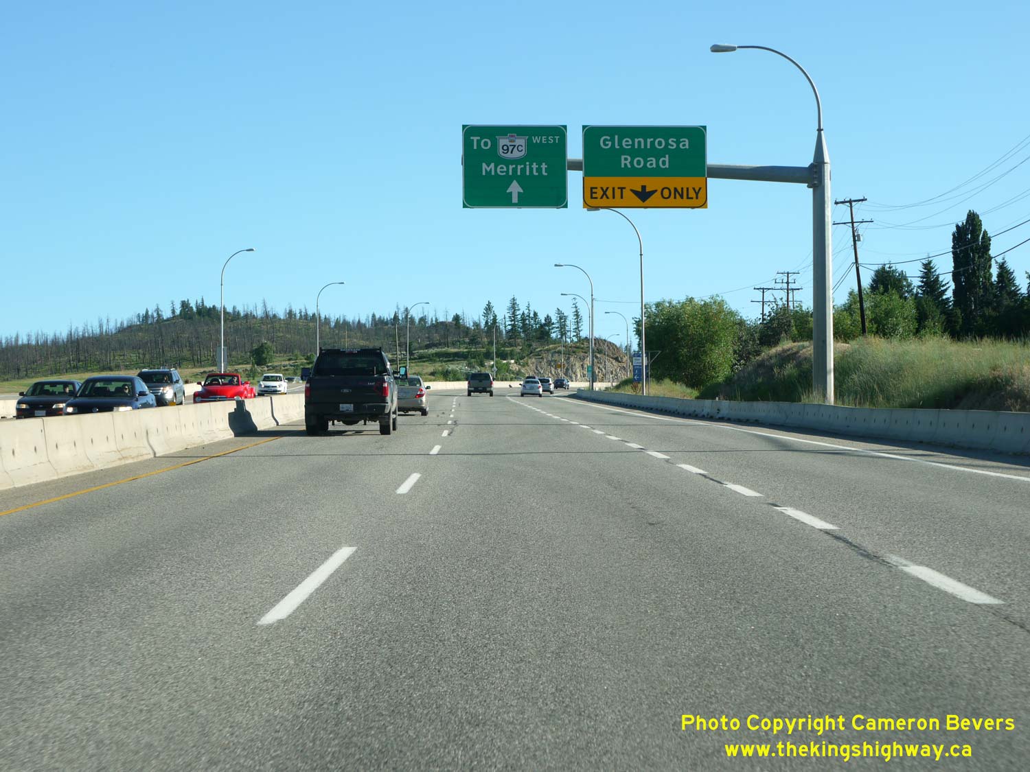
Left - Overhead guide signs on Glenrosa Road, guiding motorists to Hwy 97 South and Hwy 97C. See an
Enlarged Photo Here. (Photograph taken on June 8, 2015 - © Cameron Bevers) Right - Northbound Hwy 97 guide sign at the Glenrosa Road Interchange. This sign is in Federal Highways Administration (FHWA) font, which is an uncommon sight in British Columbia these days. Clearview font highway signs have seen widespread use in British Columbia recently. See an Enlarged Photo Here. (Photograph taken on June 8, 2015 - © Cameron Bevers) 

Left - Overhead guide signs on southbound Glenrosa Road approaching the Hwy 97 Interchange. See an
Enlarged Photo Here. (Photograph taken on June 8, 2015 - © Cameron Bevers) Right - Facing south across the Glenrosa Road Overpass. The Glenrosa Road Interchange ramps are in a diamond configuration. It is the only grade-separated interchange along Hwy 97 between the Hwy 97C Interchange and West Kelowna. This short expressway section of Hwy 97 is really just a means of carrying traffic efficiently from West Kelowna out to Hwy 97C. The sections of Hwy 97 located to the north of Glenrosa Road and south of Hwy 97C are not controlled-access highways. See an Enlarged Photo Here. (Photograph taken on June 8, 2015 - © Cameron Bevers) 

Left - Facing north along Hwy 97 towards Kelowna from the Glenrosa Road Interchange. See an
Enlarged Photo Here. (Photograph taken on June 8, 2015 - © Cameron Bevers) Right - Approaching West Kelowna on northbound Hwy 97 near the Glenrosa Road Interchange. See an Enlarged Photo Here. (Photograph taken on June 8, 2015 - © Cameron Bevers) 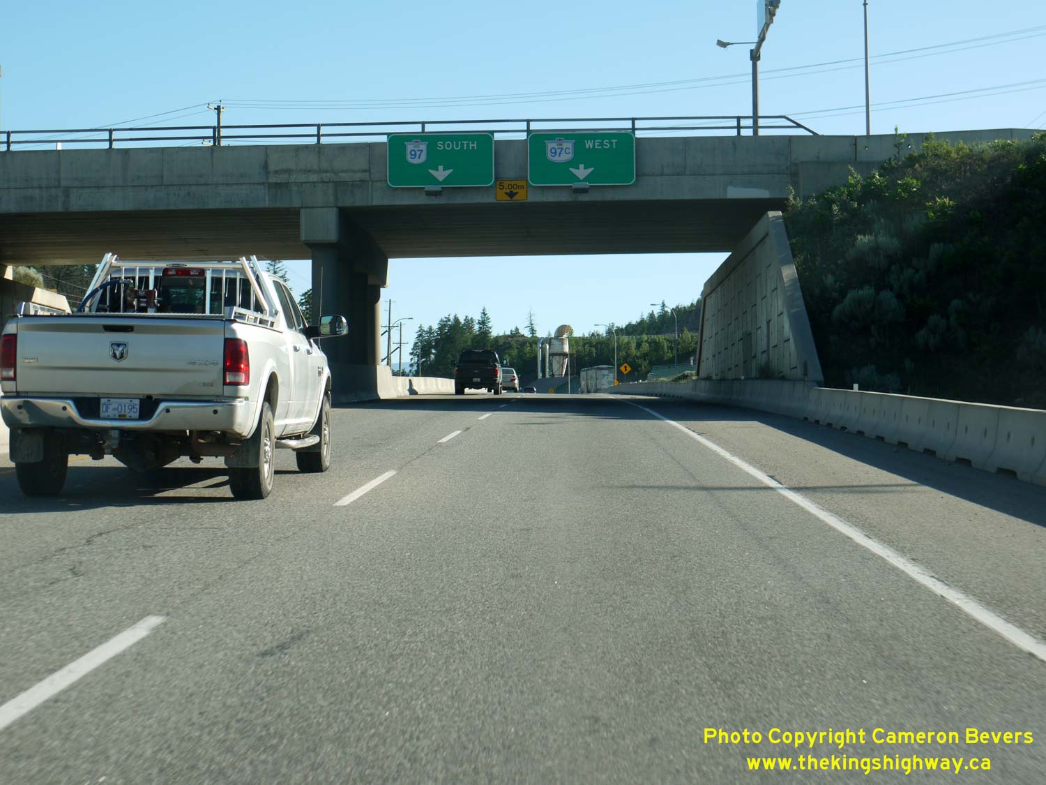
Left - Overhead guide signs on the Glenrosa Road Overpass facing southbound Hwy 97 traffic. Although the Hwy 97C Interchange is situated about 2 km to the
south, motorists are already being advised that they must keep left to stay on Hwy 97 South. See an
Enlarged Photo Here. (Photograph taken on June 8, 2015 - © Cameron Bevers) Right - Overhead guide sign on southbound Hwy 97 approaching the Glenrosa Road Interchange. See an Enlarged Photo Here. (Photograph taken on June 8, 2015 - © Cameron Bevers) 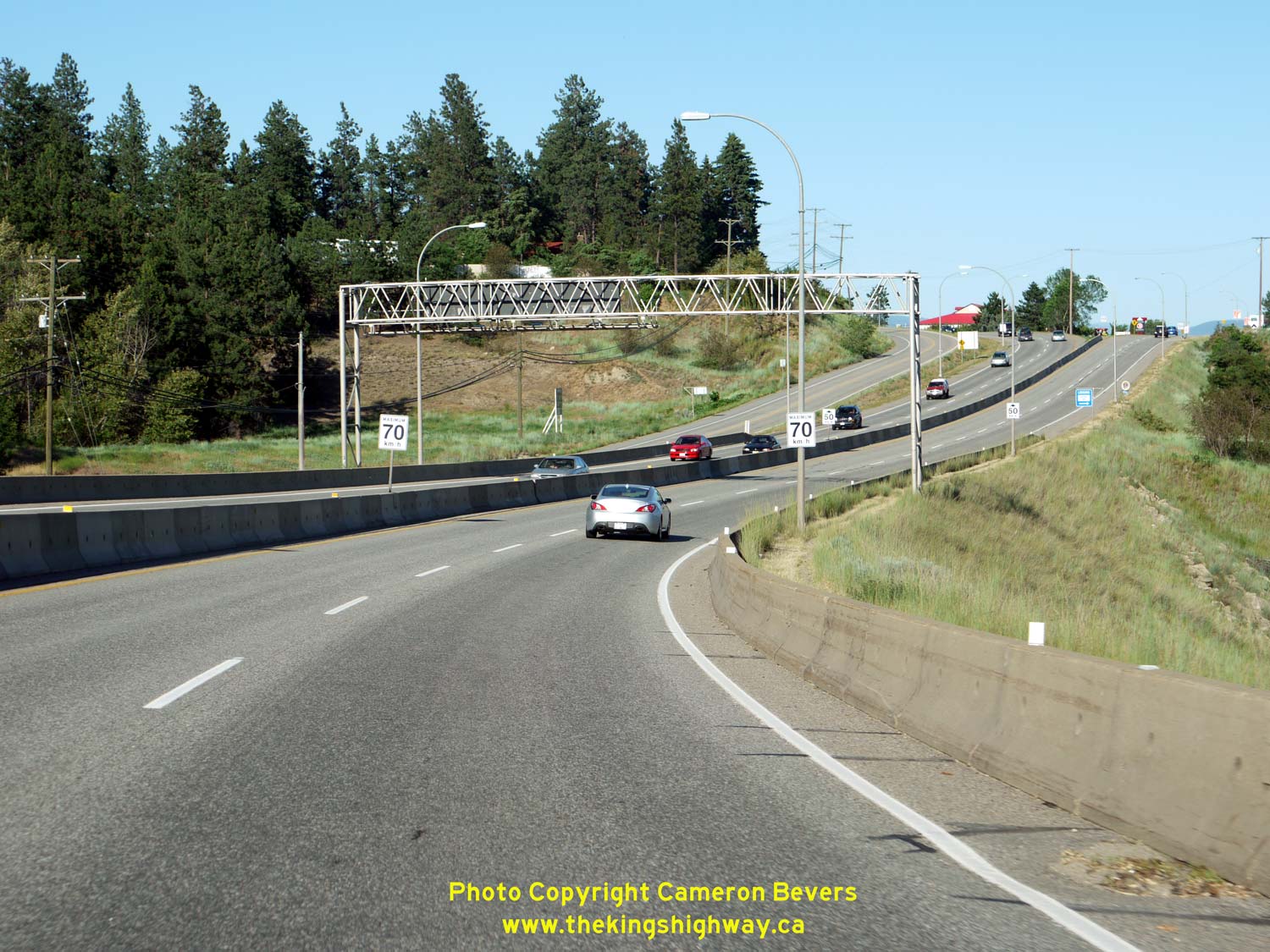
Left - As Hwy 97 climbs this hill into the Westbank area of West Kelowna, the expressway ends and northbound and southbound Hwy 97 traffic split off into
separate roadways. These routes form part of a one-way street system through the community (Main Street and Dobbin Road). The one-way street system continues for
about 1 km. See an Enlarged Photo Here. (Photograph taken on June 8, 2015 - © Cameron Bevers) Right - Facing south along Hwy 97 towards the start of the one-way street system through the Westbank area. Southbound Hwy 97 traffic uses Main Street (straight ahead) while northbound Hwy 97 traffic can be seen exiting from the one-way street system via Dobbin Road at left. See an Enlarged Photo Here. (Photograph taken on June 8, 2015 - © Cameron Bevers) 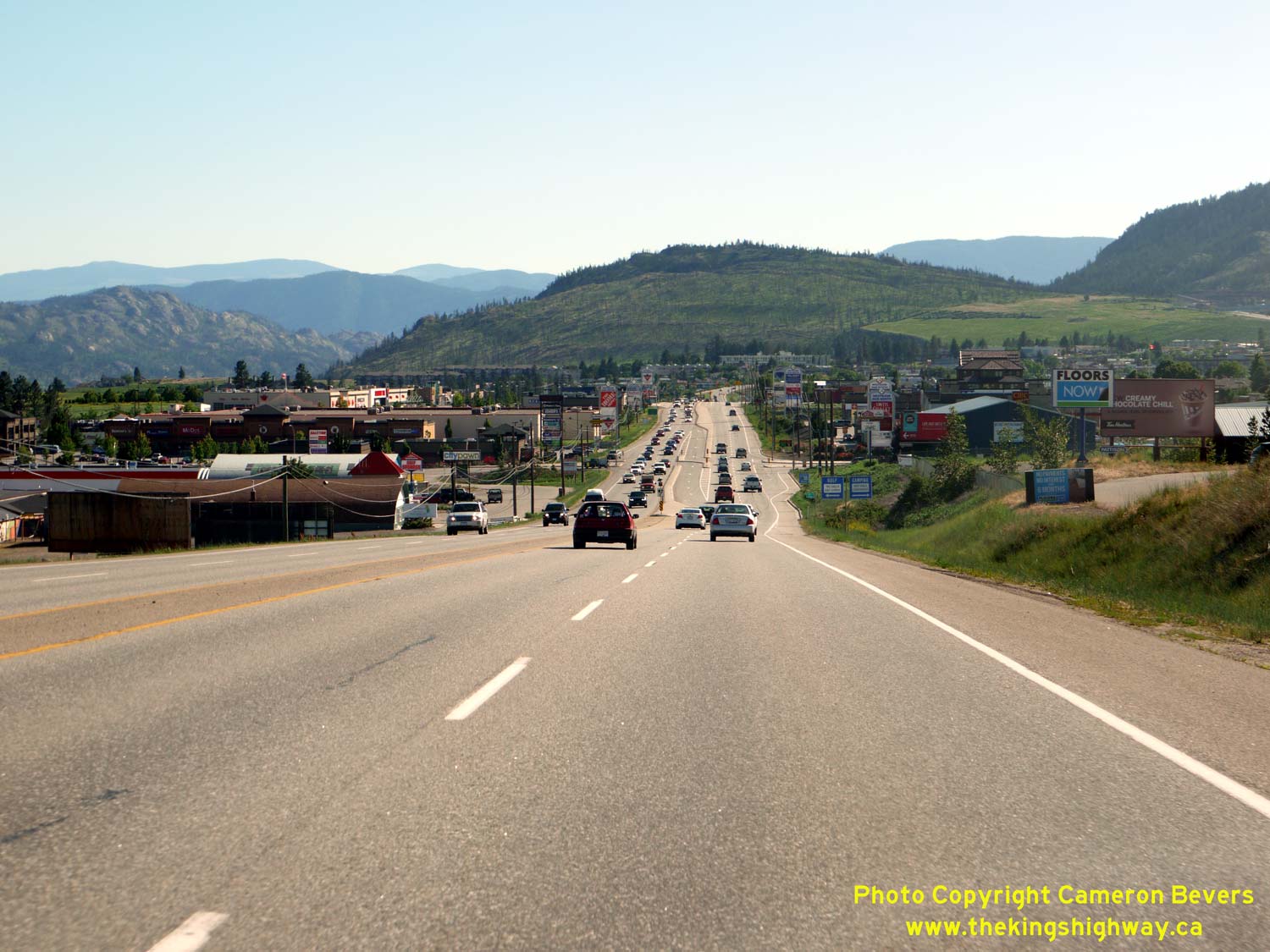
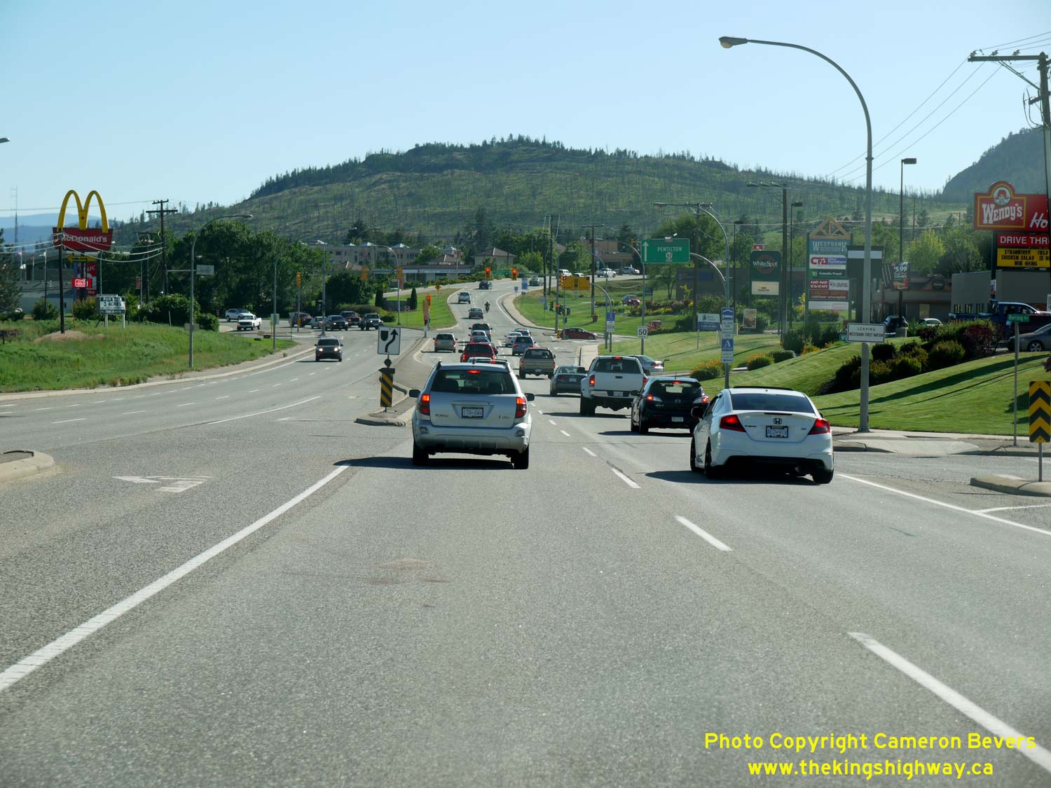
Left - Facing south along Hwy 97 towards Elk Road in West Kelowna. Through West Kelowna, Hwy 97 is very much an arterial street, with numerous at-grade
intersections. Fortunately, there are no commercial access points directly onto Hwy 97 through this section, meaning that the access to the highway is limited to
intersections with the municipal road system. See an
Enlarged Photo Here. (Photograph taken on June 8, 2015 - © Cameron Bevers) Right - Approaching Daimler Drive on Hwy 97, facing south. Along this section of Hwy 97, a series of frontage roads serves as an access control. See an Enlarged Photo Here. (Photograph taken on June 8, 2015 - © Cameron Bevers) 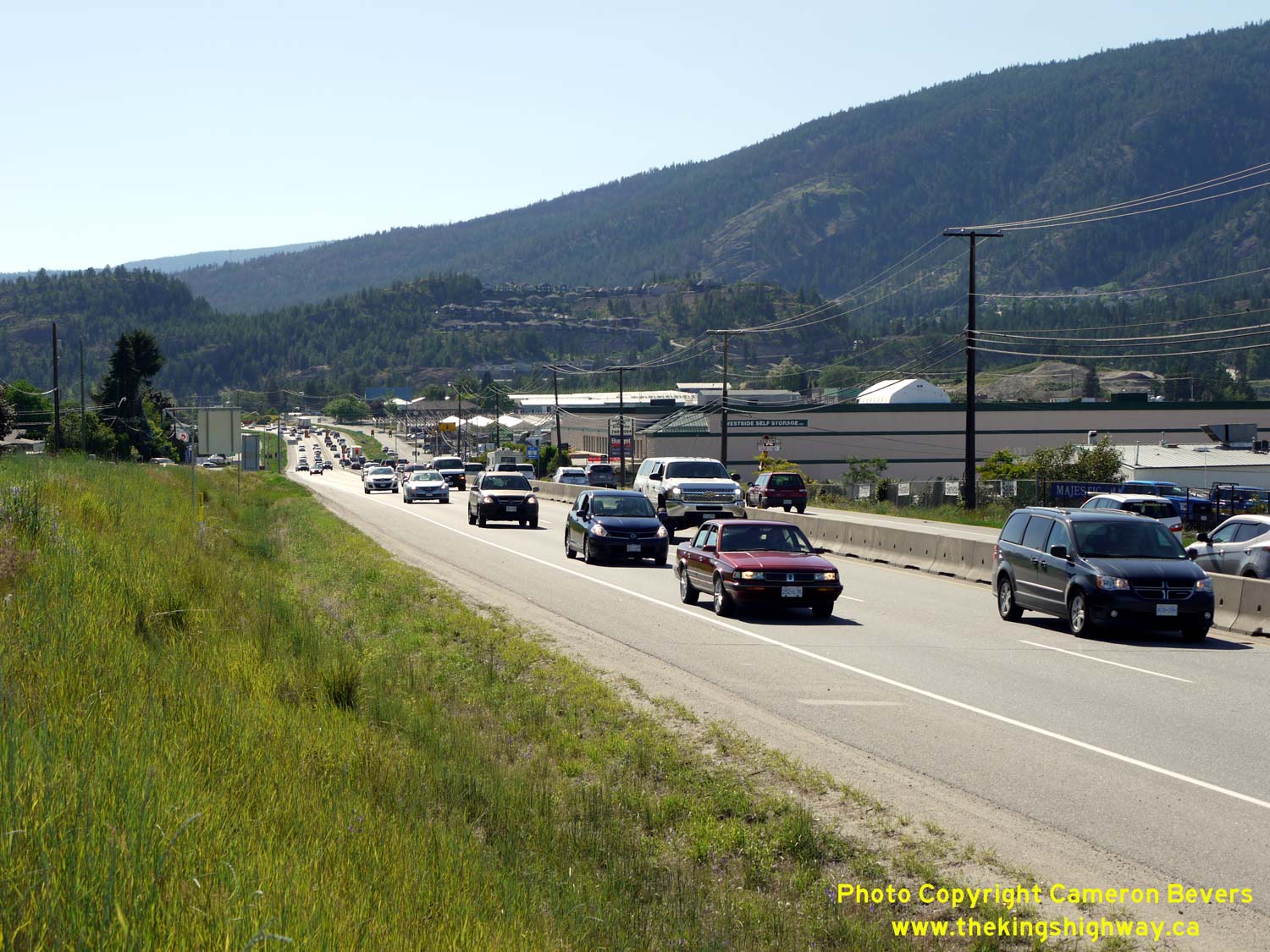
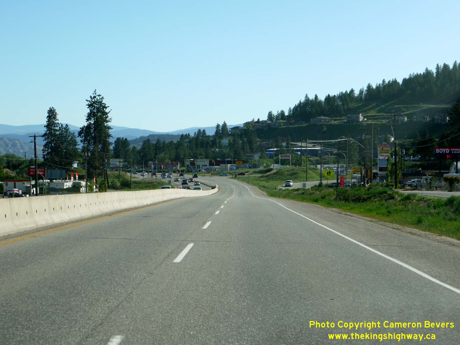
Left - Facing south along Hwy 97 near Hudson Road in West Kelowna. Hwy 97 serves as a major city street through West Kelowna as well as a long-distance through
highway. Accordingly, it is an extremely busy section of the highway. See an
Enlarged Photo Here. (Photograph taken on June 8, 2015 - © Cameron Bevers) Right - Facing north along Hwy 97 towards Hudson Road in West Kelowna. Signalized intersections such as this one are the cause of significant traffic congestion through West Kelowna. See an Enlarged Photo Here. (Photograph taken on June 8, 2015 - © Cameron Bevers) 
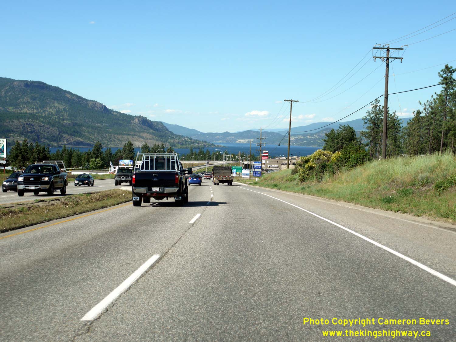
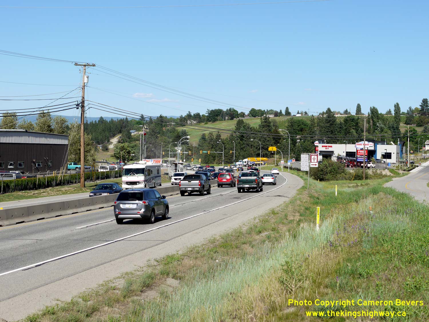
Left - Facing north along Hwy 97 towards the traffic signals at Boucherie Drive & Horizon Drive. This is the last signalized intersection along Hwy 97 in
West Kelowna. A short section of expressway begins beyond the intersection and continues across the Okanagan Lake Bridge into Downtown Kelowna. See an
Enlarged Photo Here. (Photograph taken on June 8, 2015 - © Cameron Bevers) Right - Okanagan Lake appears in the distance as Hwy 97 turns back into an expressway approaching Westside Road. See an Enlarged Photo Here. (Photograph taken on June 8, 2015 - © Cameron Bevers) 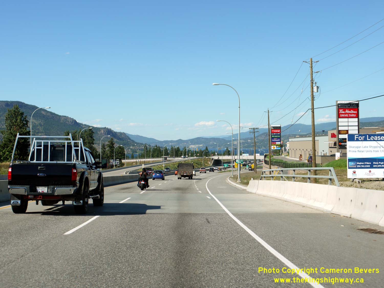

Left - Approaching the Westside Road Interchange on northbound Hwy 97. The total length of the expressway portion of Hwy 97 between West Kelowna and Downtown
Kelowna is about 4 km. This is the first of two grade-separated interchanges along the expressway. See an
Enlarged Photo Here. (Photograph taken on June 8, 2015 - © Cameron Bevers) Right - Passing underneath the Westside Road Overpass on northbound Hwy 97. As the name implies, Westside Road follows the western shores of Okanagan Lake from West Kelowna to the Vernon area. See an Enlarged Photo Here. (Photograph taken on June 8, 2015 - © Cameron Bevers) 
Left - Overhead guide signs on Westside Road approaching the Hwy 97 Interchange. See an
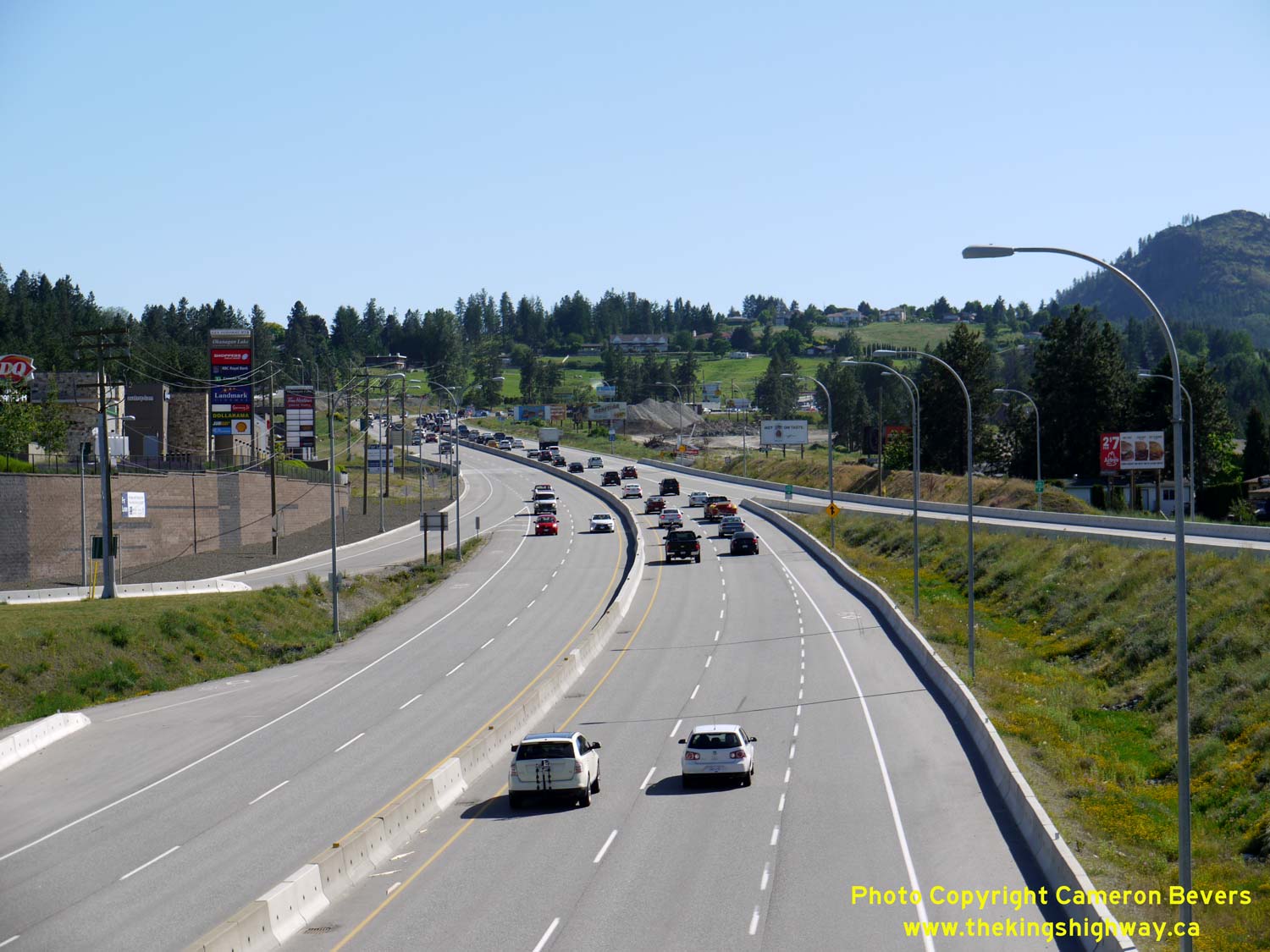
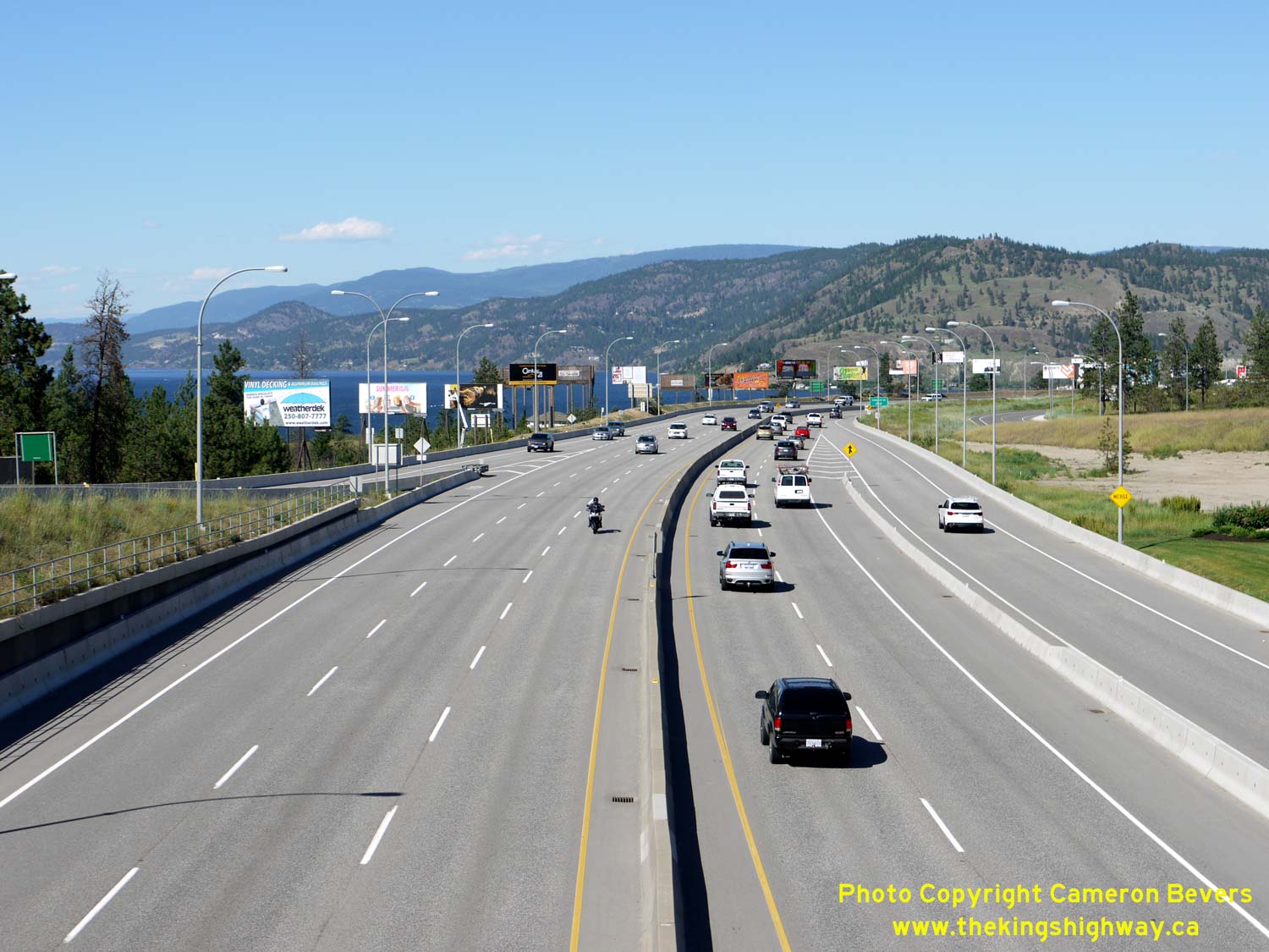
Enlarged Photo Here. (Photograph taken on June 8, 2015 - © Cameron Bevers) Right - Facing south along Hwy 97 from the Westside Road Overpass. Note the nearly kilometre-long queue along southbound Hwy 97 from the traffic signals at Boucherie Drive & Horizon Drive. The Kelowna area has seen substantial urban growth over the past two decades, as people are drawn to its warm, dry climate and scenic surroundings. This growth has put increased pressure on infrastructure, including the Hwy 97 corridor. See an Enlarged Photo Here. (Photograph taken on June 8, 2015 - © Cameron Bevers) 
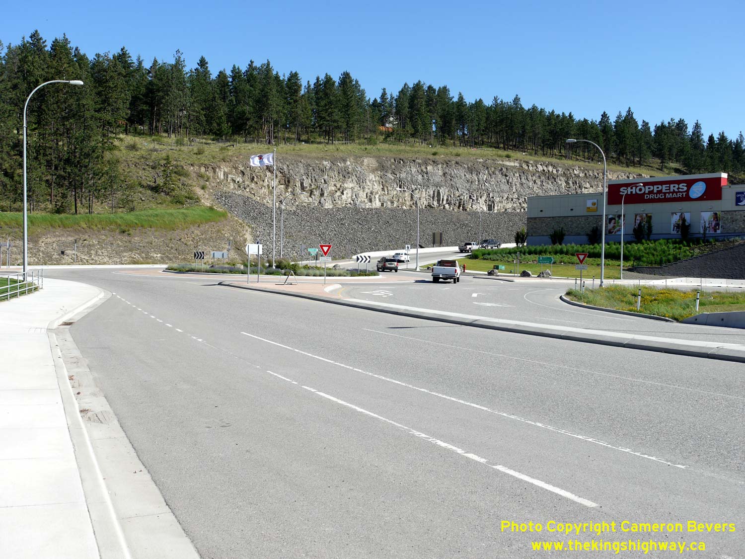
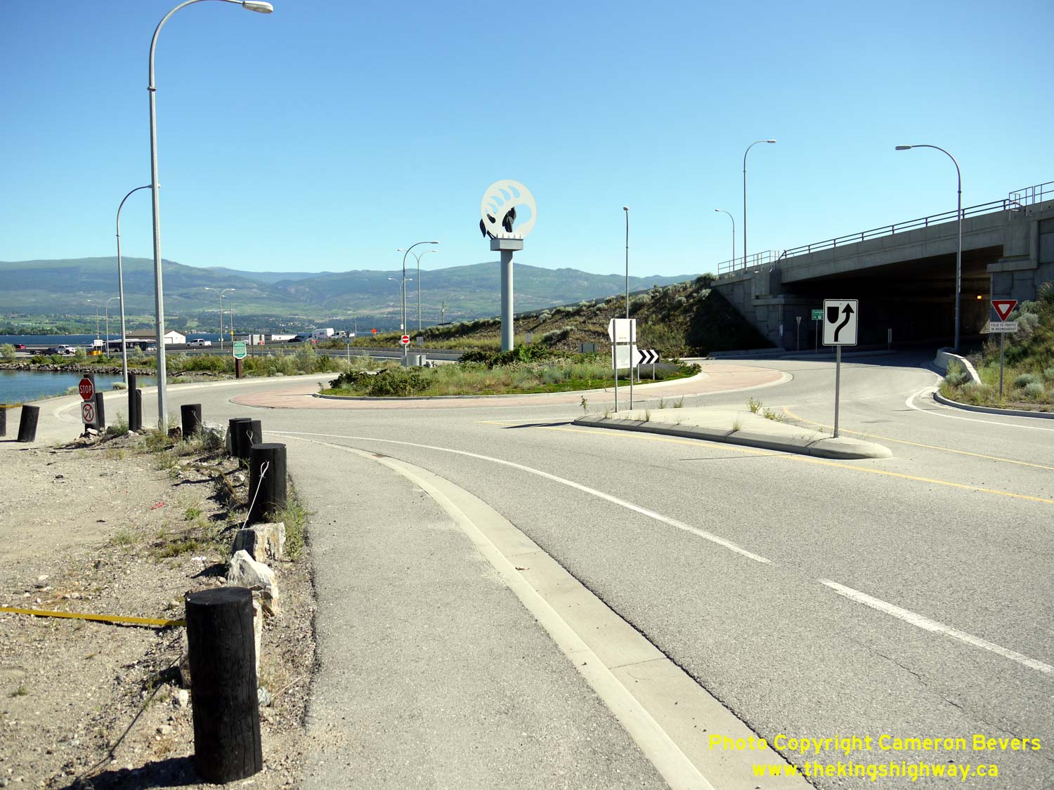
Left - The western ramp terminal at the Westside Road Interchange is controlled by traffic signals. As the pavement markings suggest, the eastern ramp terminal
is a roundabout. See an Enlarged Photo Here. (Photograph taken on June 8, 2015 - © Cameron Bevers) Right - Approaching the roundabout at the eastern ramp terminal at the Westside Road Interchange on Hwy 97. See an Enlarged Photo Here. (Photograph taken on June 8, 2015 - © Cameron Bevers) 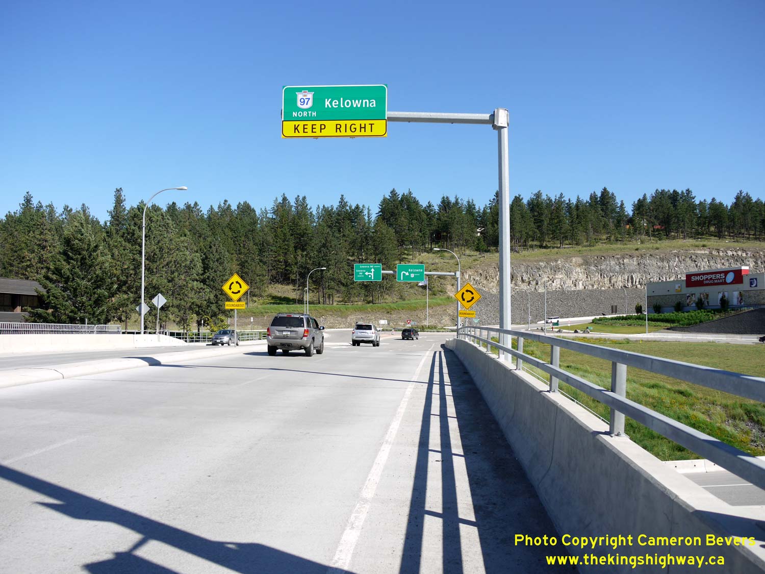
Left - An overhead guide sign directs traffic bound for Hwy 97 North to keep right. Through traffic must stay left. See an
Enlarged Photo Here. (Photograph taken on June 8, 2015 - © Cameron Bevers) Right - Facing north along Hwy 97 from the Westside Road Overpass in West Kelowna. See an Enlarged Photo Here. (Photograph taken on June 8, 2015 - © Cameron Bevers) 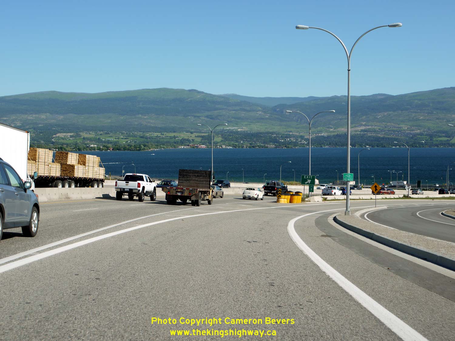
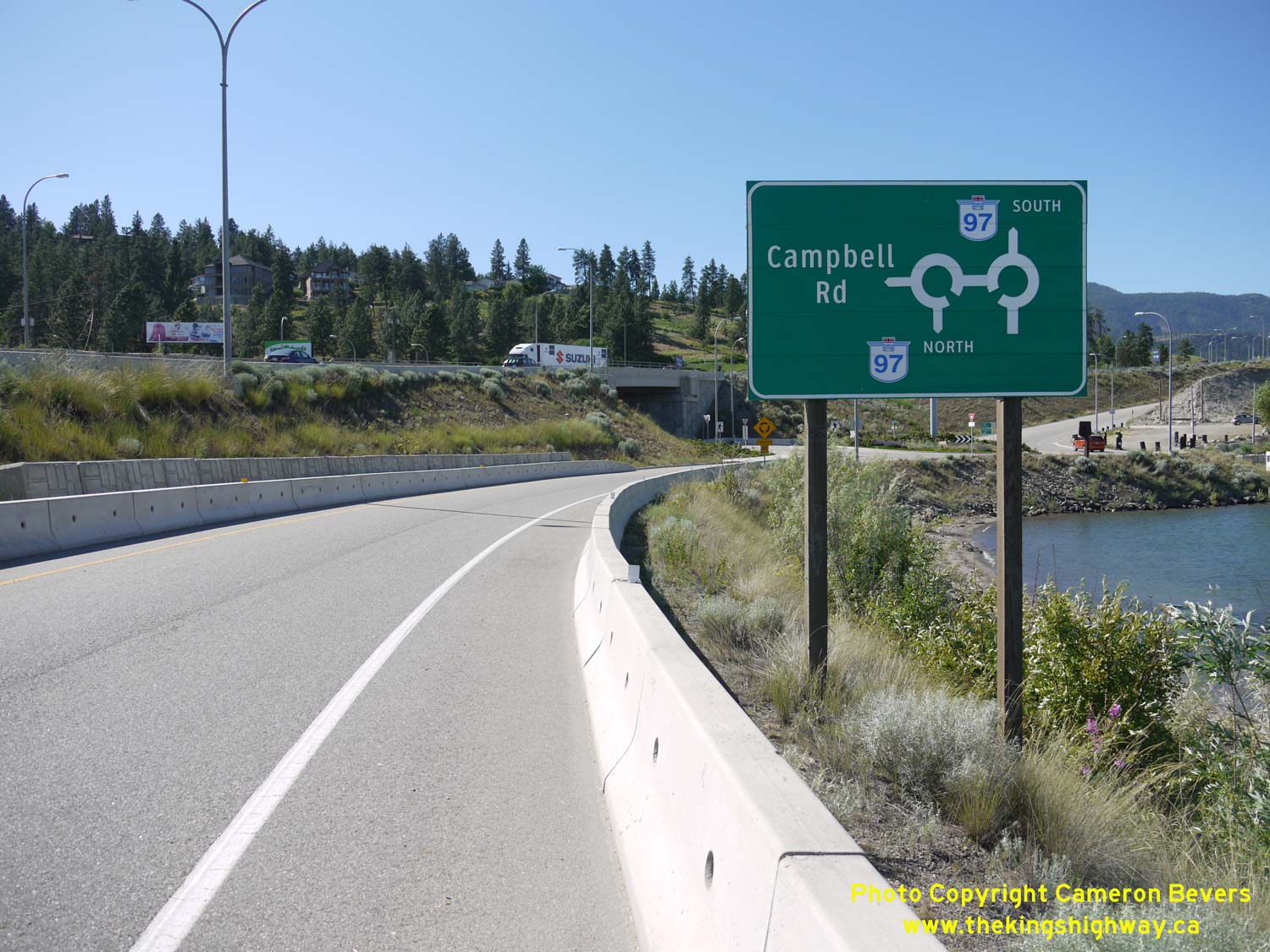
Left - Facing north along Hwy 97 towards Kelowna at the Campbell Road Interchange. See an
Enlarged Photo Here. (Photograph taken on June 8, 2015 - © Cameron Bevers) Right - Guide sign showing the dual roundabouts at the Campbell Road Interchange on Hwy 97. See an Enlarged Photo Here. (Photograph taken on June 8, 2015 - © Cameron Bevers) 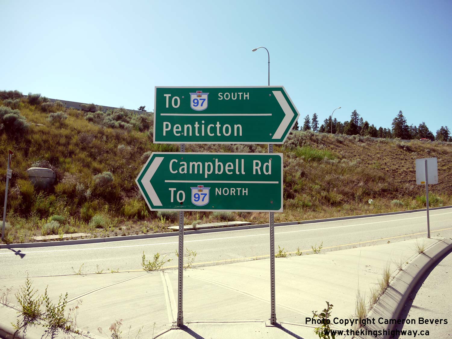
Left - Signs marking the way to Hwy 97 at the Campbell Road Interchange in West Kelowna. See an
Enlarged Photo Here. (Photograph taken on June 8, 2015 - © Cameron Bevers) Right - Roundabout at the Campbell Road east ramp terminal on Hwy 97. This diamond interchange has a roundabout at both ramp terminals. See an Enlarged Photo Here. (Photograph taken on June 8, 2015 - © Cameron Bevers) 

Left - The William R. Bennett Bridge carries Hwy 97 across Okanagan Lake between West Kelowna and Kelowna. Interestingly, this impressive new bridge actually
floats on the lake surface on a series of concrete pontoons. Due to the water depth of Okanagan Lake through these narrows, it was not possible to construct concrete
piers down to the lake bottom. This bridge replaced another floating structure which had been built across the narrows at Kelowna in 1958. See an
Enlarged Photo Here. (Photograph taken on June 8, 2015 - © Cameron Bevers) Right - Crossing the William R. Bennett Bridge across Okanagan Lake on Hwy 97, approaching Downtown Kelowna. The new bridge was officially opened to traffic on May 25, 2008, by British Columbia's Premier Gordon Campbell and former Premier William R. Bennett, after whom the bridge is named. It is interesting to note that William Bennett's father, W.A.C. Bennett, opened the original Okanagan Lake Bridge with Princess Margaret in 1958. In a fitting historical tribute, the same ribbon-cutting scissors were used for both the 1958 and 2008 bridge opening ceremonies. See an Enlarged Photo Here. (Photograph taken on June 8, 2015 - © Cameron Bevers)
Continue north along BC Highway 97 from Kelowna to Vernon |
|---|
Links to Adjacent BC Highway Photograph Pages:
Back to BC Highway 41 Photos /
British Columbia Highways Photo Index /
On to BC Highway 97A Photos
Ontario Highway History - Main Menu / Vacation Highway Photos - Main Menu Website contents, photos & text © 2002-2026, Cameron
Bevers (Webmaster) - All Rights Reserved / Contact Me
|
|---|