
| 
| |
|
|
This page contains photographs of British Columbia's Highway 97 (Okanagan Highway), arranged by location from the Canada-United
States Boundary northerly to Penticton. All photographs displayed on this page were taken by the Webmaster (Cameron Bevers). To view photos of other British
Columbia Highways, please select a highway number listed on the British Columbia Photograph Index
Page. Click on any thumbnail to see a larger image!
Please note that all photographs displayed on this website are protected by copyright. These photographs must not be
reproduced, published, electronically stored or copied, distributed, or posted onto other websites without my written permission. If you want to use photos from this
website, please email me first for permission. Thank-you!
|
|---|
|
Page 1: BC Highway 97 (Okanagan Highway) Photographs: U.S. Boundary to Penticton
Left - Facing north along Hwy 97 from the Canada-United States Boundary near Osoyoos. British Columbia's Highway 97 is the longest provincial highway in Canada.
The highway begins at the Canada-United States Boundary and continues north to the Yukon Territory Boundary in Canada's far north region. According to the British
Columbia Ministry of Transportation's Landmark Kilometre Inventory, the total length of Hwy 97 is about 2,180 km (1,355 miles). This includes a 110 km overlapped
section with the Trans-Canada Highway (Hwy 1) between Monte Creek and Cache Creek. See an
Enlarged Photo Here. (Photograph taken on June 9, 2015 - © Cameron Bevers) Right - Distance guide sign on northbound Hwy 97 at the Canada-United States Boundary near Osoyoos. See an Enlarged Photo Here. (Photograph taken on June 9, 2015 - © Cameron Bevers) 

Left - Facing south along Hwy 97 towards the Canada-United States Boundary near Osoyoos. At this point, British Columbia's Hwy 97 ends. The highway continues
south into Washington State as U.S. Route 97. See an Enlarged Photo Here. (Photograph taken on June 9, 2015 - © Cameron Bevers) Right - View of Hwy 97 facing north towards Osoyoos near the Canada-United States Boundary. See an Enlarged Photo Here. (Photograph taken on June 9, 2015 - © Cameron Bevers) 

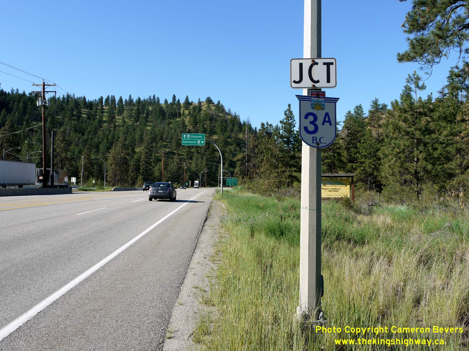
Left - Advance destination guide sign for the westbound Crowsnest Highway (Hwy 3) on northbound Hwy 97 approaching Osoyoos. See an
Enlarged Photo Here. (Photograph taken on June 9, 2015 - © Cameron Bevers) Right - Advance destination guide sign for the eastbound Crowsnest Highway (Hwy 3) on northbound Hwy 97 approaching Osoyoos. See an Enlarged Photo Here. (Photograph taken on June 9, 2015 - © Cameron Bevers) 

Left - Facing north along Hwy 97 in Osoyoos, approaching the Crowsnest Highway (Hwy 3) Junction. See an
Enlarged Photo Here. (Photograph taken on June 9, 2015 - © Cameron Bevers) Right - Northbound Hwy 97 guide sign in Osoyoos at the Hwy 3 Junction. This sign is in Federal Highways Administration (FHWA) font, which is an uncommon sight in British Columbia these days. Clearview font highway signs have seen widespread use in British Columbia. See an Enlarged Photo Here. (Photograph taken on June 9, 2015 - © Cameron Bevers) 

Left - Overhead guide signs marking the upcoming Crowsnest Highway (Hwy 3) Junction on northbound Hwy 97. See an
Enlarged Photo Here. (Photograph taken on June 9, 2015 - © Cameron Bevers) Right - Junction sign assembly on northbound Hwy 97 at the Hwy 3 Junction in Osoyoos. See an Enlarged Photo Here. (Photograph taken on June 9, 2015 - © Cameron Bevers) 

Left - Facing south along Hwy 97 from the Crowsnest Highway (Hwy 3) Junction in Osoyoos. See an
Enlarged Photo Here. (Photograph taken on June 9, 2015 - © Cameron Bevers) Right - Older angled destination guide signs for the upcoming Hwy 97 Junction on eastbound Hwy 3 in Osoyoos. See an Enlarged Photo Here. (Photograph taken on June 9, 2015 - © Cameron Bevers) 

Left - Approaching the Hwy 97 Junction on eastbound Hwy 3 in Osoyoos. The dry, desert climate of the Osoyoos area is rather apparent in this photo. In fact,
the photo looks like it was taken somewhere in Arizona, rather than Canada. With sparse rainfall and scorching summer temperatures, the area around Osoyoos is
actually the northernmost tip of the Sonoran Desert. Summer daytime temperatures in excess of 40 Celsius (104 Fahrenheit) are observed periodically in this part of
British Columbia. It was 38 Celsius (100 Fahrenheit) the day I took this photo. See an
Enlarged Photo Here. (Photograph taken on June 9, 2015 - © Cameron Bevers) Right - Junction sign assembly on eastbound Hwy 3 approaching the Hwy 97 Junction in Osoyoos. See an Enlarged Photo Here. (Photograph taken on June 9, 2015 - © Cameron Bevers) 

Left - A desert cactus sports its colourful springtime blooms in Osoyoos. The Crowsnest Highway (Hwy 3) can be seen curving its way west out of Osoyoos in the
background. See an Enlarged Photo Here. (Photograph taken on June 9, 2015 - © Cameron Bevers) Right - Facing west along the Crowsnest Highway (Hwy 3) from the Hwy 97 Junction in Osoyoos. It is a little over 400 km to Vancouver from Osoyoos. The Crowsnest Highway ends at the Trans-Canada Highway (Hwy 1) in Hope. Traffic must then follow either Hwy 1 or Hwy 7 between Hope and Vancouver. See an Enlarged Photo Here. (Photograph taken on June 9, 2015 - © Cameron Bevers) 

Left - Hwy 97 Junction sign on the westbound Crowsnest Highway (Hwy 3) in Osoyoos. See an
Enlarged Photo Here. (Photograph taken on June 9, 2015 - © Cameron Bevers) Right - Older guide signs on the westbound Crowsnest Highway (Hwy 3) at the Hwy 97 Junction in Osoyoos. Supposedly, the route of Hwy 3A begins at this intersection and heads north concurrently with Hwy 97 from Osoyoos to Kaleden, via Oliver. However, the route of Hwy 3A is not signed at the Osoyoos terminus of the route. Concurrent Hwy 3A & Hwy 97 signs do begin to appear along the route in the Oliver area, about 20 km to the north. See an Enlarged Photo Here. (Photograph taken on June 9, 2015 - © Cameron Bevers) 

Left - Junction sign assembly on westbound Hwy 3 approaching the Hwy 97 Junction in Osoyoos. See an
Enlarged Photo Here. (Photograph taken on June 9, 2015 - © Cameron Bevers) Right - Guide sign on southbound Hwy 3A & Hwy 97 in Osoyoos at the Hwy 3 Junction, marking the direction to the United States Boundary. Oroville is just across the border in Washington State on U.S. Route 97, about 10 km south of Osoyoos. See an Enlarged Photo Here. (Photograph taken on June 9, 2015 - © Cameron Bevers) 

Left - Overhead guide signs on southbound Hwy 3A & Hwy 97 marking the Crowsnest Highway (Hwy 3) Junction in Osoyoos. See an
Enlarged Photo Here. (Photograph taken on June 9, 2015 - © Cameron Bevers) Right - View of Hwy 3A & Hwy 97 entering Osoyoos, facing south. The Crowsnest Highway (Hwy 3) Junction can be seen in the background. See an Enlarged Photo Here. (Photograph taken on June 9, 2015 - © Cameron Bevers) 
Above - Crowsnest Highway (Hwy 3) route marker on southbound Hwy 3A & Hwy 97 in Osoyoos. See an
Enlarged Photo Here. (Photograph taken on June 9, 2015 - © Cameron Bevers) 

Left - Facing north along Hwy 3A & Hwy 97 towards Oliver from the urbanized north limits of Osoyoos. See an
Enlarged Photo Here. (Photograph taken on June 9, 2015 - © Cameron Bevers) Right - Facing north along Hwy 3A & Hwy 97 near Osoyoos Lake, about 2 km north of the Hwy 3 Junction. See an Enlarged Photo Here. (Photograph taken on June 9, 2015 - © Cameron Bevers) 

Left - New four-lane Hwy 3A & Hwy 97 alignment between Osoyoos and Oliver, facing north. See an
Enlarged Photo Here. (Photograph taken on June 9, 2015 - © Cameron Bevers) Right - Newly-widened Hwy 3A & Hwy 97 north of Osoyoos, facing south. The original two-lane highway was bypassed by a new four-lane undivided highway in 2011. See an Enlarged Photo Here. (Photograph taken on June 9, 2015 - © Cameron Bevers) 

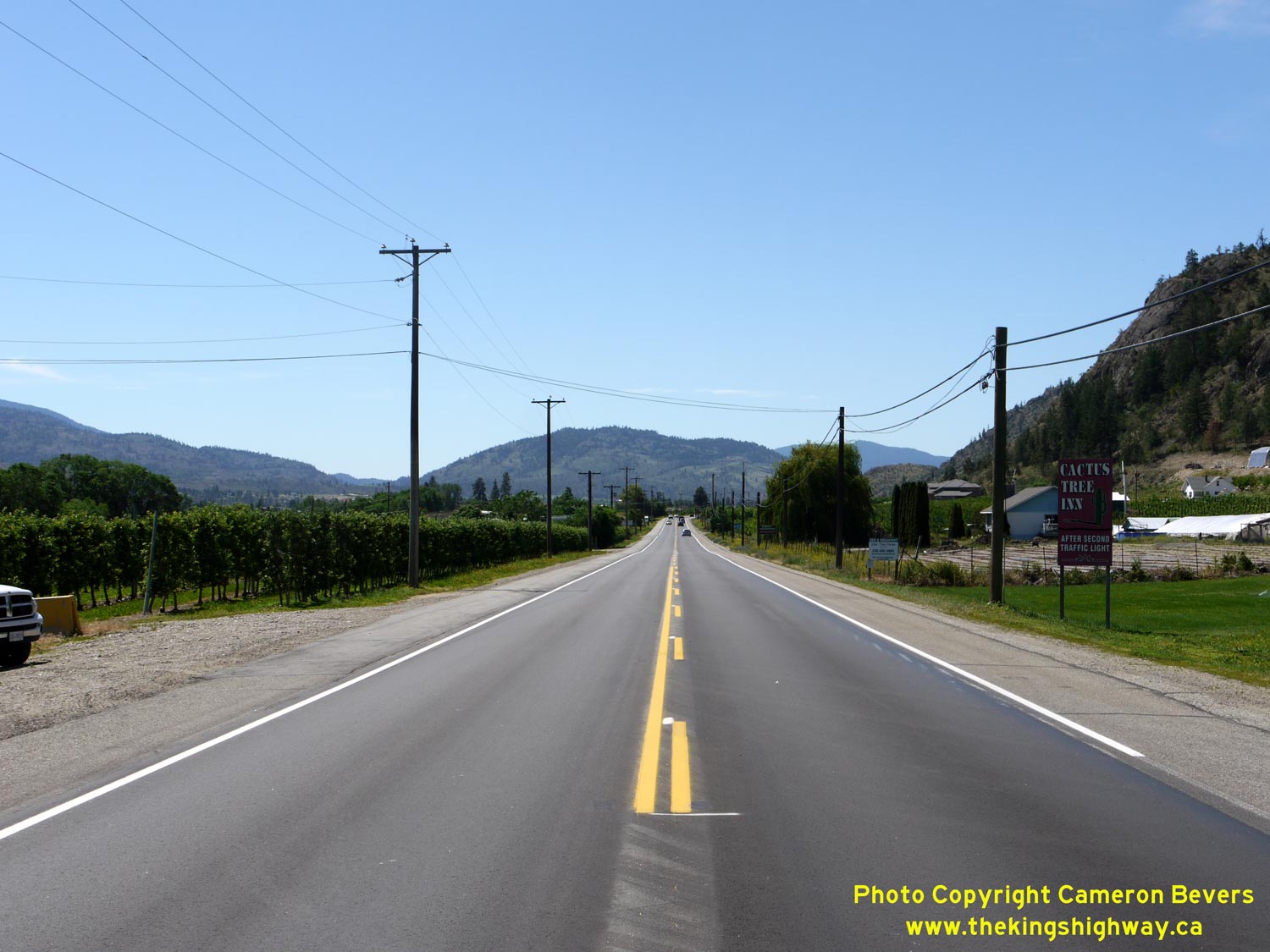
Left - This former alignment of Hwy 3A & Hwy 97 now forms a frontage road beside the new four-lane highway north of Osoyoos. See an
Enlarged Photo Here. (Photograph taken on June 9, 2015 - © Cameron Bevers) Right - The vineyards of the Oliver area provide for some pleasant views along Hwy 3A & Hwy 97. See an Enlarged Photo Here. (Photograph taken on June 9, 2015 - © Cameron Bevers) 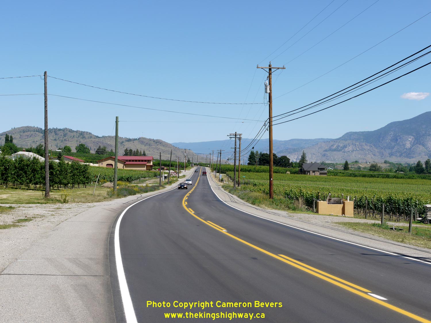

Left - Facing north along Hwy 3A & Hwy 97 about 6 km south of Oliver. See an
Enlarged Photo Here. (Photograph taken on June 9, 2015 - © Cameron Bevers) Right - Facing south along Hwy 3A & Hwy 97 towards Osoyoos about 6 km south of Oliver. See an Enlarged Photo Here. (Photograph taken on June 9, 2015 - © Cameron Bevers) 
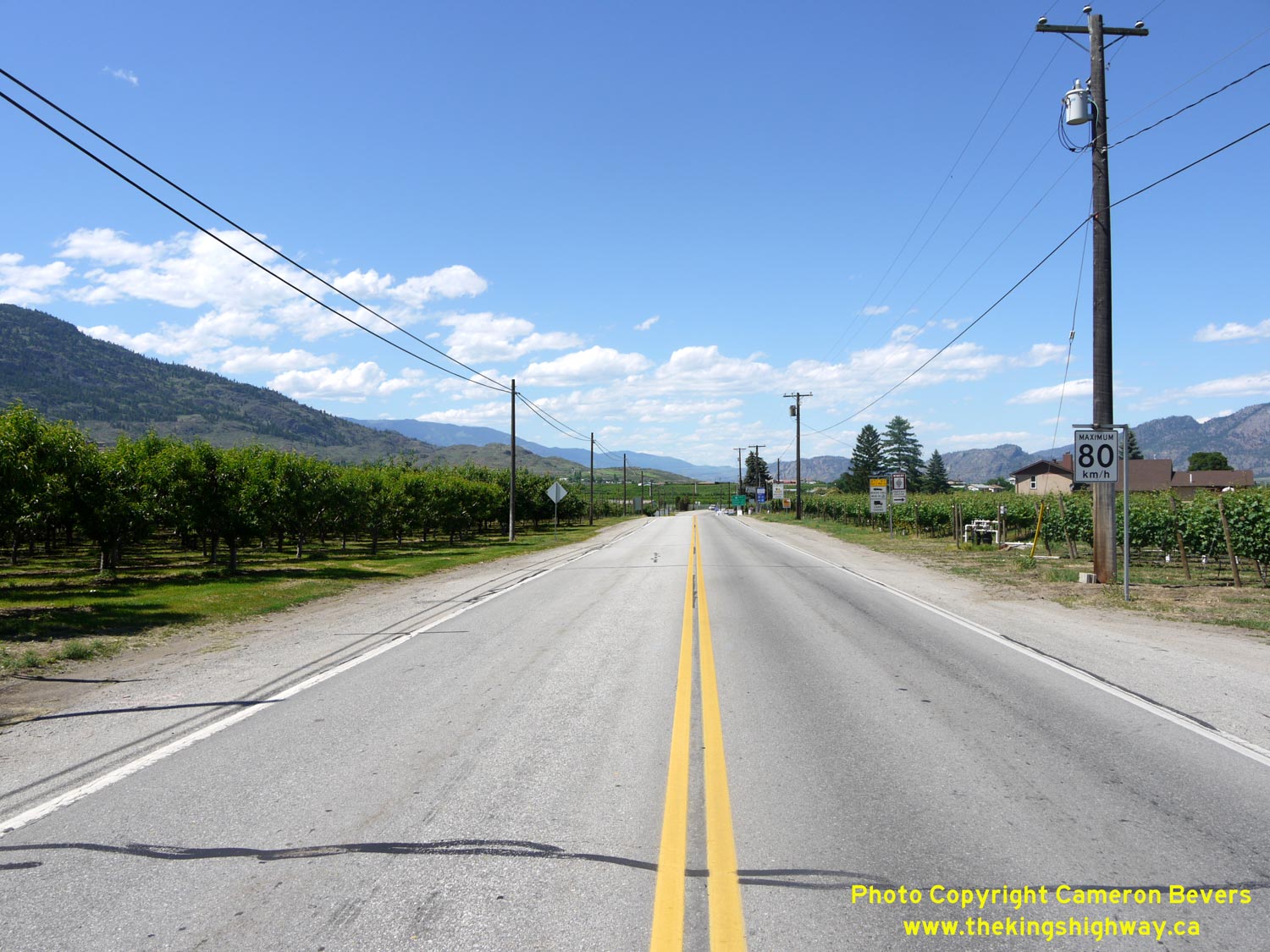
Left - Fruit orchards line both sides of Hwy 3A & Hwy 97, about 4 km south of Oliver. See an
Enlarged Photo Here. (Photograph taken on June 9, 2015 - © Cameron Bevers) Right - Entrance sign to Oliver on northbound Hwy 3A & Hwy 97. See an Enlarged Photo Here. (Photograph taken on June 9, 2015 - © Cameron Bevers) 

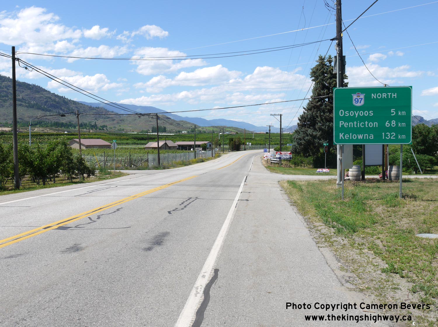
Left - Distance guide sign on southbound Hwy 3A & Hwy 97, departing Oliver. See an
Enlarged Photo Here. (Photograph taken on June 9, 2015 - © Cameron Bevers) Right - Dual Hwy 3A & Hwy 97 route markers departing Oliver. This is the last reference to the overlapped route of these two highways. From this point south to Osoyoos, all highway signs indicate the route of Hwy 97 only. See an Enlarged Photo Here. (Photograph taken on June 9, 2015 - © Cameron Bevers) 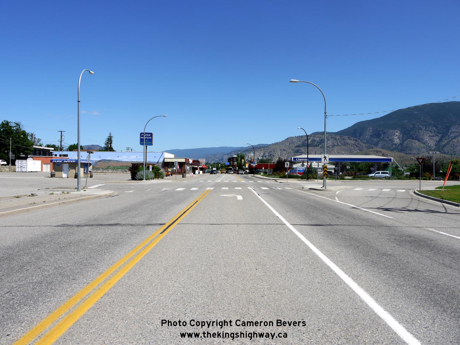

Left - Facing north along Hwy 3A & Hwy 97 at Co-Op Avenue, approaching Downtown Oliver. See an
Enlarged Photo Here. (Photograph taken on June 9, 2015 - © Cameron Bevers) Right - Facing south along Hwy 3A & Hwy 97 at School Avenue in Downtown Oliver. See an Enlarged Photo Here. (Photograph taken on June 9, 2015 - © Cameron Bevers) 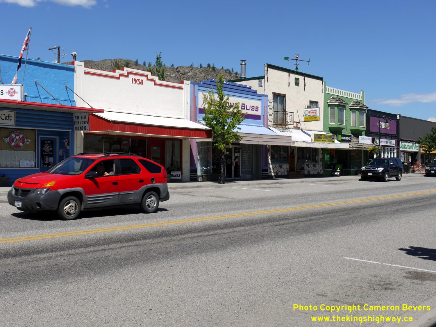

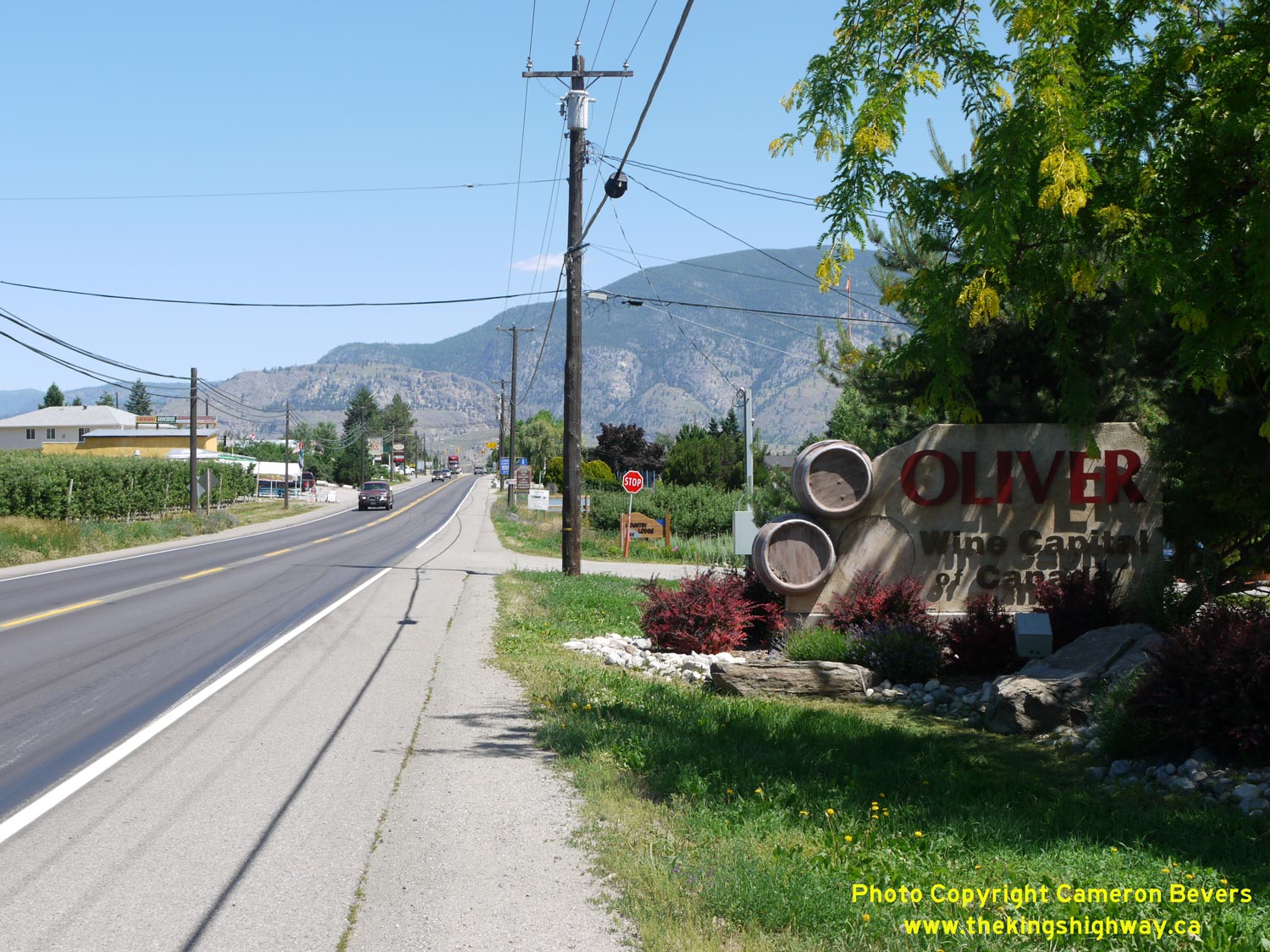
Left - Downtown Oliver's false-fronted buildings on Hwy 3A & Hwy 97 seem right at home in the dry climate of British Columbia's interior regions. This part
of British Columbia looks more like areas of California or Arizona. See an
Enlarged Photo Here. (Photograph taken on June 9, 2015 - © Cameron Bevers) Right - Facing north along Hwy 3A & Hwy 97 at School Avenue in Downtown Oliver. See an Enlarged Photo Here. (Photograph taken on June 9, 2015 - © Cameron Bevers) 
Left - Facing south along Hwy 3A & Hwy 97 at Veterans Avenue in Downtown Oliver. See an
Enlarged Photo Here. (Photograph taken on June 9, 2015 - © Cameron Bevers) Right - Facing south along Hwy 3A & Hwy 97, about 3 km north of Oliver. See an Enlarged Photo Here. (Photograph taken on June 9, 2015 - © Cameron Bevers) 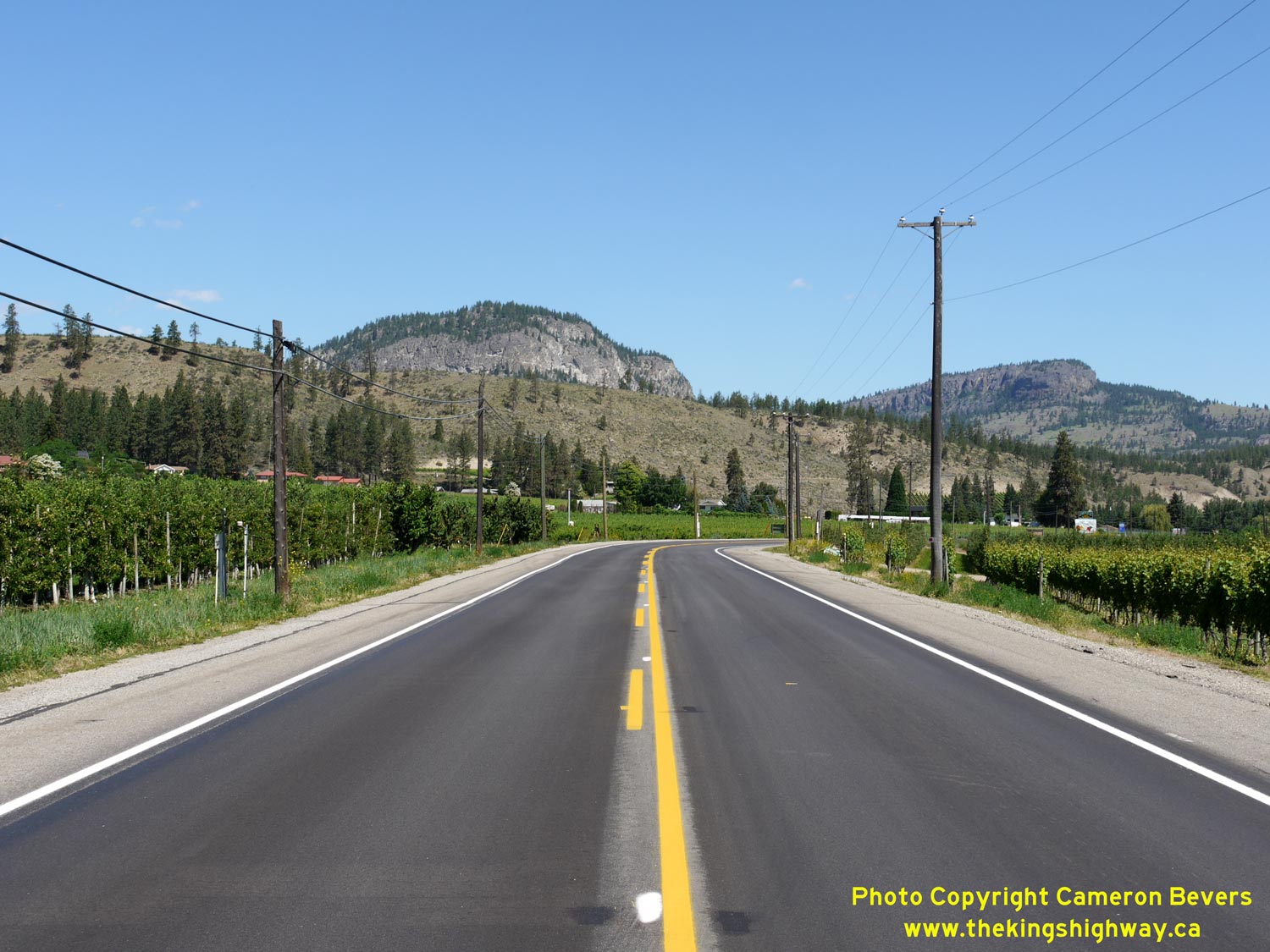

Left - Vineyards and fruit orchards line both sides of Hwy 3A & Hwy 97, about 3 km north of Oliver. The dry, hot summers and comparatively mild winters
make the Oliver area (and the Okanagan Valley in general) Canada's premier wine producing region. A clever system of irrigation channels has made this valley arable.
Before the irrigation system was built, the valley floor probably looked more like the arid hills in the background. See an
Enlarged Photo Here. (Photograph taken on June 9, 2015 - © Cameron Bevers) Right - The sheer rock face of McIntyre Bluff forms a scenic but imposing background along Hwy 3A & Hwy 97 about 10 km north of Oliver. See an Enlarged Photo Here. (Photograph taken on June 9, 2015 - © Cameron Bevers) 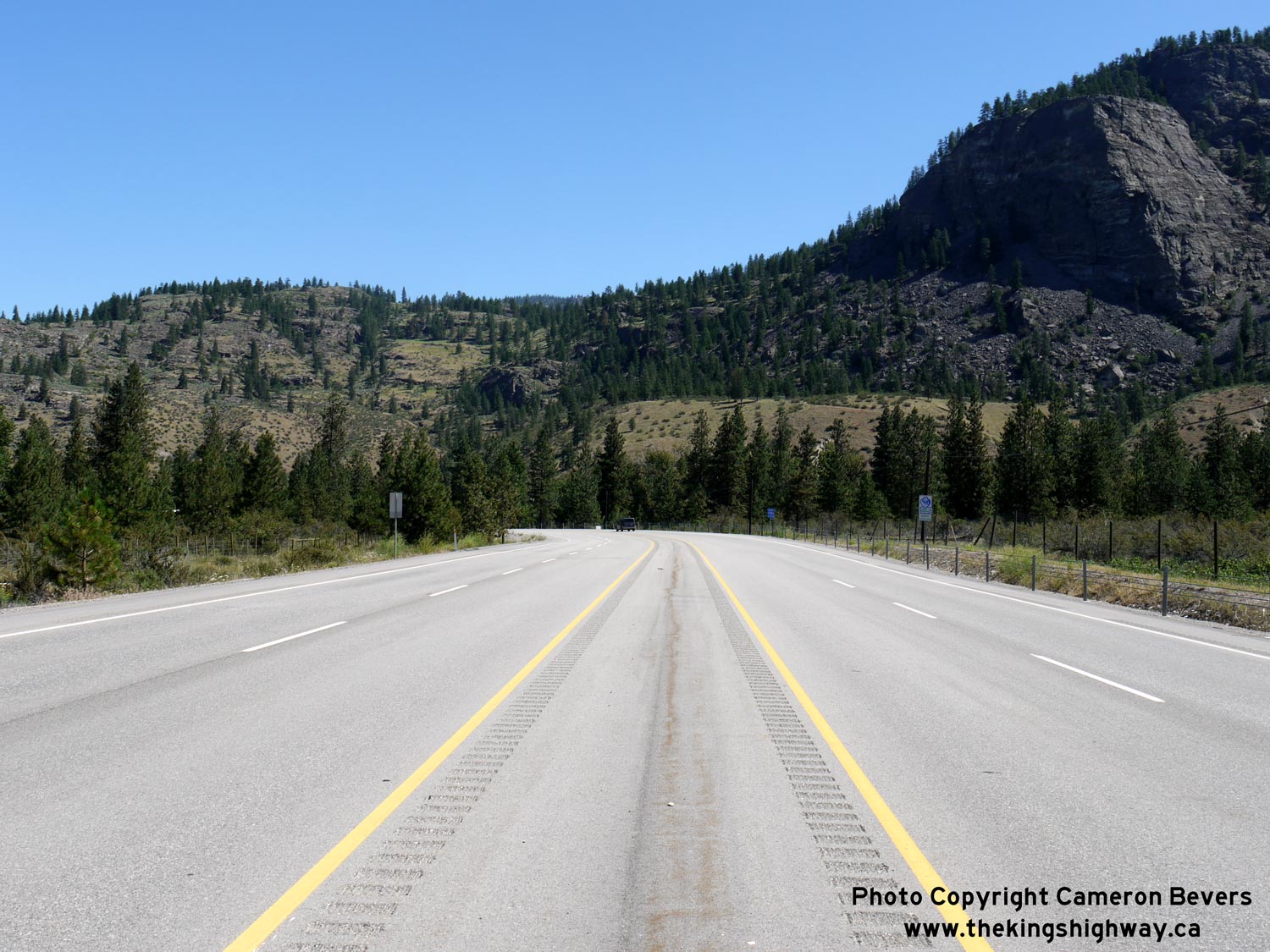
Left - Facing north along Hwy 3A & Hwy 97 about 10 km north of Oliver. This section of the highway was recently widened from two to four lanes in 2013. See an
Enlarged Photo Here. (Photograph taken on June 9, 2015 - © Cameron Bevers) Right - Approaching Vaseux Lake on Hwy 3A & Hwy 97, facing north towards Okanagan Falls. See an Enlarged Photo Here. (Photograph taken on June 9, 2015 - © Cameron Bevers) 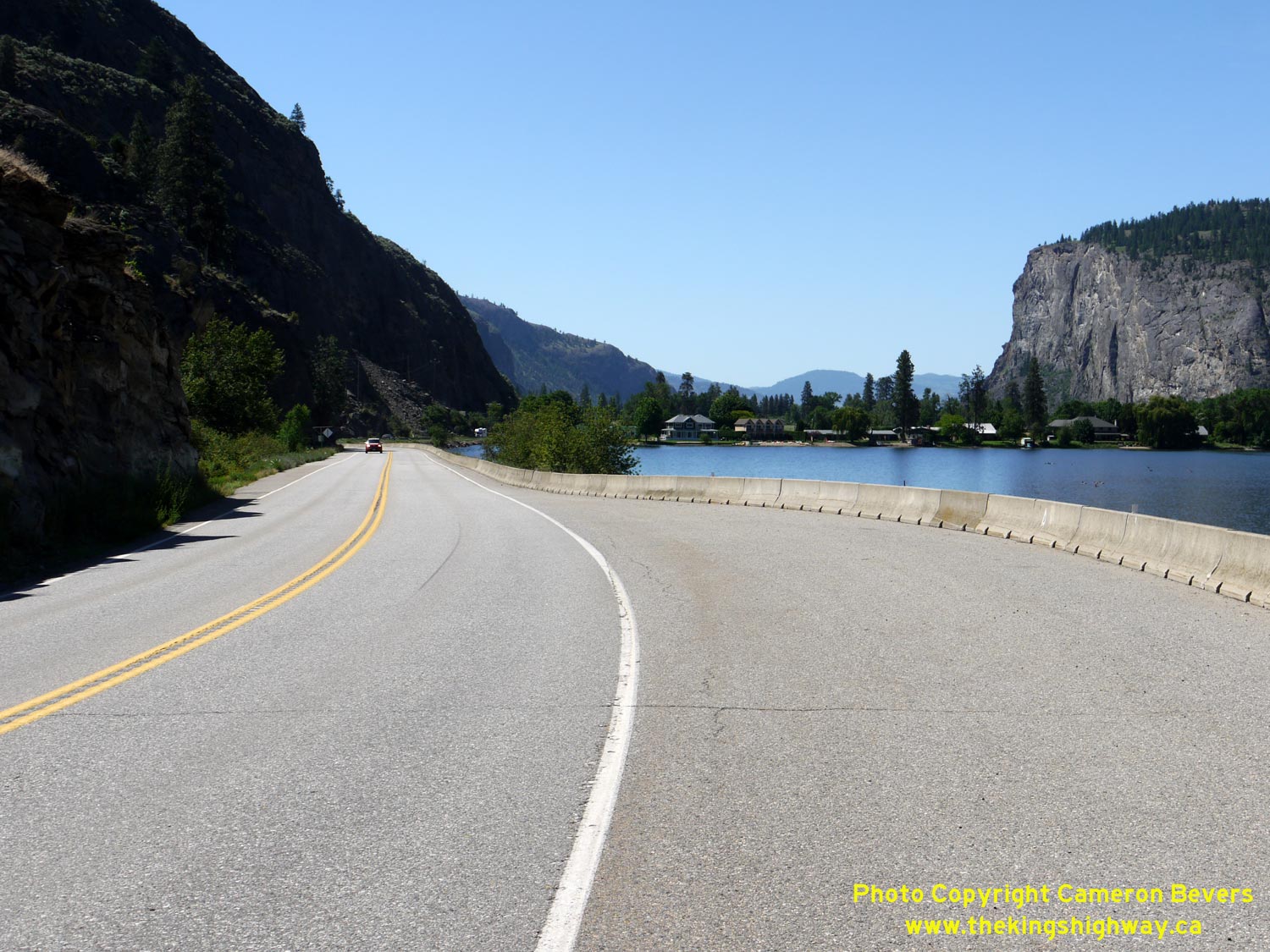

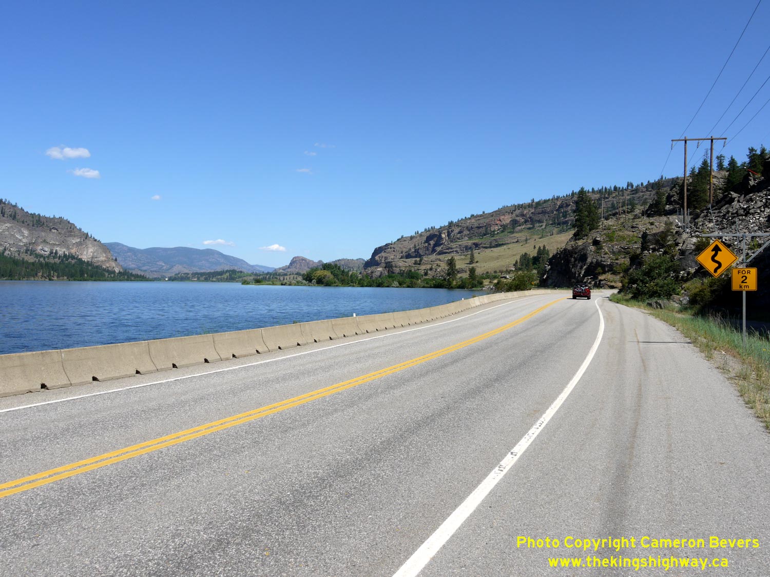
Left - McIntyre Bluff can be seen in the background, as Hwy 3A & Hwy 97 curves south towards Oliver beside scenic Vaseux Lake. See an
Enlarged Photo Here. (Photograph taken on June 9, 2015 - © Cameron Bevers) Right - The scenery along Hwy 3A & Hwy 97 at Vaseux Lake is quite spectacular! The highway's shoreline route makes it easy for motorists to enjoy the pleasant roadside views. The Okanagan Valley has many scenic stretches of highway. See an Enlarged Photo Here. (Photograph taken on June 9, 2015 - © Cameron Bevers) 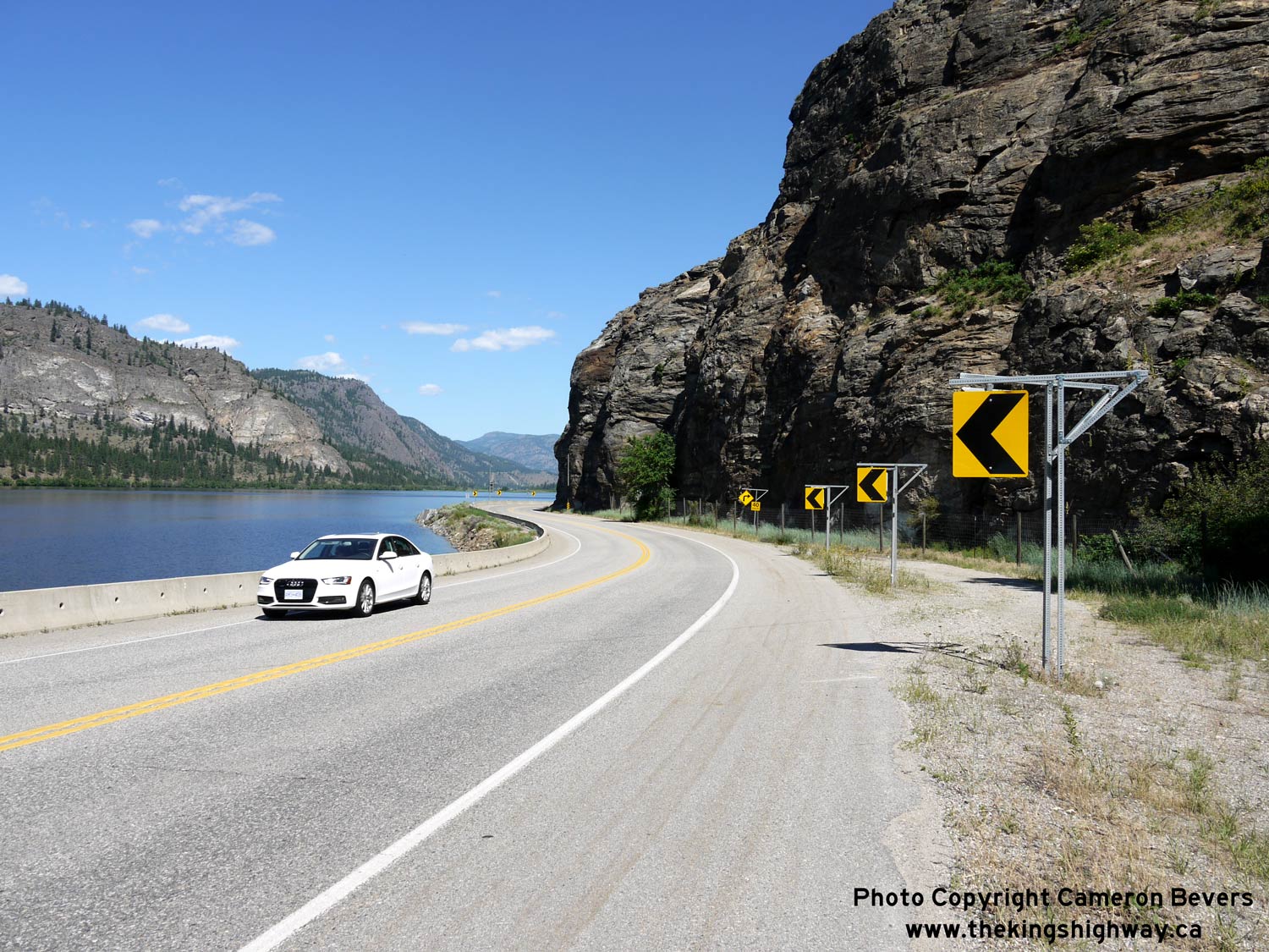

Left - I think the picture says it all! See an Enlarged Photo Here. (Photograph taken on June 9, 2015 - © Cameron Bevers) Right - A series of sharp curves along Hwy 3A & Hwy 97 at Vaseux Lake likely catches some motorists off-guard. An LED sign in the background illuminates whenever vehicles approach the curves too fast. See an Enlarged Photo Here. (Photograph taken on June 9, 2015 - © Cameron Bevers) 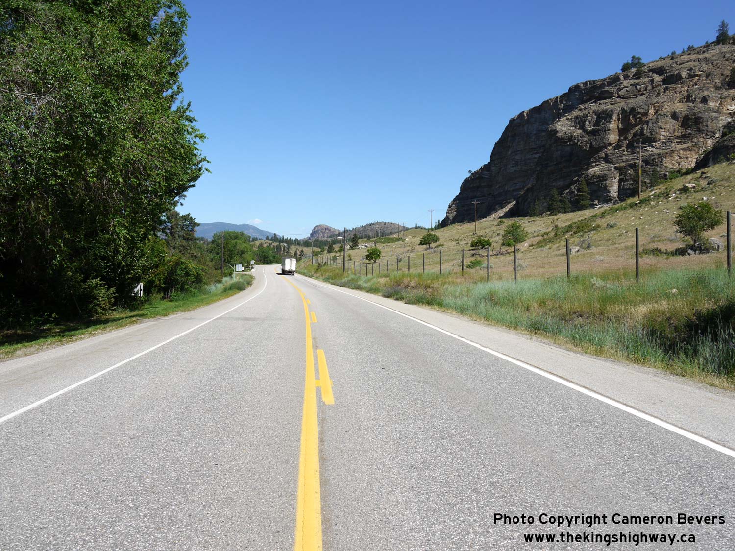
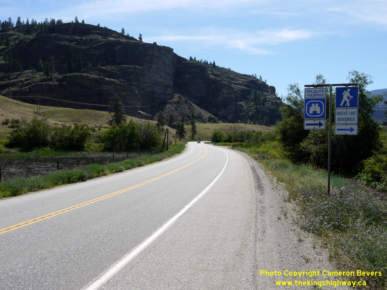
Left - Facing north along Hwy 3A & Hwy 97 approaching Vaseux Lake Provincial Park near Okanagan Falls. See an
Enlarged Photo Here. (Photograph taken on June 9, 2015 - © Cameron Bevers) Right - Facing south along Hwy 3A & Hwy 97 at Vaseux Lake Provincial Park near Okanagan Falls. See an Enlarged Photo Here. (Photograph taken on June 9, 2015 - © Cameron Bevers) 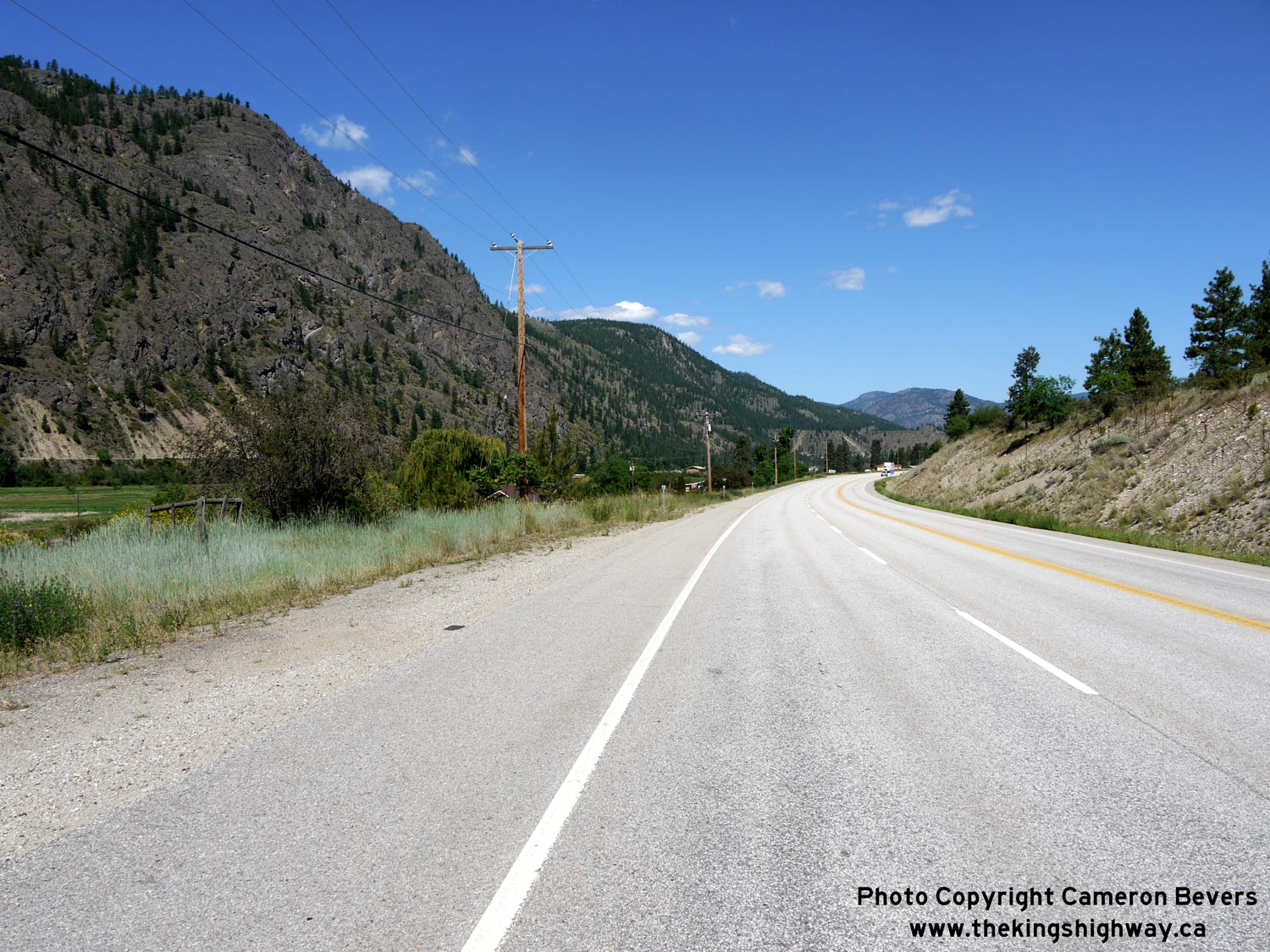
Left - Dry rugged mountains and sagebrush line the highway south of Okanagan Falls. See an
Enlarged Photo Here. (Photograph taken on June 9, 2015 - © Cameron Bevers) Right - Distance guide sign on southbound Hwy 3A & Hwy 97 departing Okanagan Falls. See an Enlarged Photo Here. (Photograph taken on June 9, 2015 - © Cameron Bevers) 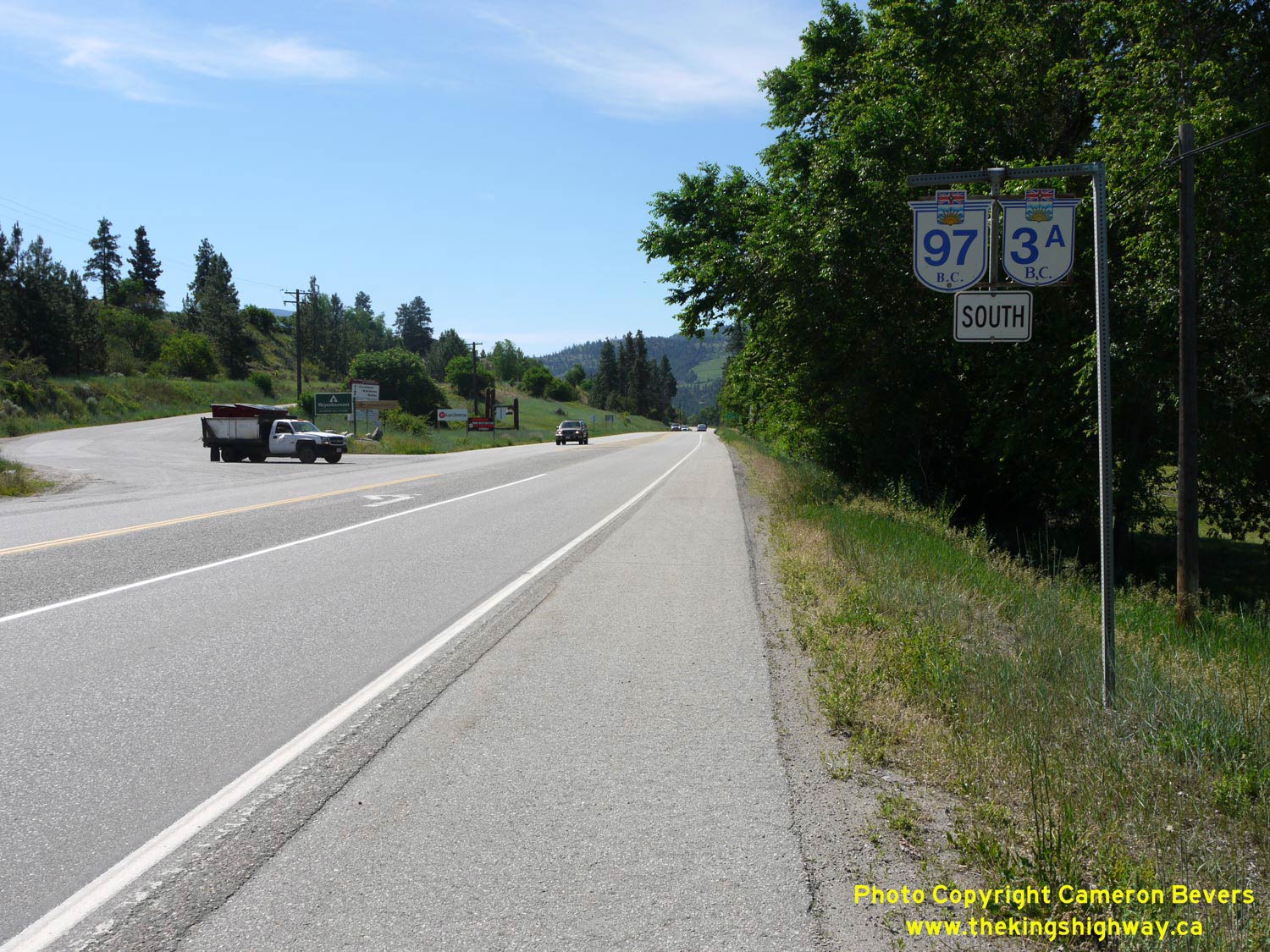

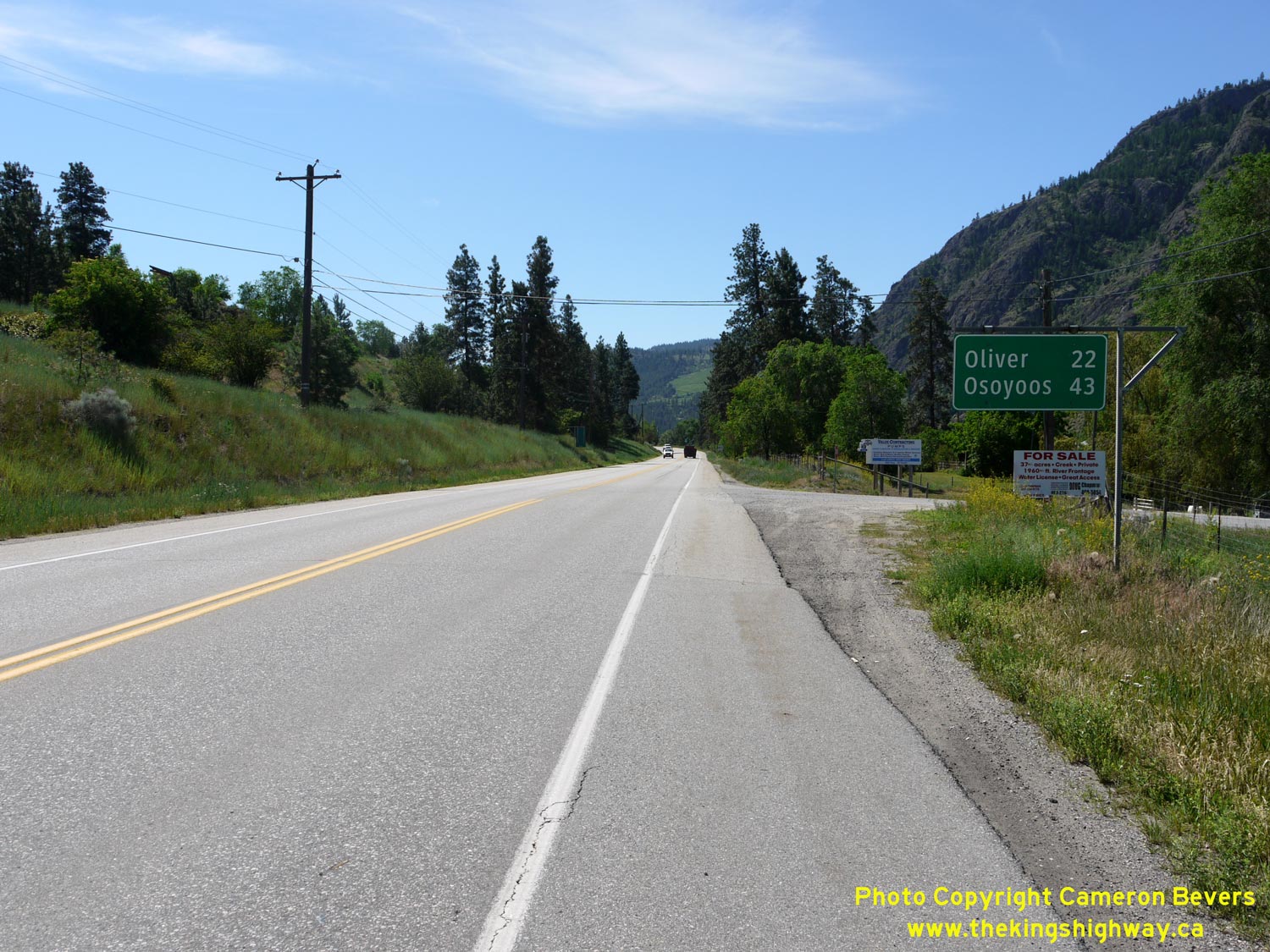
Left - Dual Hwy 3A & Hwy 97 route markers departing Okanagan Falls. See an
Enlarged Photo Here. (Photograph taken on June 9, 2015 - © Cameron Bevers) Right - Okanagan Wine Route marker on southbound Hwy 3A & Hwy 97. See an Enlarged Photo Here. (Photograph taken on June 9, 2015 - © Cameron Bevers) 

Left - Facing north along Main Street (Hwy 97) in Okanagan Falls. At the flashing beacon, Hwy 97 turns left and briefly heads west along 9th Avenue through
Okanagan Falls before resuming its route north towards Penticton. There are no references to Hwy 3A at the intersection. See an
Enlarged Photo Here. (Photograph taken on June 9, 2015 - © Cameron Bevers) Right - Facing west along 9th Avenue (Hwy 97) from Main Street in Okanagan Falls. See an Enlarged Photo Here. (Photograph taken on June 9, 2015 - © Cameron Bevers) 

Left - Overhead guide sign on 9th Avenue marking the route of Hwy 97, heading southbound in Okanagan Falls. See an
Enlarged Photo Here. (Photograph taken on June 9, 2015 - © Cameron Bevers) Right - Facing north along Hwy 3A & Hwy 97 at the Okanagan River Bridge. See an Enlarged Photo Here. (Photograph taken on June 9, 2015 - © Cameron Bevers) 

Left - The Okanagan River Bridge is at the northwest corner of Okanagan Falls, where Hwy 3A & Hwy 97 depart from town. Note the 1952 date stamp on the
northeast parapet wall. See an Enlarged Photo Here. (Photograph taken on June 9, 2015 - © Cameron Bevers) Right - The Okanagan River Bridge is a steel beam structure, supported on steel H-pile bents. See an Enlarged Photo Here. (Photograph taken on June 9, 2015 - © Cameron Bevers) 

Left - Western side of the Okanagan River Bridge on Hwy 3A & Hwy 97. See an
Enlarged Photo Here. (Photograph taken on June 9, 2015 - © Cameron Bevers) Right - View of the Okanagan River from Hwy 3A & Hwy 97. See an Enlarged Photo Here. (Photograph taken on June 9, 2015 - © Cameron Bevers) 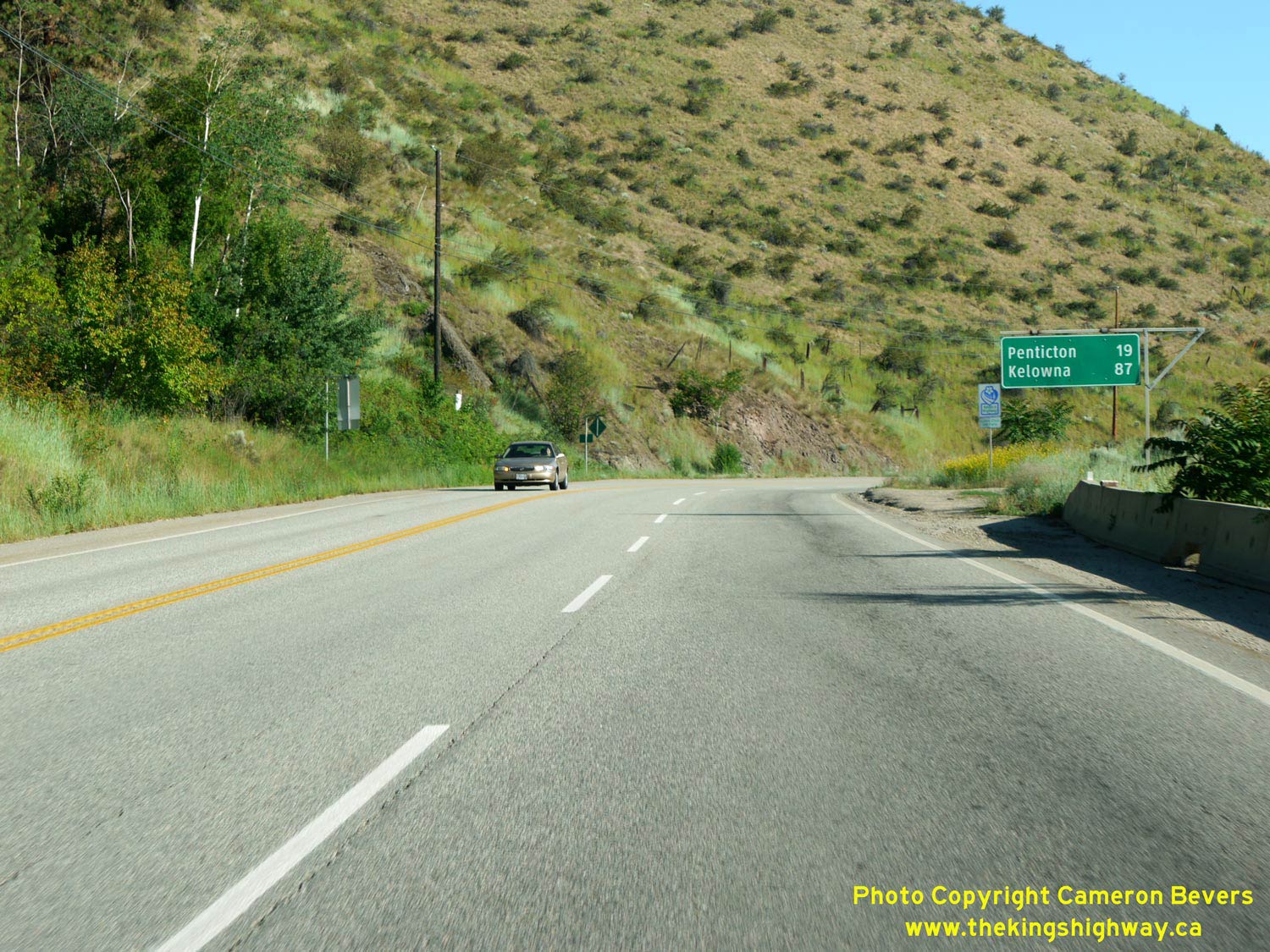

Left - Distance guide sign on northbound Hwy 3A & Hwy 97 departing Okanagan Falls. See an
Enlarged Photo Here. (Photograph taken on June 9, 2015 - © Cameron Bevers) Right - Hwy 3A & Hwy 97 climb quickly into the foothills north of Okanagan Falls. See an Enlarged Photo Here. (Photograph taken on June 9, 2015 - © Cameron Bevers) 

Left - Facing south along Hwy 3A & Hwy 97 approaching Skaha Lake and Okanagan Falls. See an
Enlarged Photo Here. (Photograph taken on June 9, 2015 - © Cameron Bevers) Right - Junction sign assembly marking the Hwy 3A turn-off 6 km north of Okanagan Falls. From here, Hwy 3A loops around and heads southwest towards Keremeos, where it rejoins with the Crowsnest Highway (Hwy 3). Oddly, the abbreviation "Hwy" appears in the Hwy 3A route marker itself. Typically, only the route number is shown in the marker. See an Enlarged Photo Here. (Photograph taken on June 9, 2015 - © Cameron Bevers) 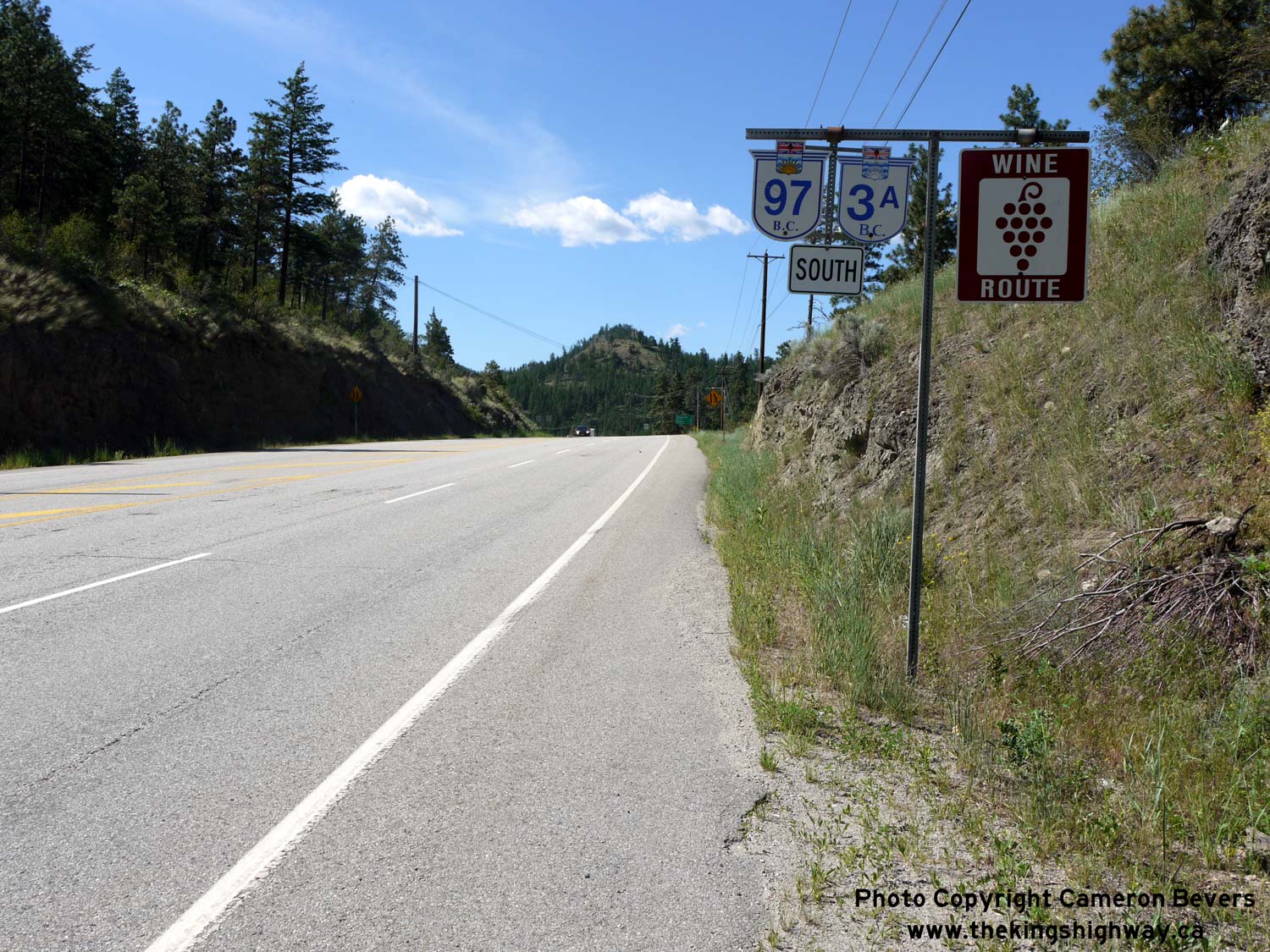

Left - Dual Hwy 3A & Hwy 97 route markers and Okanagan Wine Route marker heading southbound from the Hwy 3A turn-off. See an
Enlarged Photo Here. (Photograph taken on June 9, 2015 - © Cameron Bevers) Right - Distance guide sign on southbound Hwy 3A & Hwy 97 at the Hwy 3A West turn-off. See an Enlarged Photo Here. (Photograph taken on June 9, 2015 - © Cameron Bevers) 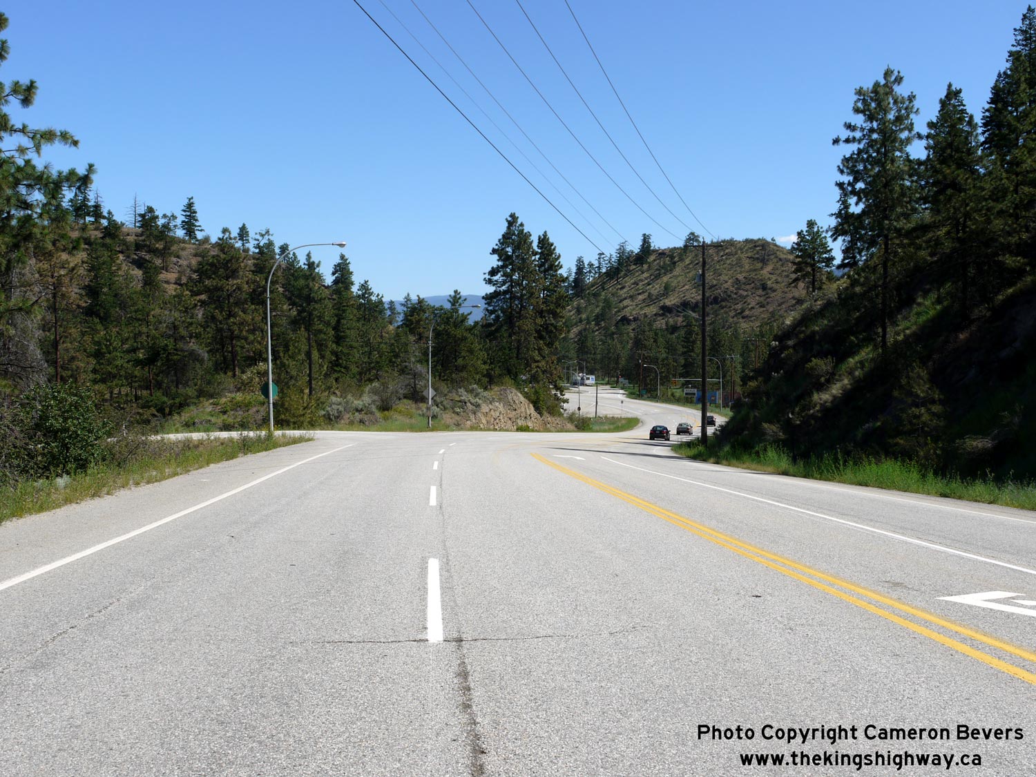
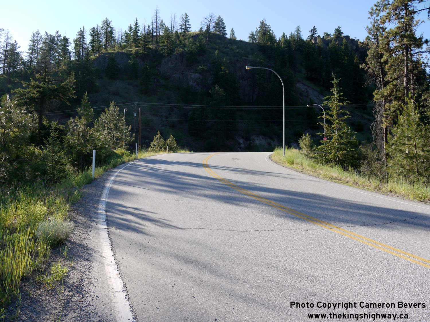
Left - The Hwy 3A turn-off is a directional "Y" intersection. The south leg of the "Y" intersection joins Hwy 97 at left. See an
Enlarged Photo Here. (Photograph taken on June 9, 2015 - © Cameron Bevers) Right - Approaching the Hwy 97 Junction on the south leg of the directional "Y" intersection with Hwy 3A. Eastbound traffic on Hwy 3A has to ascend a steep grade in order to reach Hwy 97. See an Enlarged Photo Here. (Photograph taken on June 9, 2015 - © Cameron Bevers) 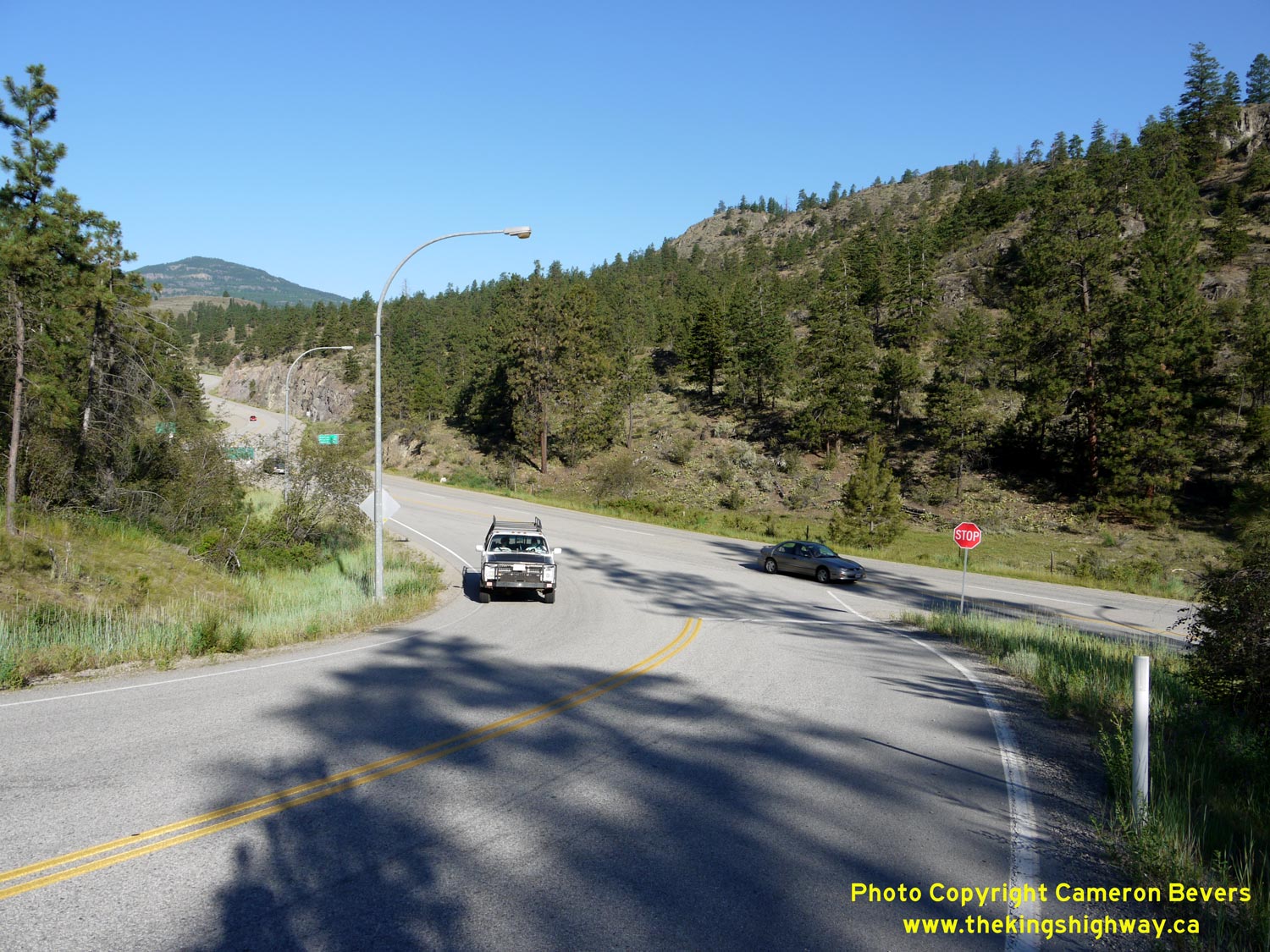

Left - The north and south legs of the Hwy 3A directional "Y" intersection join here on their route west towards Keremeos. See an
Enlarged Photo Here. (Photograph taken on June 9, 2015 - © Cameron Bevers) Right - Facing east along Hwy 3A towards the directional "Y" intersection at Hwy 97. The route of Hwy 3A follows the south leg of the "Y" at right where it connects to southbound Hwy 97. The left leg of the "Y" carries eastbound Hwy 3A traffic to northbound Hwy 97. See an Enlarged Photo Here. (Photograph taken on June 9, 2015 - © Cameron Bevers) 

Left - Facing west along Hwy 3A towards Keremeos from the Hwy 97 Junction. The south leg of the directional "Y" junction joins Hwy 3A at left. See an
Enlarged Photo Here. (Photograph taken on June 9, 2015 - © Cameron Bevers) Right - The route of Hwy 3A rounds a pair of reverse curves as it departs from the directional "Y" intersection at Hwy 97. See an Enlarged Photo Here. (Photograph taken on June 9, 2015 - © Cameron Bevers) 

Left - Directional guide sign on eastbound Hwy 3A approaching the Hwy 97 Junction between Okanagan Falls and Penticton. See an
Enlarged Photo Here. (Photograph taken on June 9, 2015 - © Cameron Bevers) Right - The north leg of the Hwy 3A directional "Y" intersection comes to an end at Hwy 97. From here, most traffic turns north along Hwy 97 towards Penticton. See an Enlarged Photo Here. (Photograph taken on June 9, 2015 - © Cameron Bevers) 

Left - Facing north along Hwy 97 towards Penticton approaching the north leg of the directional "Y" intersection at Hwy 3A. See an
Enlarged Photo Here. (Photograph taken on June 9, 2015 - © Cameron Bevers) Right - Approaching the truck scales located at the Hwy 3A & Hwy 97 Junction. Note the old "flip-disc" changeable message sign indicating that the truck scales are open. Flip-disc signs such as this one use round plastic discs with alternating colours on each side which can be reversed or flipped mechanically to display a pre-determined message to motorists. This type of highway sign has been made largely obsolete with the introduction of LED electronic signs, which can be customized to display a wide range of messages. See an Enlarged Photo Here. (Photograph taken on June 9, 2015 - © Cameron Bevers) 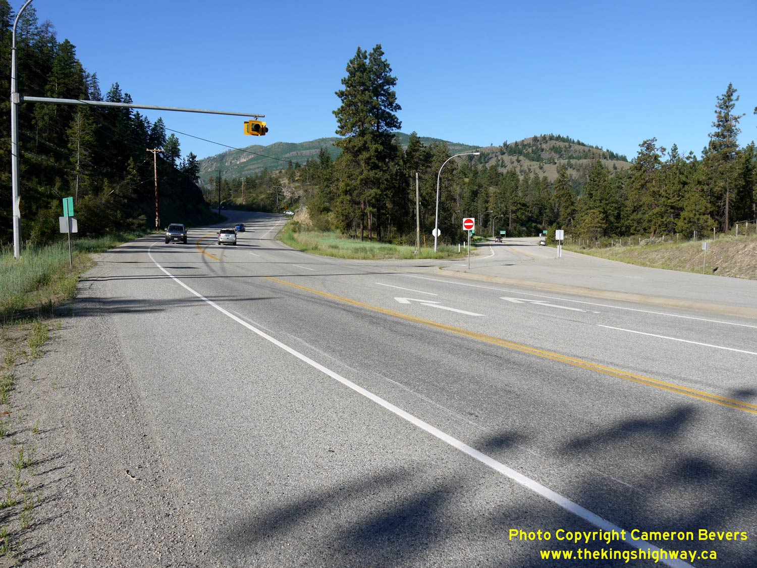

Left - A view of the skewed junction of Hwy 3A & Hwy 97, facing west towards Keremeos. Prior to the completion of the Okanagan Connector (Hwy 97C) in the
1990s, all traffic travelling between the Okanagan Valley and Vancouver would have passed through this intersection. By comparison, Hwy 3A is quite lightly travelled
today. See an Enlarged Photo Here. (Photograph taken on June 9, 2015 - © Cameron Bevers) Right - Facing south along Hwy 97 approaching the Hwy 3A turn-off. The right turn from southbound Hwy 97 to westbound Hwy 3A is channelized. See an Enlarged Photo Here. (Photograph taken on June 9, 2015 - © Cameron Bevers) 
Left - The Okanagan Wine Route continues north along Hwy 97 towards Penticton from the Hwy 3A turn-off. See an
Enlarged Photo Here. (Photograph taken on June 9, 2015 - © Cameron Bevers) Right - Hwy 3A junction marker on southbound Hwy 97. See an Enlarged Photo Here. (Photograph taken on June 9, 2015 - © Cameron Bevers) 

Left - Overhead guide sign marking the Hwy 3A turn-off from southbound Hwy 97. See an
Enlarged Photo Here. (Photograph taken on June 9, 2015 - © Cameron Bevers) Right - Destination guide signs on southbound Hwy 97 approaching the Hwy 3A Junction. See an Enlarged Photo Here. (Photograph taken on June 9, 2015 - © Cameron Bevers) 
Left - Guide sign for Hwy 97 South approaching the Hwy 3A turn-off. There is a long uphill truck climbing lane along southbound Hwy 97 passing through the
Hwy 3A Junction. This sign is presumably in place to encourage motorists to make use of both lanes rather than occupy the left lane only, since the next sign suggests
that staying to the right will force traffic to exit Hwy 97 towards Vancouver. See an
Enlarged Photo Here. (Photograph taken on June 9, 2015 - © Cameron Bevers) Right - Distance guide sign on northbound Hwy 97 at the Hwy 3A turn-off. See an Enlarged Photo Here. (Photograph taken on June 9, 2015 - © Cameron Bevers) 

Left - View of Hwy 97 at dusk, facing north towards Penticton about 2 km north of the Hwy 3A Junction. See an
Enlarged Photo Here. (Photograph taken on June 8, 2015 - © Cameron Bevers) Right - Hwy 97 clings to the side of this precipitous cliff above Skaha Lake about 3 km south of Penticton. See an Enlarged Photo Here. (Photograph taken on June 9, 2015 - © Cameron Bevers) 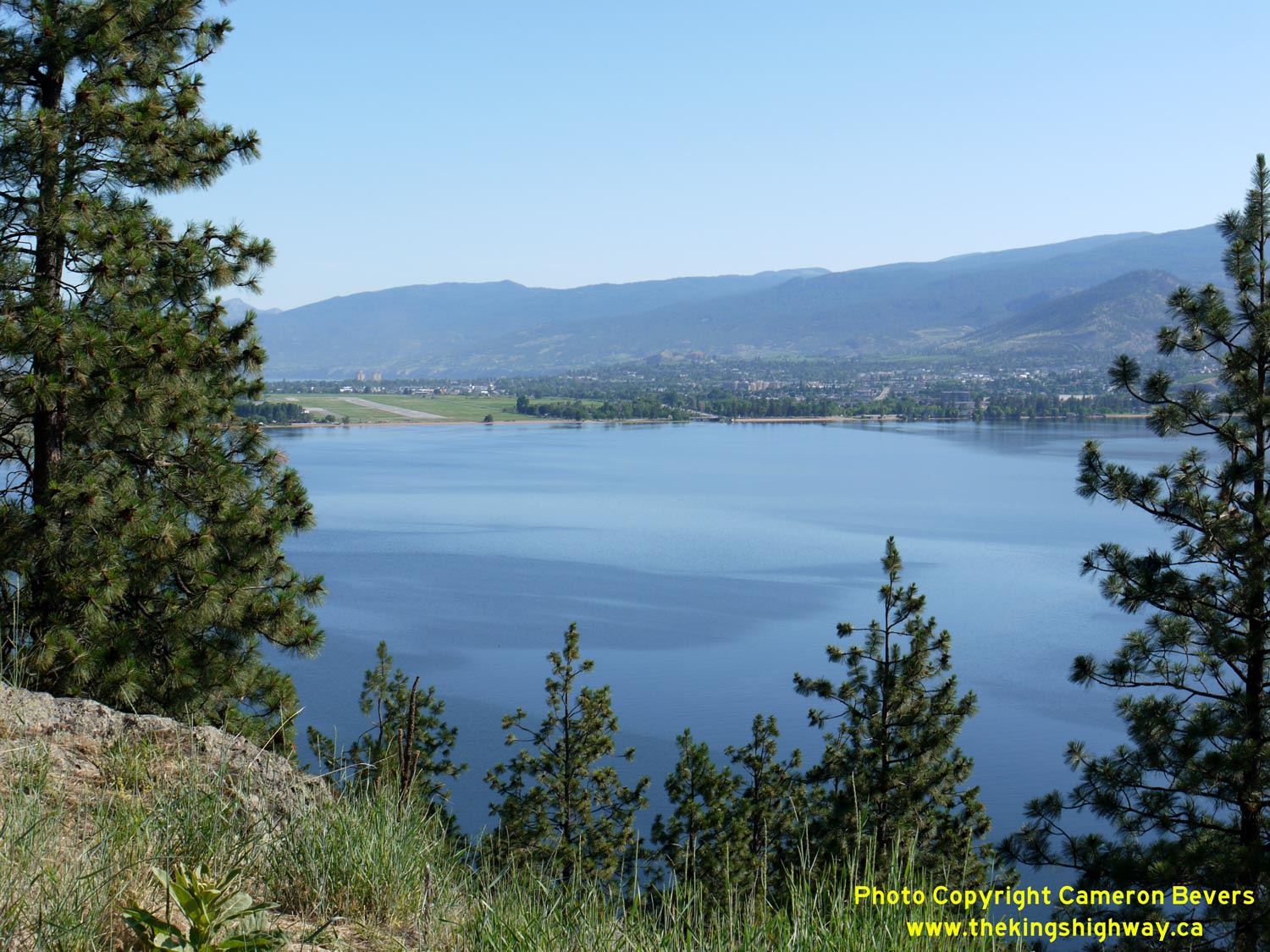

Left - The City of Penticton can be seen at the northern end of Skaha Lake, from this roadside park and lookout on Hwy 97. See an
Enlarged Photo Here. (Photograph taken on June 9, 2015 - © Cameron Bevers) Right - One of many spectacular views of Skaha Lake from Hwy 97 south of Penticton. See an Enlarged Photo Here. (Photograph taken on June 9, 2015 - © Cameron Bevers) 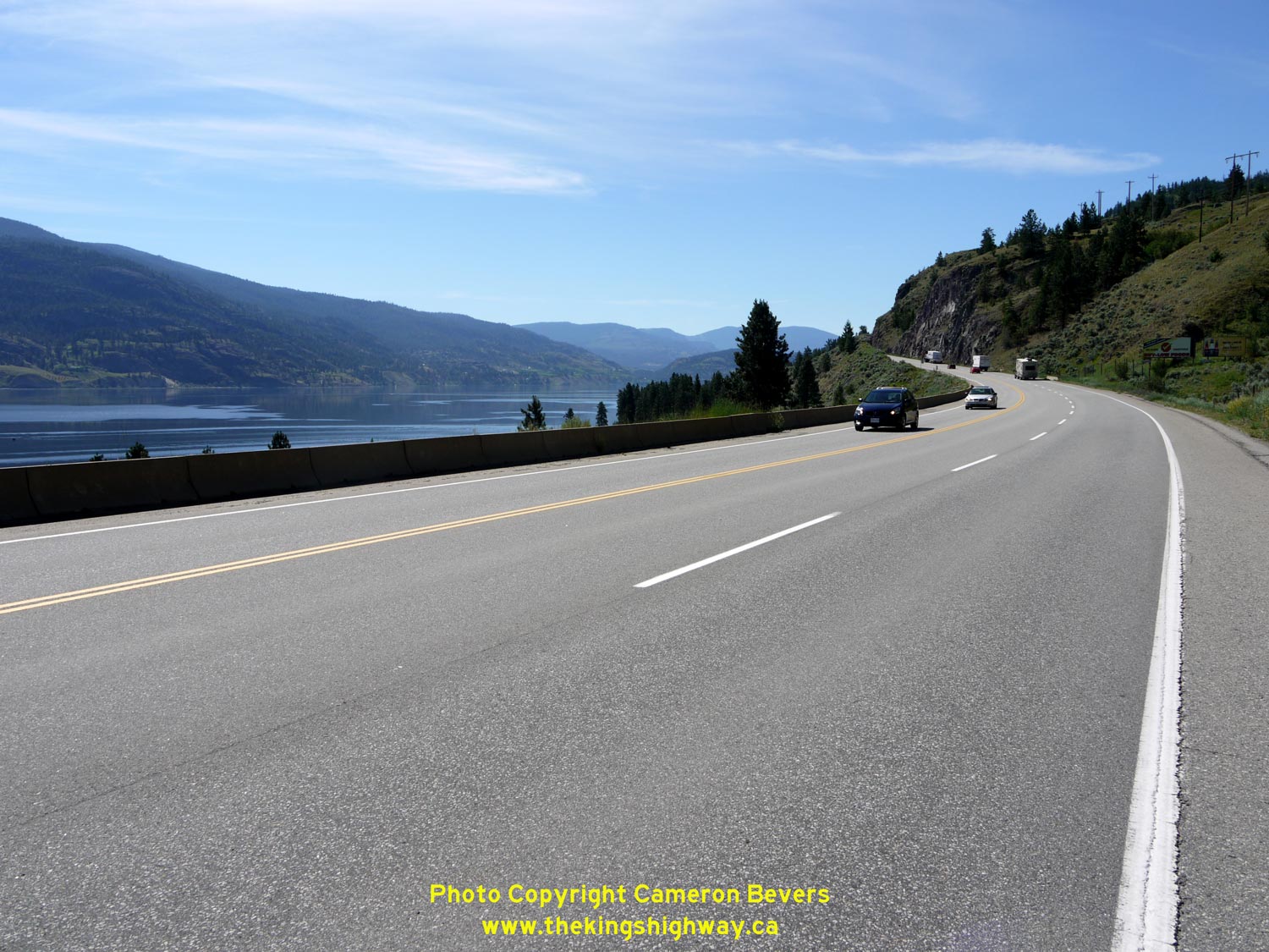
Left - Facing south along Hwy 97 towards Okanagan Falls, about 2 km south of Penticton. See an
Enlarged Photo Here. (Photograph taken on June 9, 2015 - © Cameron Bevers) Right - Facing north along Hwy 97 towards Penticton. See an Enlarged Photo Here. (Photograph taken on June 9, 2015 - © Cameron Bevers) 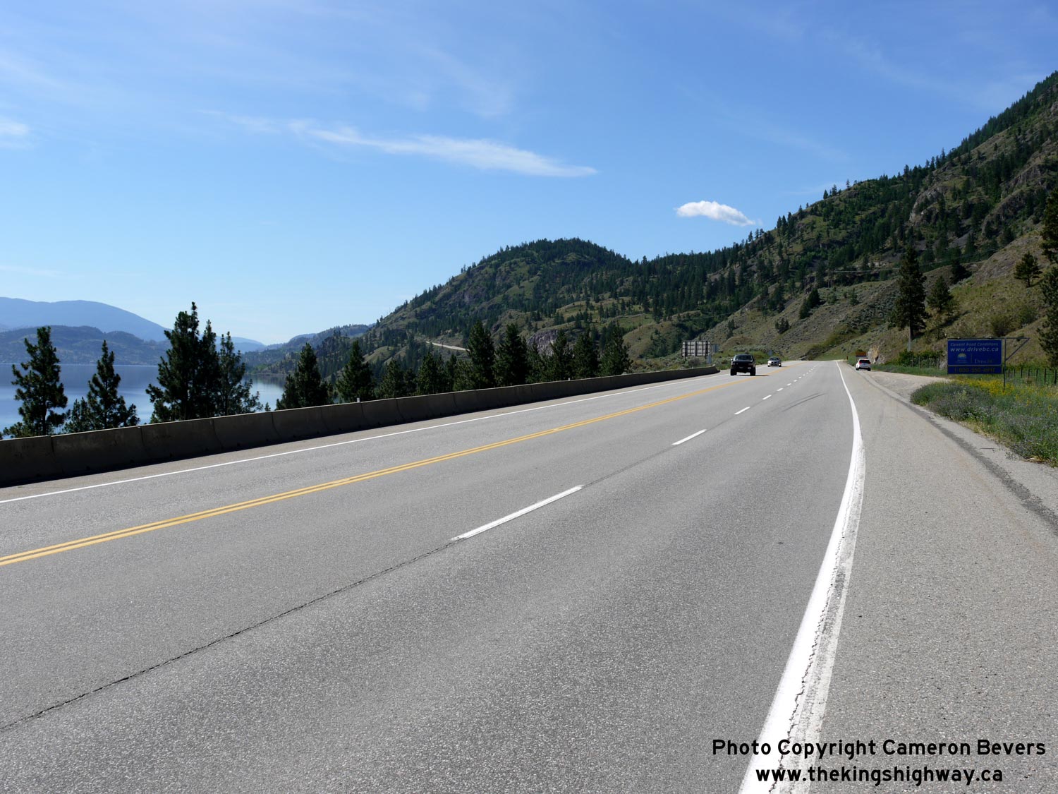

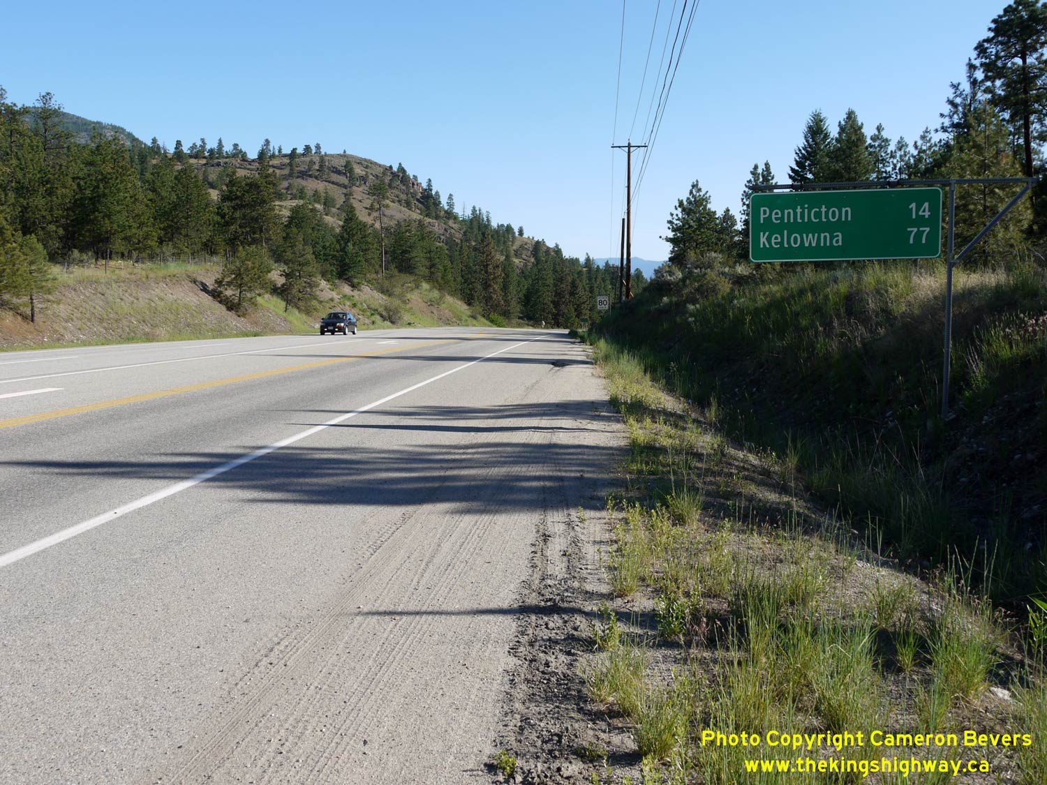
Left - Hwy 97 slowly ascends from Penticton into the hills on the west side of Skaha Lake. See an
Enlarged Photo Here. (Photograph taken on June 9, 2015 - © Cameron Bevers) Right - Distance guide sign on southbound Hwy 97 departing Penticton. See an Enlarged Photo Here. (Photograph taken on June 9, 2015 - © Cameron Bevers) 

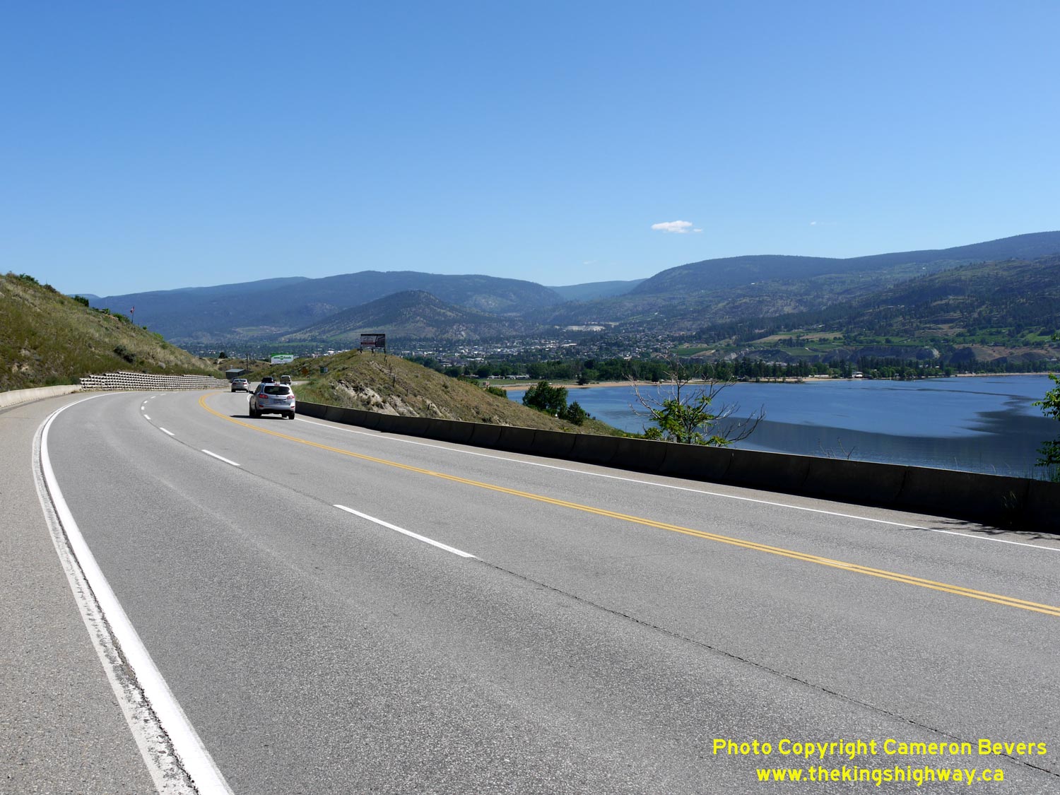
Left - Facing south along Hwy 97 towards Okanagan Falls from Penticton. See an
Enlarged Photo Here. (Photograph taken on June 9, 2015 - © Cameron Bevers) Right - Approaching Penticton on Hwy 97. This is the first major city along Hwy 97 in British Columbia north of the Canada-United States Boundary. See an Enlarged Photo Here. (Photograph taken on June 9, 2015 - © Cameron Bevers) 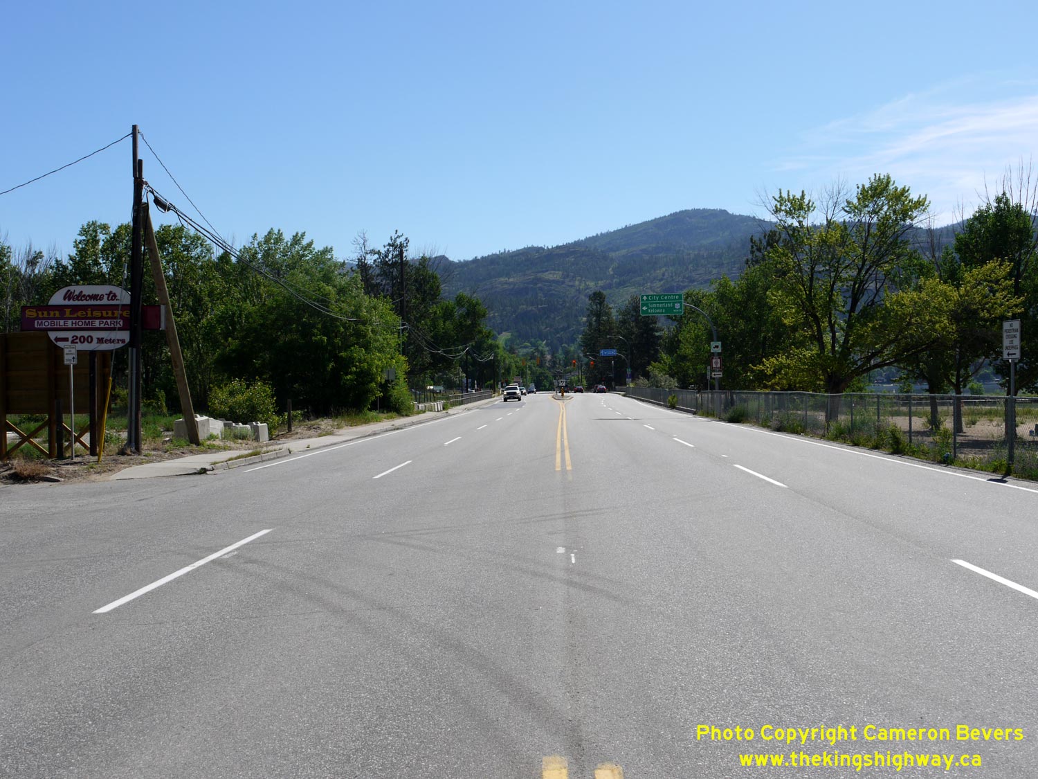

Left - The route of Hwy 97 curves along the north shore of Skaha Lake. Just beyond Penticton Airport, Hwy 97 turns left and heads north towards Downtown
Penticton. See an Enlarged Photo Here. (Photograph taken on June 9, 2015 - © Cameron Bevers) Right - The City Centre is signed straight ahead via Skaha Lake Road. However, the quickest way to reach Downtown is via Channel Parkway, which was obviously designed as a truck bypass around the city. Although the distance offered by both routes is comparable, the highway route has fewer traffic signals. See an Enlarged Photo Here. (Photograph taken on June 9, 2015 - © Cameron Bevers)
Continue north along BC Highway 97 from Penticton to Kelowna |
|---|
Links to Adjacent BC Highway Photograph Pages:
Back to BC Highway 41 Photos /
British Columbia Highways Photo Index /
On to BC Highway 97A Photos
Ontario Highway History - Main Menu / Vacation Highway Photos - Main Menu Website contents, photos & text © 2002-2026, Cameron
Bevers (Webmaster) - All Rights Reserved / Contact Me
|
|---|