
| 
| |
|
|
This page contains photographs of British Columbia's Highway 6, arranged by location from New Denver northerly to Nakusp. All
photographs displayed on this page were taken by the Webmaster (Cameron Bevers). To view photos of other British Columbia Highways, please select a highway number
listed on the British Columbia Photograph Index Page. Click on any
thumbnail to see a larger image!
Please note that all photographs displayed on this website are protected by copyright. These photographs must not be
reproduced, published, electronically stored or copied, distributed, or posted onto other websites without my written permission. If you want to use photos from this
website, please email me first for permission. Thank-you!
|
|---|
|
Page 1: BC Highway 6 Photographs: New Denver to Nakusp


Left - Facing south along Hwy 6 towards Nelson from the Hwy 31A Junction in New Denver. See an
Enlarged Photo Here. (Photograph taken on June 5, 2017 - © Cameron Bevers) Right - Approaching the Hwy 31A Junction on Hwy 6 in New Denver, facing north. Hwy 31A crosses over the Goat Range and connects to Hwy 31 in Kaslo, on the other side of the mountains. Hwy 31A is an essential alternate route to Hwy 31 in the winter months, as a significant section of Hwy 31 is not kept open between Kaslo and Galena Bay. See an Enlarged Photo Here. (Photograph taken on June 5, 2017 - © Cameron Bevers) 

Left - Facing north along Hwy 6 towards the Hwy 31A Junction in New Denver. See an
Enlarged Photo Here. (Photograph taken on June 5, 2017 - © Cameron Bevers) Right - Hwy 6 & Hwy 31A route marker assembly in New Denver, facing northbound traffic. The Historic Mining Route follows Hwy 31A up into the Goat Range, where it passes the sites of several historical mining towns. A significant mining boom took place in the New Denver and Kaslo areas during the 1890s. See an Enlarged Photo Here. (Photograph taken on June 5, 2017 - © Cameron Bevers) 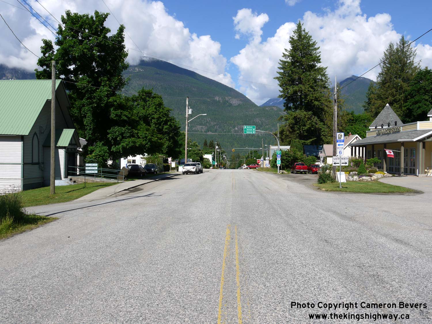

Left - Approaching the western terminus of Hwy 31A at the Hwy 6 Junction in New Denver. Traffic can either turn right along Hwy 6 North towards Nakusp or Hwy 6
South towards Nelson, or continue west for a few blocks via 6th Avenue into the historic New Denver Town Centre. See an
Enlarged Photo Here. (Photograph taken on June 5, 2017 - © Cameron Bevers) Right - Facing east along Hwy 31A towards Kaslo from the Hwy 6 Junction in New Denver. See an Enlarged Photo Here. (Photograph taken on June 5, 2017 - © Cameron Bevers) 

Left - Facing south along Hwy 6 towards the Hwy 31A Junction in New Denver. See an
Enlarged Photo Here. (Photograph taken on June 5, 2017 - © Cameron Bevers) Right - An example of a British Columbia Pedestrian Crossover on Hwy 6 in New Denver. See an Enlarged Photo Here. (Photograph taken on June 5, 2017 - © Cameron Bevers) 

Left - Facing north along Hwy 6 towards Nakusp from the Hwy 31A Junction in New Denver. See an
Enlarged Photo Here. (Photograph taken on June 5, 2017 - © Cameron Bevers) Right - Hwy 6 rounds this sharp reverse curve on its northern approach to New Denver. See an Enlarged Photo Here. (Photograph taken on June 5, 2017 - © Cameron Bevers) 

Left - Facing north along Hwy 6 towards Nakusp from Rosebery. See an
Enlarged Photo Here. (Photograph taken on June 5, 2017 - © Cameron Bevers) Right - Approaching Rosebery on Hwy 6, facing south. Rosebery is situated about 6 km north of New Denver. See an Enlarged Photo Here. (Photograph taken on June 5, 2017 - © Cameron Bevers) 

Left - Facing south along Hwy 6 towards New Denver from the Rosebery Lookout. Long Mountain can be seen in the distance. See an
Enlarged Photo Here. (Photograph taken on June 5, 2017 - © Cameron Bevers) Right - This spectacular view of Slocan Lake can be viewed from the Rosebery Lookout, located about 8 km north of New Denver. See an Enlarged Photo Here. (Photograph taken on June 5, 2017 - © Cameron Bevers) 

Left - The snow-covered peak of Mount Ferrie comes into view as Hwy 6 rounds this curve north of Rosebery. See an
Enlarged Photo Here. (Photograph taken on June 5, 2017 - © Cameron Bevers) Right - Facing south along Hwy 6 about 2 km north of Rosebery. See an Enlarged Photo Here. (Photograph taken on June 5, 2017 - © Cameron Bevers) 

Left - Distance guide sign on southbound Hwy 6, 10 km north of New Denver. See an
Enlarged Photo Here. (Photograph taken on June 5, 2017 - © Cameron Bevers) Right - Distance guide sign north of New Denver on northbound Hwy 6. See an Enlarged Photo Here. (Photograph taken on June 5, 2017 - © Cameron Bevers) 

Left - Hwy 6 slowly winds its way north beside Slocan Lake towards Nakusp. Although Slocan Lake is less than 200 metres away from Hwy 6 for much of the route
north of New Denver, the thick forests on both sides of the highway prevent views of the lake. See an
Enlarged Photo Here. (Photograph taken on June 5, 2017 - © Cameron Bevers) Right - Facing south along Hwy 6 about 6 km north of Rosebery. See an Enlarged Photo Here. (Photograph taken on June 5, 2017 - © Cameron Bevers) 

Left - The snow-capped peaks of the Goat Range begin to encroach towards this freshly-paved section of Hwy 6 betwen New Denver and Nakusp. See an
Enlarged Photo Here. (Photograph taken on June 5, 2017 - © Cameron Bevers) Right - The thick forests along Hwy 6 make deer crossing signs along the highway a fairly frequent sight. Watch for deer along Hwy 6, especially if you are driving at night. See an Enlarged Photo Here. (Photograph taken on June 5, 2017 - © Cameron Bevers) 

Left - Facing north along Hwy 6 towards Nakusp, about 2 km south of Summit Lake. See an
Enlarged Photo Here. (Photograph taken on June 5, 2017 - © Cameron Bevers) Right - Summit Lake on Hwy 6, located about 18 km south of Nakusp. See an Enlarged Photo Here. (Photograph taken on June 5, 2017 - © Cameron Bevers) 

Left - The high peaks of the Goat Range overlook Hwy 6 at Summit Lake south of Nakusp. See an
Enlarged Photo Here. (Photograph taken on June 5, 2017 - © Cameron Bevers) Right - A thick blanket of fog enshrouds the north end of Summit Lake and the pass leading across the mountains to Nakusp. See an Enlarged Photo Here. (Photograph taken on June 5, 2017 - © Cameron Bevers) 

Left - Distance guide sign for Nelson on southbound Hwy 6 near Summit Lake. See an
Enlarged Photo Here. (Photograph taken on June 5, 2017 - © Cameron Bevers) Right - Distance guide sign south of Nakusp near Summit Lake, showing distances to Castlegar and other locations along Hwy 6. See an Enlarged Photo Here. (Photograph taken on June 5, 2017 - © Cameron Bevers) 

Left - Approaching Nakusp on Hwy 6, facing north. See an
Enlarged Photo Here. (Photograph taken on June 5, 2017 - © Cameron Bevers) Right - Distance guide sign on southbound Hwy 6 departing Nakusp. See an Enlarged Photo Here. (Photograph taken on June 7, 2015 - © Cameron Bevers) 

Left - Facing south along Hwy 6 departing Nakusp. The highway climbs a fairly steep grade on its way out of town. A truck climbing lane is provided to allow
faster traffic to pass. See an Enlarged Photo Here. (Photograph taken on June 7, 2015 - © Cameron Bevers) Right - Guide sign on northbound Hwy 6 approaching Government Hill Road in Nakusp. Although it isn't indicated on this sign. Hwy 6 splits into two routes through Nakusp. The route at left marked as "Town Centre" is a shorter cut-off route which connects to Hwy 6 West to Vernon. The "loop" route of Hwy 6 continues straight ahead and connects to Hwy 23, before doubling back on itself through Downtown Nakusp. The loop route of Hwy 6 is almost 3 km longer than the cut-off route of Hwy 6 via Government Hill Road and Nelson Avenue and is really only beneficial for traffic that is bound for Hwy 23 to Revelstoke. See an Enlarged Photo Here. (Photograph taken on June 7, 2015 - © Cameron Bevers) 

Left - Facing north along Hwy 6 at Government Hill Road (Hwy 6 Cut-Off Route) in Nakusp. See an
Enlarged Photo Here. (Photograph taken on June 7, 2015 - © Cameron Bevers) Right - Green guide sign on Government Hill Road approaching the Hwy 6 Junction. To avoid confusion, Hwy 6 North is signed only as Hwy 23 Revelstoke. See an Enlarged Photo Here. (Photograph taken on June 7, 2015 - © Cameron Bevers) 

Left - Green guide sign on southbound Hwy 6 approaching Government Hill Road (Hwy 6 Cut-Off Route) in Nakusp. See an
Enlarged Photo Here. (Photograph taken on June 7, 2015 - © Cameron Bevers) Right - Hwy 6 North route marker on the Nakusp Loop Route between Government Hill Road and the Hwy 23 Junction. See an Enlarged Photo Here. (Photograph taken on June 7, 2015 - © Cameron Bevers) 

Left - Facing west along Hwy 6 towards Downtown Nakusp from the Hwy 23 Junction. See an
Enlarged Photo Here. (Photograph taken on June 7, 2015 - © Cameron Bevers) Right - Approaching the Hwy 23 Junction on eastbound Hwy 6 in Nakusp. See an Enlarged Photo Here. (Photograph taken on June 7, 2015 - © Cameron Bevers) 

Left - Guide sign marking the Hwy 6 & Hwy 23 Junction departing Nakusp. At the highway junction, Hwy 6 turns right and heads south towards Nelson, while
Hwy 23 continues straight ahead towards Revelstoke. See an Enlarged Photo Here. (Photograph taken on June 7, 2015 - © Cameron Bevers) Right - Facing north towards Revelstoke at the Hwy 6 & Hwy 23 Junction at Nakusp. See an Enlarged Photo Here. (Photograph taken on June 7, 2015 - © Cameron Bevers) 

Left - Guide sign on northbound Hwy 6 approaching the Hwy 23 Junction in Nakusp. At the highway junction, Hwy 6 turns left and heads through Downtown Nakusp on
its route west towards Vernon. The text on this highway sign is in Federal Highways Administration (FHWA) Highway Gothic font, which is an uncommon sign font for
British Columbia. See an Enlarged Photo Here. (Photograph taken on June 7, 2015 - © Cameron Bevers) Right - Hwy 6 & Hwy 23 route markers approaching the highway junction in Nakusp. See an Enlarged Photo Here. (Photograph taken on June 7, 2015 - © Cameron Bevers) 

Left - Facing north along Hwy 6 at the Hwy 6 & Hwy 23 Junction in Nakusp. The turn to Hwy 23 is channelized, as this is the predominant movement at this
highway junction. Although a loop route of Hwy 6 is signed through the northern end of Nakusp, this route is mostly intended for trucks bound for Hwy 23. A much
shorter cut-off route can be found between Hwy 6 South and Hwy 6 West via Government Hill Road and Nelson Avenue through Nakusp. See an
Enlarged Photo Here. (Photograph taken on June 7, 2015 - © Cameron Bevers) Right - Facing south along Hwy 6 from the Hwy 23 Junction in Nakusp. See an Enlarged Photo Here. (Photograph taken on June 7, 2015 - © Cameron Bevers) 

Left - Southern terminus of Hwy 23 at the Hwy 6 Junction in Nakusp. At this highway junction, traffic can continue straight ahead via Hwy 6 West through
Downtown Nakusp, or turn left and follow Hwy 6 South towards Nelson. See an
Enlarged Photo Here. (Photograph taken on June 7, 2015 - © Cameron Bevers) Right - Hwy 6 route markers marking the upcoming highway junction at Nakusp. Hwy 6 is signed as a north-south highway from the Canada-United States Boundary to Nakusp, and then signed as an east-west highway between Nakusp and Vernon. See an Enlarged Photo Here. (Photograph taken on June 7, 2015 - © Cameron Bevers) 

Left - Facing north along Hwy 23 from the Hwy 6 Junction in Nakusp. The route of Hwy 23 crosses Upper Arrow Lake via a ferry crossing. The ferry dock at Galena
Bay lies about half-way between Nakusp and Revelstoke and provides hourly crossings (on the half-hour) from 5:30 am to 12:30 am daily. The ferry crossing takes about
25 minutes. See an Enlarged Photo Here. (Photograph taken on June 7, 2015 - © Cameron Bevers) Right - Sign on southbound Hwy 23 advising trucks to turn left onto Hwy 6 to head to Nelson and Castlegar. See an Enlarged Photo Here. (Photograph taken on June 7, 2015 - © Cameron Bevers)
Continue west along BC Highway 6 from Nakusp to Vernon (Future Page) |
|---|
Links to Adjacent BC Highway Photograph Pages:
On to BC Highway 5A Photos /
British Columbia Highways Photo Index /
On to BC Highway 8 Photos
Ontario Highway History - Home / Vacation Highway Photos - Home Website contents, photos & text © 2002-2024, Cameron
Bevers (Webmaster) - All Rights Reserved / Contact Me |
|---|