
| 
| |
|
|
This page contains photographs of British Columbia's Highway 33 (Kelowna-Rock Creek Highway), arranged by location from
Rock Creek northerly to Kelowna. All photographs displayed on this page were taken by the Webmaster (Cameron Bevers). To view photos of other British Columbia
Highways, please select a highway number listed on the British Columbia Photograph Index Page.
Click on any thumbnail to see a larger image!
Please note that all photographs displayed on this website are protected by copyright. These photographs must not be
reproduced, published, electronically stored or copied, distributed, or posted onto other websites without my written permission. If you want to use photos from this
website, please email me first for permission. Thank-you!
|
|---|
|
Page 1: BC Highway 33 Photographs: Rock Creek to Kelowna


Left - At Rock Creek, the Crowsnest Highway connects to Hwy 33. This highway departs from Rock Creek and heads northwesterly to Kelowna. See an
Enlarged Photo Here. (Photograph taken on June 13, 2017 - © Cameron Bevers) Right - Facing east along Hwy 33 towards Midway from the Hwy 33 Junction in Rock Creek. See an Enlarged Photo Here. (Photograph taken on June 13, 2017 - © Cameron Bevers) 
Above - Hwy 3 & Hwy 33 Junction assembly on the westbound Crowsnest Highway in Rock Creek. See an
Enlarged Photo Here. (Photograph taken on June 13, 2017 - © Cameron Bevers) 

Left - Approaching the Hwy 33 Junction on the westbound Crowsnest Highway (Hwy 3) in Rock Creek. From here, motorists can either continue straight ahead via
Hwy 3 towards Osoyoos and Vancouver, or turn right and follow Hwy 33 towards Kelowna and Vernon. Regardless of the route chosen, fill up in Rock Creek - it is a long
way before another gas station is seen. See an Enlarged Photo Here. (Photograph taken on June 13, 2017 - © Cameron Bevers) Right - Facing north along Hwy 33 towards Kelowna from the Hwy 3 Junction in Rock Creek. The Kelowna-Rock Creek Highway (Hwy 33) is a relative newcomer in the British Columbia highway system. When the highway was first opened to traffic in 1970, it reduced the highway distance between Kelowna and Rock Creek by 50 km. See an Enlarged Photo Here. (Photograph taken on June 13, 2017 - © Cameron Bevers) 

Left - Approaching the Crowsnest Highway (Hwy 3) on southbound Hwy 33 in Rock Creek. Due to the adjacent grade on Hwy 3, the intersection is extremely skewed
and inconspicuous - the hydro pole line in the background follows Hwy 3. Accordingly, motorists using this junction should use extra caution. See an
Enlarged Photo Here. (Photograph taken on June 13, 2017 - © Cameron Bevers) Right - Hwy 3 begins its long ascent up the mountainside west of the Hwy 33 Junction in Rock Creek. See an Enlarged Photo Here. (Photograph taken on June 13, 2017 - © Cameron Bevers) 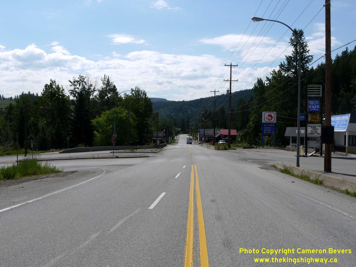

Left - Facing east along the Crowsnest Highway (Hwy 3) at the Hwy 33 Junction in Rock Creek. See an
Enlarged Photo Here. (Photograph taken on June 13, 2017 - © Cameron Bevers) Right - Distance guide sign on the westbound Crowsnest Highway (Hwy 3) departing Rock Creek. Between here and Osoyoos, Hwy 3 climbs quickly towards Anarchist Summit. The elevation of the mountain pass is 1,233 metres (4,045 feet) above sea level. The summit lies about 20 km west of the Hwy 33 Junction. See an Enlarged Photo Here. (Photograph taken on June 13, 2017 - © Cameron Bevers) 

Left - Approaching Rock Creek on the eastbound Crowsnest Highway (Hwy 3). See an
Enlarged Photo Here. (Photograph taken on June 13, 2017 - © Cameron Bevers) Right - Junction assembly for the upcoming Hwy 33 Junction on eastbound Hwy 3 in Rock Creek. See an Enlarged Photo Here. (Photograph taken on June 13, 2017 - © Cameron Bevers) |
|---|
Links to Adjacent BC Highway Photograph Pages:
Back to BC Highway 31A Photos /
British Columbia Highways Photo Index /
On to BC Highway 41 Photos
Ontario Highway History - Main Menu / Vacation Highway Photos - Main Menu Website contents, photos & text © 2002-2026, Cameron
Bevers (Webmaster) - All Rights Reserved / Contact Me
|
|---|