
| 
| |
|
|
This page contains photographs of British Columbia's Highway 23 (Nakusp-Revelstoke Highway), arranged by location from Nakusp
northerly to Revelstoke. All photographs displayed on this page were taken by the Webmaster (Cameron Bevers). To view photos of other British Columbia Highways,
please select a highway number listed on the British Columbia Photograph Index Page. Click on any
thumbnail to see a larger image!
Please note that all photographs displayed on this website are protected by copyright. These photographs must not be
reproduced, published, electronically stored or copied, distributed, or posted onto other websites without my written permission. If you want to use photos from this
website, please email me first for permission. Thank-you!
|
|---|
|
Page 1: BC Highway 23 Photographs: Nakusp to Revelstoke


Left - Facing west along Hwy 6 towards Downtown Nakusp from the Hwy 23 Junction. See an
Enlarged Photo Here. (Photograph taken on June 7, 2015 - © Cameron Bevers) Right - Approaching the Hwy 23 Junction on eastbound Hwy 6 in Nakusp. See an Enlarged Photo Here. (Photograph taken on June 7, 2015 - © Cameron Bevers) 

Left - Guide sign marking the Hwy 6 & Hwy 23 Junction departing Nakusp. At the highway junction, Hwy 6 turns right and heads south towards Nelson, while
Hwy 23 continues straight ahead towards Revelstoke. See an Enlarged Photo Here. (Photograph taken on June 7, 2015 - © Cameron Bevers) Right - Facing north towards Revelstoke at the Hwy 6 & Hwy 23 Junction at Nakusp. See an Enlarged Photo Here. (Photograph taken on June 7, 2015 - © Cameron Bevers) 

Left - Guide sign on northbound Hwy 6 approaching the Hwy 23 Junction in Nakusp. At the highway junction, Hwy 6 turns left and heads through Downtown Nakusp on
its route west towards Vernon. The text on this highway sign is in Federal Highways Administration (FHWA) Highway Gothic font, which is an uncommon sign font for
British Columbia. See an Enlarged Photo Here. (Photograph taken on June 7, 2015 - © Cameron Bevers) Right - Hwy 6 & Hwy 23 route markers approaching the highway junction in Nakusp. See an Enlarged Photo Here. (Photograph taken on June 7, 2015 - © Cameron Bevers) 

Left - Facing north along Hwy 6 at the Hwy 6 & Hwy 23 Junction in Nakusp. The turn to Hwy 23 is channelized, as this is the predominant movement at this
highway junction. Although a loop route of Hwy 6 is signed through the northern end of Nakusp, this route is mostly intended for trucks bound for Hwy 23. A much
shorter cut-off route can be found between Hwy 6 South and Hwy 6 West via Government Hill Road and Nelson Avenue through Nakusp. See an
Enlarged Photo Here. (Photograph taken on June 7, 2015 - © Cameron Bevers) Right - Facing south along Hwy 6 from the Hwy 23 Junction in Nakusp. See an Enlarged Photo Here. (Photograph taken on June 7, 2015 - © Cameron Bevers) 

Left - Southern terminus of Hwy 23 at the Hwy 6 Junction in Nakusp. At this highway junction, traffic can continue straight ahead via Hwy 6 West through
Downtown Nakusp, or turn left and follow Hwy 6 South towards Nelson. See an
Enlarged Photo Here. (Photograph taken on June 7, 2015 - © Cameron Bevers) Right - Hwy 6 route markers marking the upcoming highway junction at Nakusp. Hwy 6 is signed as a north-south highway from the Canada-United States Boundary to Nakusp, and then signed as an east-west highway between Nakusp and Vernon. See an Enlarged Photo Here. (Photograph taken on June 7, 2015 - © Cameron Bevers) 

Left - Facing north along Hwy 23 from the Hwy 6 Junction in Nakusp. The route of Hwy 23 crosses Upper Arrow Lake via a ferry crossing. The ferry dock at Galena
Bay lies about half-way between Nakusp and Revelstoke and provides hourly crossings (on the half-hour) from 5:30 am to 12:30 am daily. The ferry crossing takes about
25 minutes. See an Enlarged Photo Here. (Photograph taken on June 7, 2015 - © Cameron Bevers) Right - Sign on southbound Hwy 23 advising trucks to turn left onto Hwy 6 to head to Nelson and Castlegar. See an Enlarged Photo Here. (Photograph taken on June 7, 2015 - © Cameron Bevers) 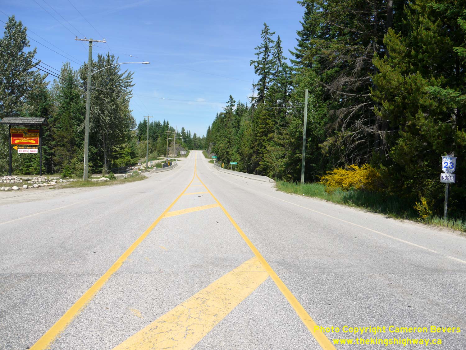

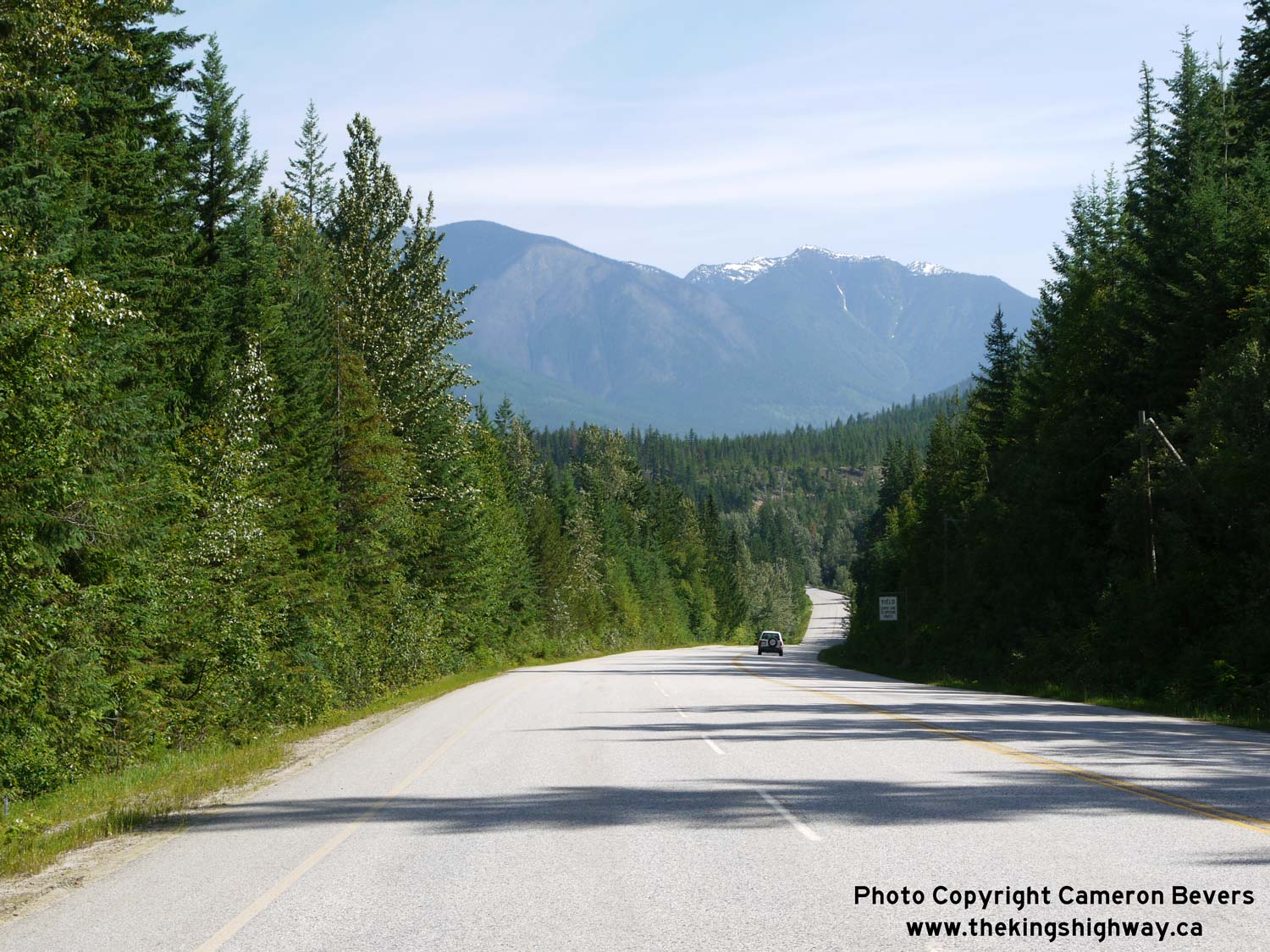
Left - Facing north towards Revelstoke along Hwy 23 departing Nakusp. There are no services along the roughly 100 km (60 mile) route of Hwy 23 between Nakusp
and Revelstoke. See an Enlarged Photo Here. (Photograph taken on June 7, 2015 - © Cameron Bevers) Right - Distance guide sign on northbound Hwy 23 departing Nakusp. See an Enlarged Photo Here. (Photograph taken on June 7, 2015 - © Cameron Bevers) 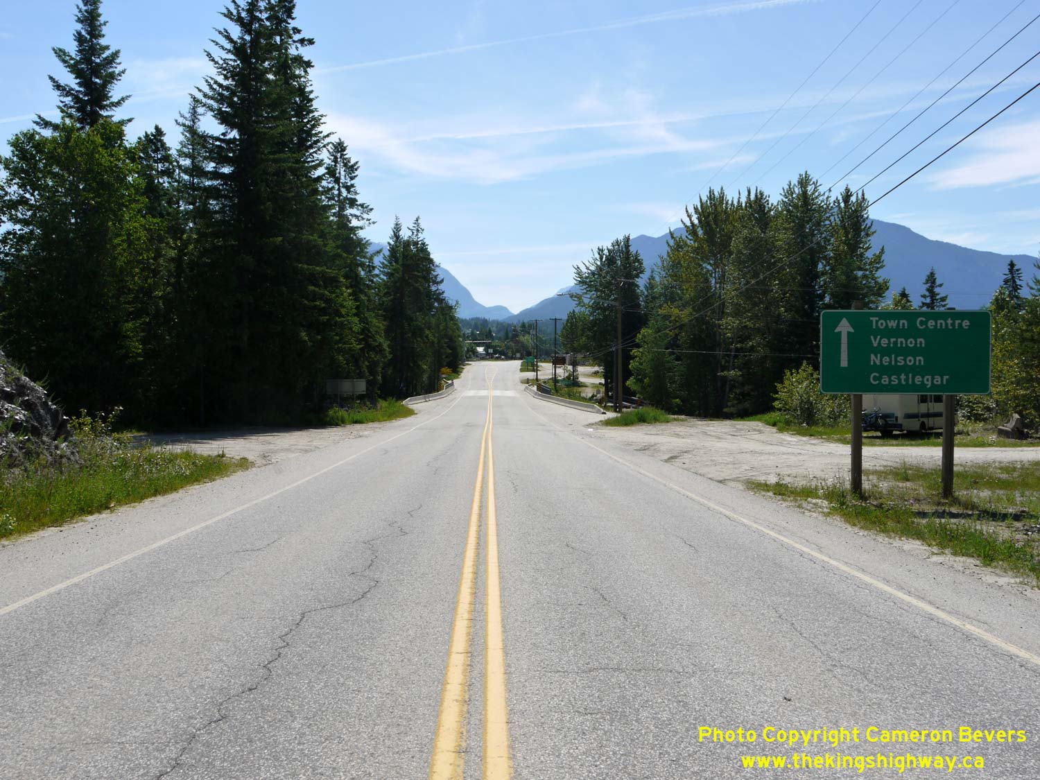
Left - Guide sign on southbound Hwy 23 approaching Nakusp. All non-truck traffic is encouraged to follow the Hwy 6 alternate route via Nelson Avenue through
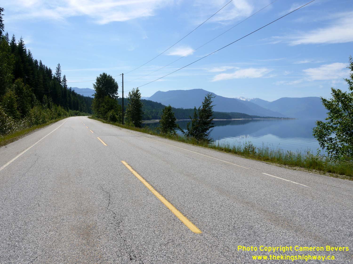
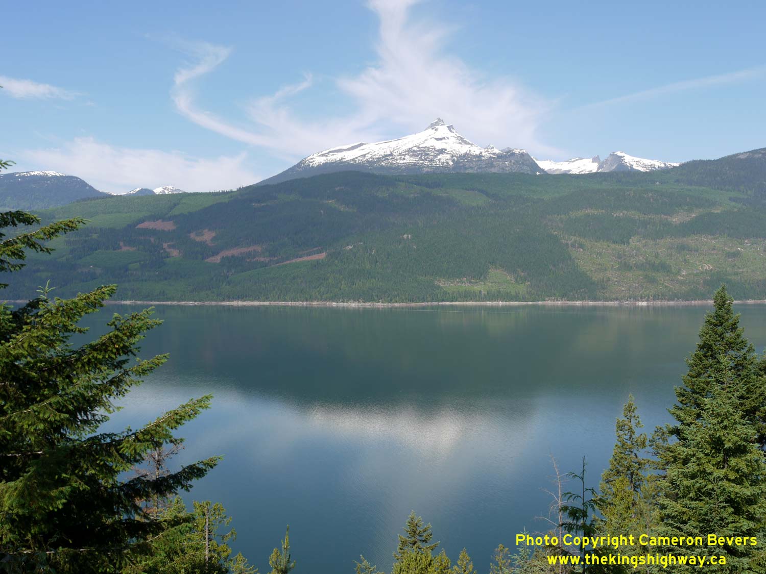
Downtown Nakusp. See an Enlarged Photo Here. (Photograph taken on June 7, 2015 - © Cameron Bevers) Right - This spectacular view of Upper Arrow Lake can be found about 6 km north of Nakusp. See an Enlarged Photo Here. (Photograph taken on June 7, 2015 - © Cameron Bevers) 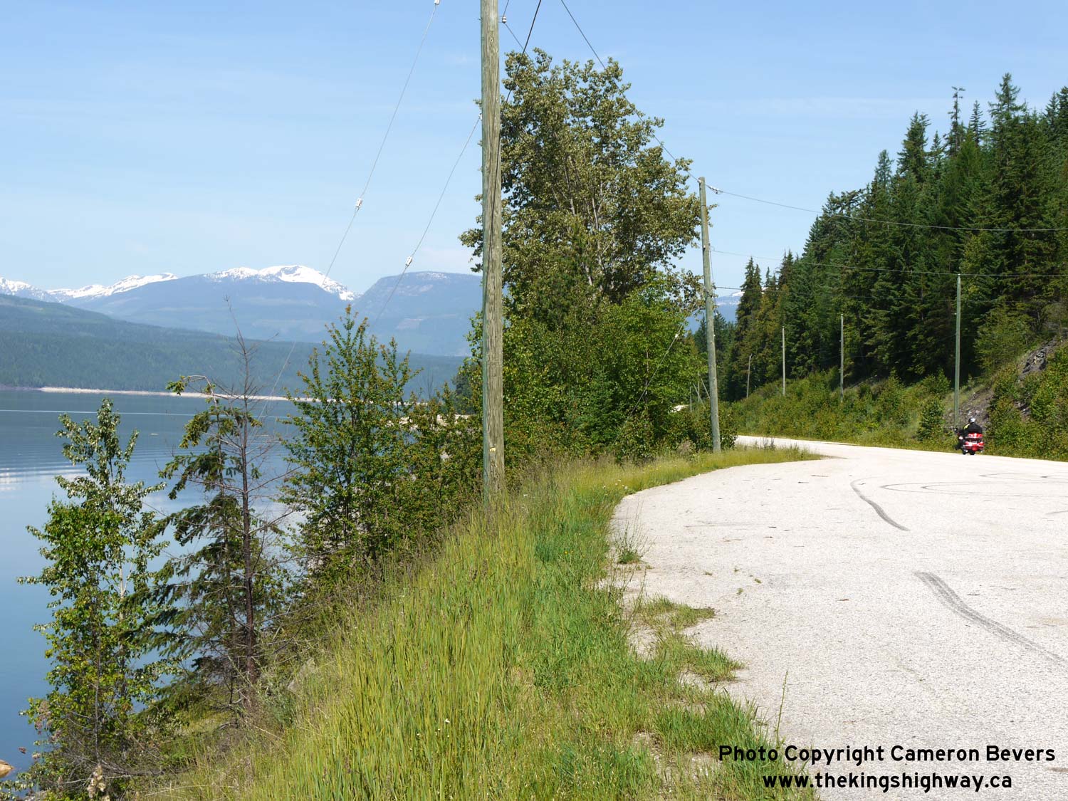
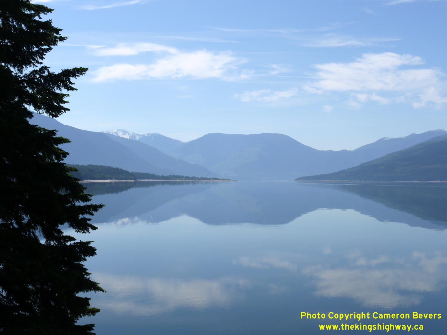
Left - Snow-capped peaks beside Upper Arrow Lake, as seen from the roadside turnout on Hwy 23 located about 6 km north of Nakusp. See an
Enlarged Photo Here. (Photograph taken on June 7, 2015 - © Cameron Bevers) Right - Scenic Upper Arrow Lake as seen from Hwy 23, about 6 km north of Nakusp. See an Enlarged Photo Here. (Photograph taken on June 7, 2015 - © Cameron Bevers) 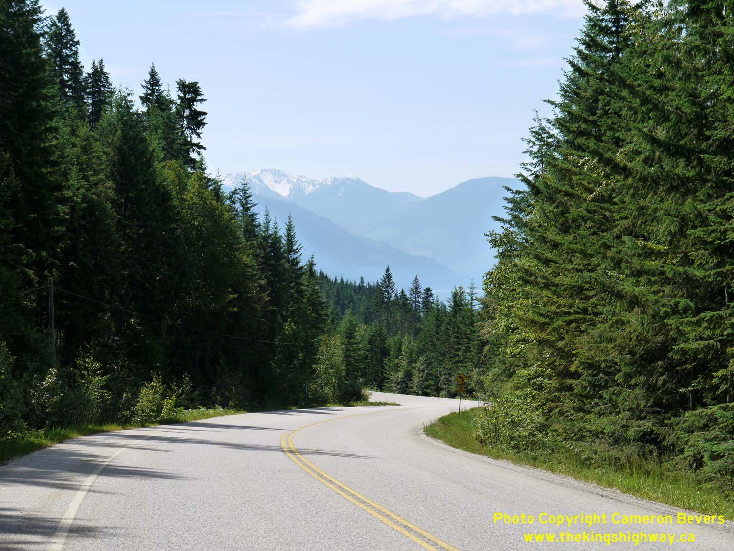

Left - Reverse curve on Hwy 23 about 9 km north of Nakusp, facing south. See an
Enlarged Photo Here. (Photograph taken on June 7, 2015 - © Cameron Bevers) Right - Silver Mountain rises majestically above Upper Arrow Lake in this view along Hwy 23 about 14 km north of Nakusp. See an Enlarged Photo Here. (Photograph taken on June 7, 2015 - © Cameron Bevers) 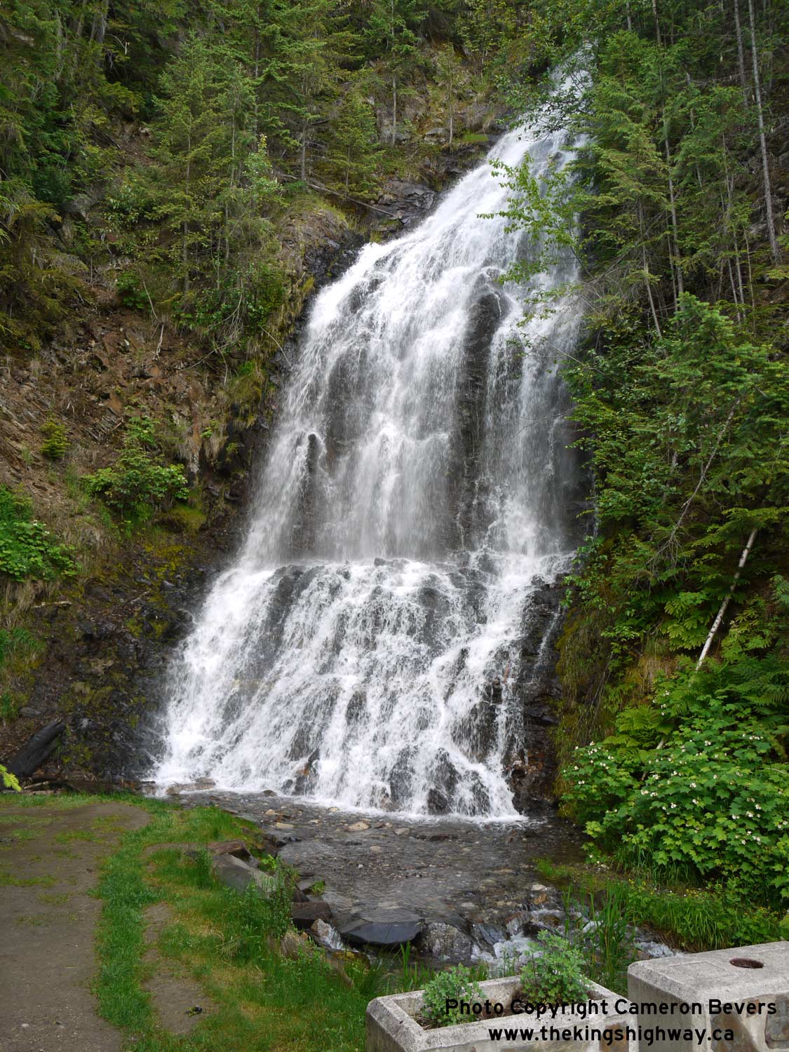
Above - This small waterfall is the highlight of the Ione Falls Roadside Park along Hwy 23, about 20 km north of Nakusp. See an
Enlarged Photo Here. (Photograph taken on June 7, 2015 - © Cameron Bevers) 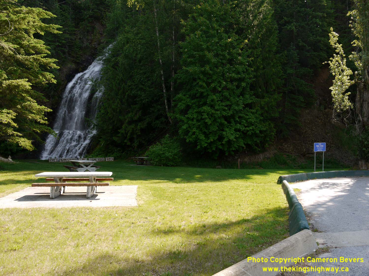
Left - View of the Ione Falls Roadside Park along Hwy 23 between Nakusp and Galena Bay. See an
Enlarged Photo Here. (Photograph taken on June 7, 2015 - © Cameron Bevers) Right - This long grade on Hwy 23 about 22 km north of Nakusp has a southbound passing lane so that faster vehicles can overtake slow trucks. See an Enlarged Photo Here. (Photograph taken on June 7, 2015 - © Cameron Bevers) 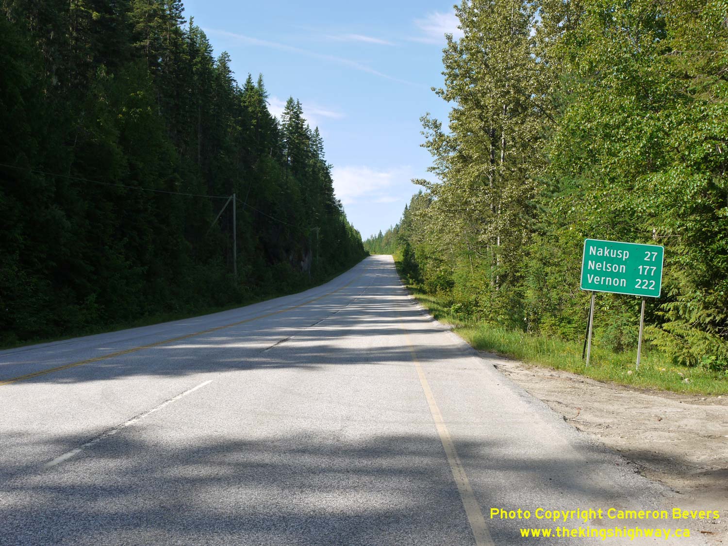
Left - Distance guide sign on southbound Hwy 23 between Galena Bay and Nakusp. See an
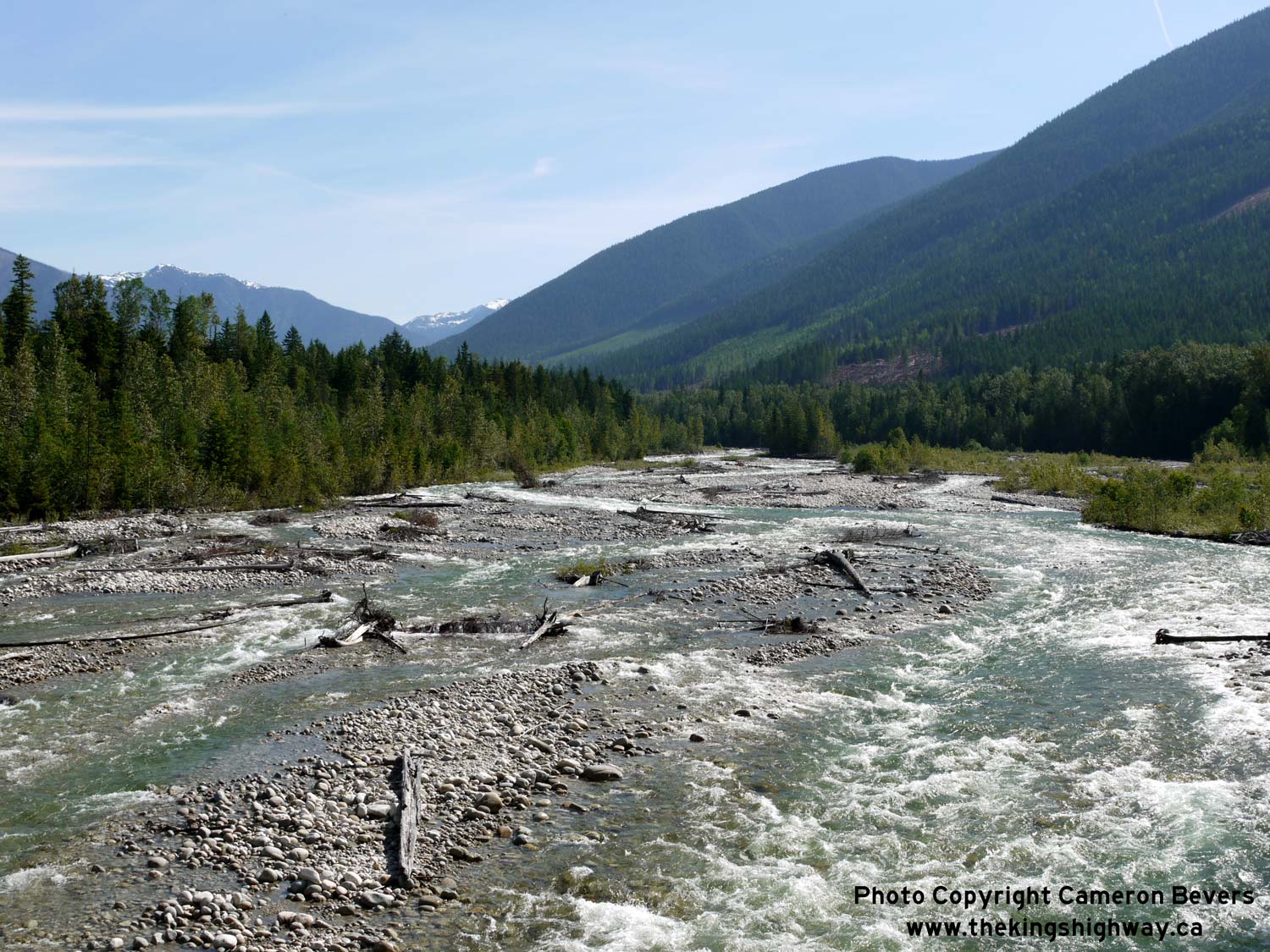
Enlarged Photo Here. (Photograph taken on June 7, 2015 - © Cameron Bevers) Right - Scenic view of the Halfway River from Hwy 23 near St. Leon. See an Enlarged Photo Here. (Photograph taken on June 7, 2015 - © Cameron Bevers) 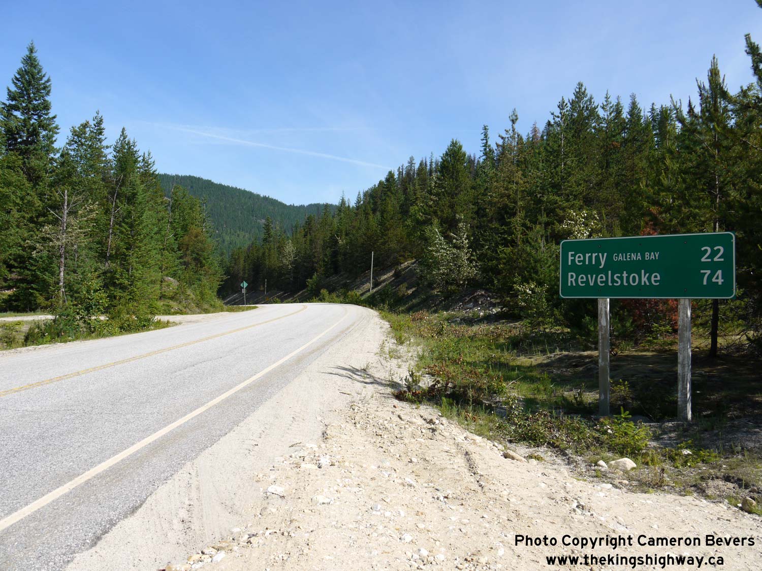
Left - Distance guide sign on northbound Hwy 23 between Nakusp and Galena Bay. See an
Enlarged Photo Here. (Photograph taken on June 7, 2015 - © Cameron Bevers) Right - View of Mount Burnham from Hwy 23, about 35 km north of Nakusp. The highway passes through a heavily-forested area north of Nakusp, so views of the mountains to the west of Upper Arrow Lake are infrequent but nevertheless rewarding. See an Enlarged Photo Here. (Photograph taken on June 7, 2015 - © Cameron Bevers) 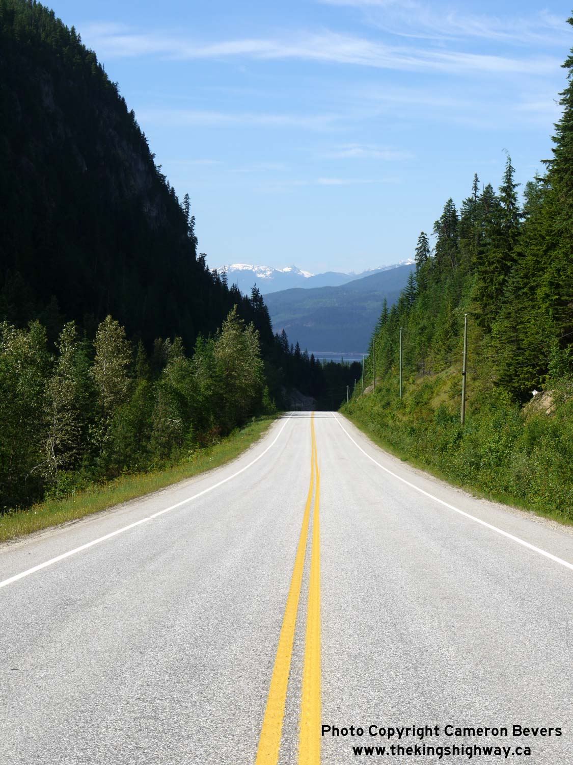
Above - Although it lies 50 km away to the south, Pinnacle Peak can be seen on the horizon along Hwy 23, about 37 km north of Nakusp. See an
Enlarged Photo Here. (Photograph taken on June 7, 2015 - © Cameron Bevers) 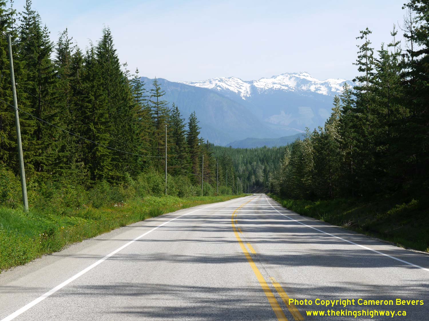

Left - The Selkirk Mountains begin to appear on the horizon in this view of Hwy 23, 41 km north of Nakusp. See an
Enlarged Photo Here. (Photograph taken on June 7, 2015 - © Cameron Bevers) Right - Approaching the Hwy 31 Junction on Hwy 23, facing north towards Galena Bay. See an Enlarged Photo Here. (Photograph taken on June 7, 2015 - © Cameron Bevers) 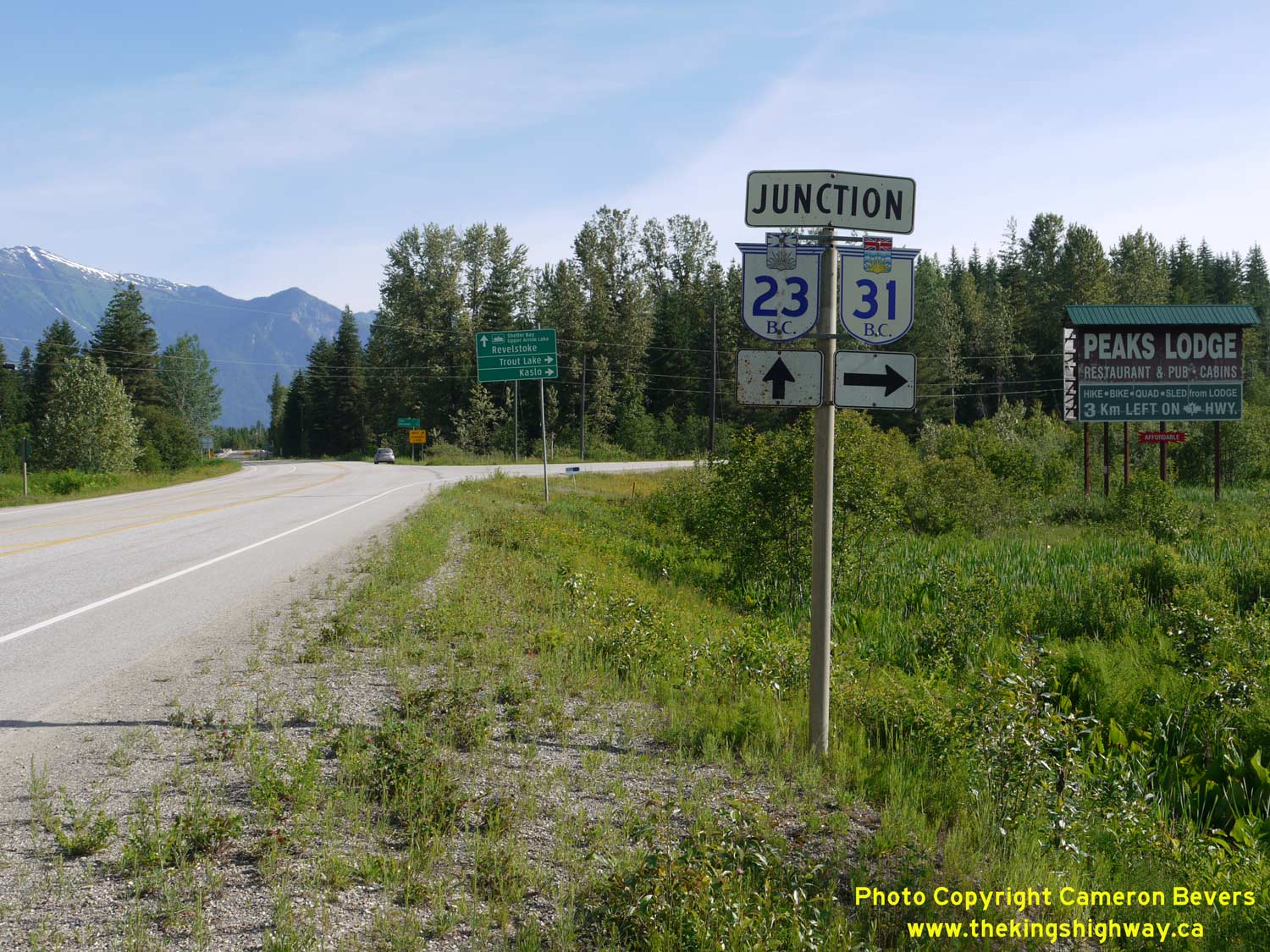

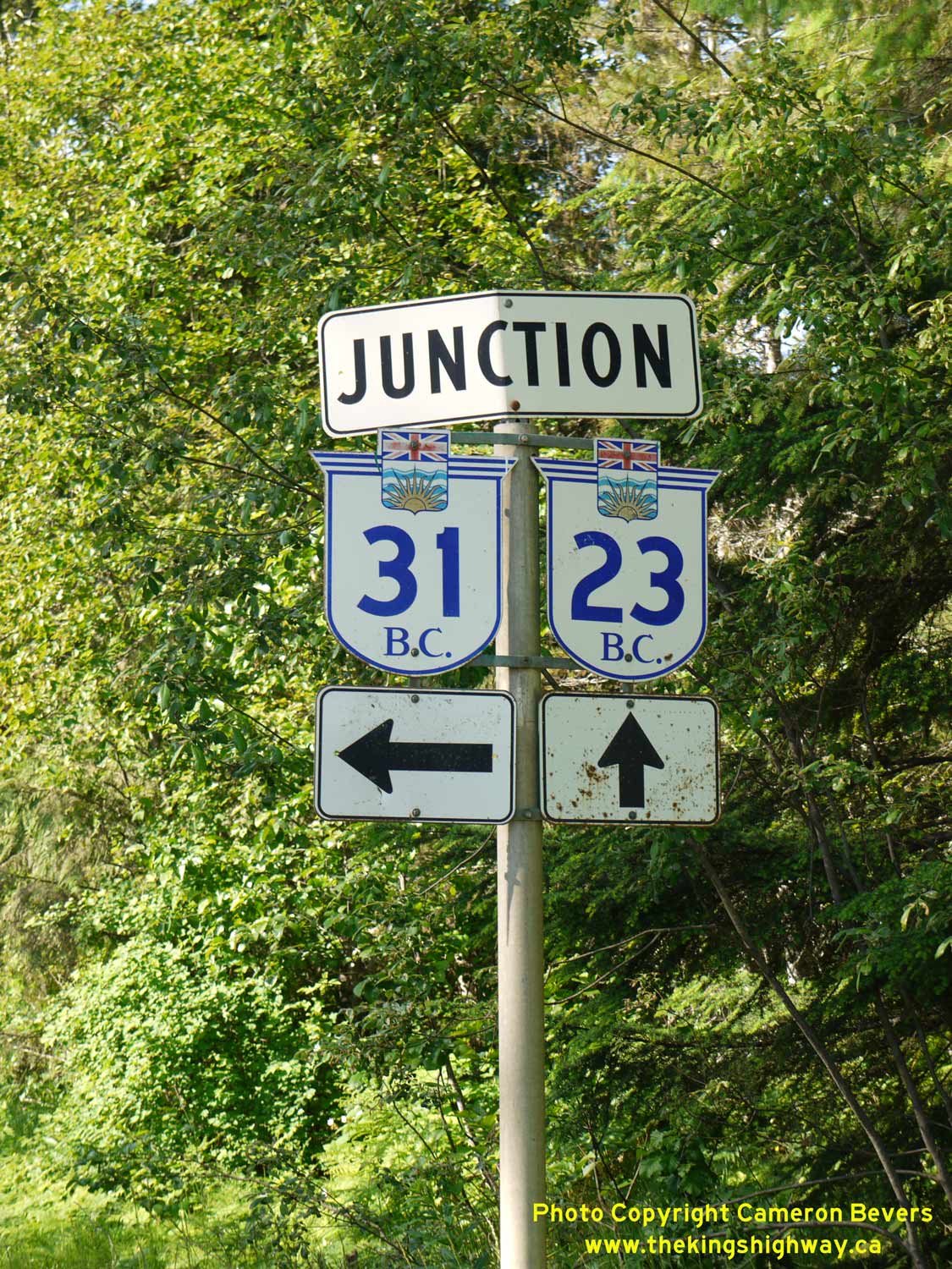
Left - Junction signs marking the Hwy 23 & Hwy 31 Junction, facing north. The two highways join together just south of the Galena Bay Ferry Dock. See an
Enlarged Photo Here. (Photograph taken on June 7, 2015 - © Cameron Bevers) Right - Destination guide sign on northbound Hwy 23 at the Hwy 31 Junction near Galena Bay. See an Enlarged Photo Here. (Photograph taken on June 7, 2015 - © Cameron Bevers) 

Left - Facing south along Hwy 23 towards Nakusp from the Hwy 31 Junction. See an
Enlarged Photo Here. (Photograph taken on June 7, 2015 - © Cameron Bevers) Right - Facing south along Hwy 31 from the Hwy 23 Junction. Hwy 31 heads deep into the Selkirk Mountains, before slowly looping back south towards the Nelson area via Kaslo. This highway is narrow and winding and is not recommended for heavy trucks. See an Enlarged Photo Here. (Photograph taken on June 7, 2015 - © Cameron Bevers) 

Left - Facing north along Hwy 31, approaching the Hwy 23 Junction near Galena Bay. See an
Enlarged Photo Here. (Photograph taken on June 7, 2015 - © Cameron Bevers) Right - Approaching the northern terminus of Hwy 31 at the Hwy 23 Junction near Galena Bay. Traffic can either turn left and follow Hwy 23 south to Nakusp or turn right and follow Hwy 23 north to Revelstoke via the Upper Arrow Lake Ferry at Galena Bay. See an Enlarged Photo Here. (Photograph taken on June 7, 2015 - © Cameron Bevers) 
Left - Close-up view of the Hwy 23 junction signs on northbound Hwy 31 approaching Galena Bay. See an
Enlarged Photo Here. (Photograph taken on June 7, 2015 - © Cameron Bevers) Right - Junction assembly on southbound Hwy 23 approaching the Hwy 31 Junction. See an Enlarged Photo Here. (Photograph taken on June 7, 2015 - © Cameron Bevers) 

Left - Facing south along Hwy 23 towards the Hwy 31 Junction near Galena Bay. See an
Enlarged Photo Here. (Photograph taken on June 7, 2015 - © Cameron Bevers) Right - Approaching the Hwy 31 Junction on Hwy 23, facing south. See an Enlarged Photo Here. (Photograph taken on June 7, 2015 - © Cameron Bevers) 
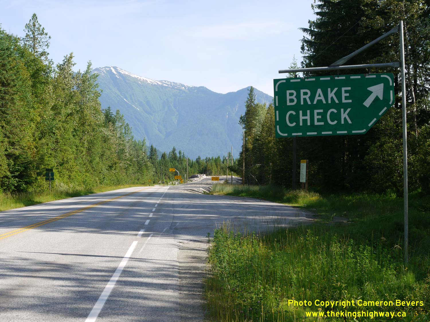
Left - Distance guide sign on northbound Hwy 23 at the Hwy 31 Junction. The Galena Bay Ferry Dock lies 2 km to the north. See an
Enlarged Photo Here. (Photograph taken on June 7, 2015 - © Cameron Bevers) Right - Sign marking a truck brake check area on northbound Hwy 23 approaching the Galena Bay Ferry Dock. The approach to the ferry dock is very steep. See an Enlarged Photo Here. (Photograph taken on June 7, 2015 - © Cameron Bevers) 
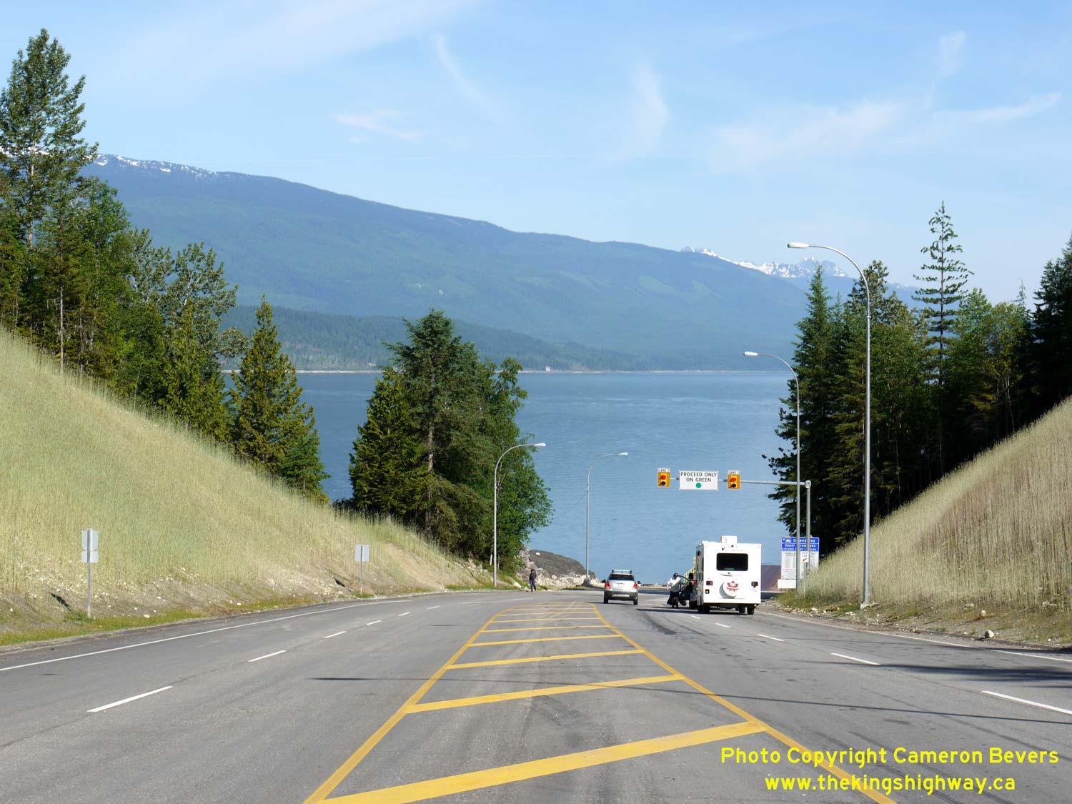
Left - Facing south along Hwy 23 from the Galena Bay Ferry Dock. A passing lane exists immediately south of the ferry dock, as heavy vehicles would encounter
difficulty ascending this grade from a stop condition. See an Enlarged Photo Here. (Photograph taken on June 7, 2015 - © Cameron Bevers) Right - Approaching the Galena Bay Ferry Dock on northbound Hwy 23. There are two traffic lanes provided in the ferry staging area. See an Enlarged Photo Here. (Photograph taken on June 7, 2015 - © Cameron Bevers) 
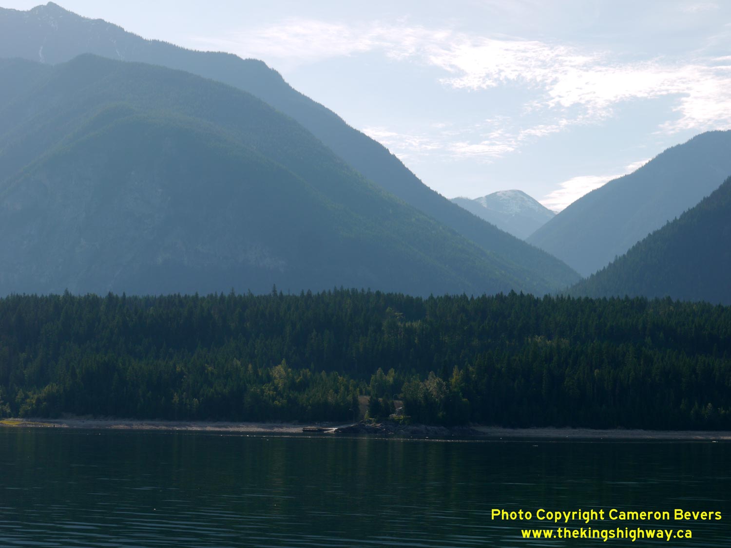
Left - View of the Galena Bay Ferry Dock on Hwy 23, following the ferry's departure. Upper Arrow Lake is a hydro-electric reservoir, so the lake's surface
elevation changes throughout the year. The ferry dock is adjusted periodically by sliding the dock up or down the concrete ramp in the background. See an
Enlarged Photo Here. (Photograph taken on June 7, 2015 - © Cameron Bevers) Right - The spectacular Selkirk Mountains appear along the northeast shore of Upper Arrow Lake, as seen from the Galena Bay Ferry Dock on Hwy 23. During the 1950s and early 1960s, the Trans-Canada Highway was forged through the exceptionally rugged terrain of Rogers Pass, which lies about 70 km to the northeast across these mountains. See an Enlarged Photo Here. (Photograph taken on June 7, 2015 - © Cameron Bevers) 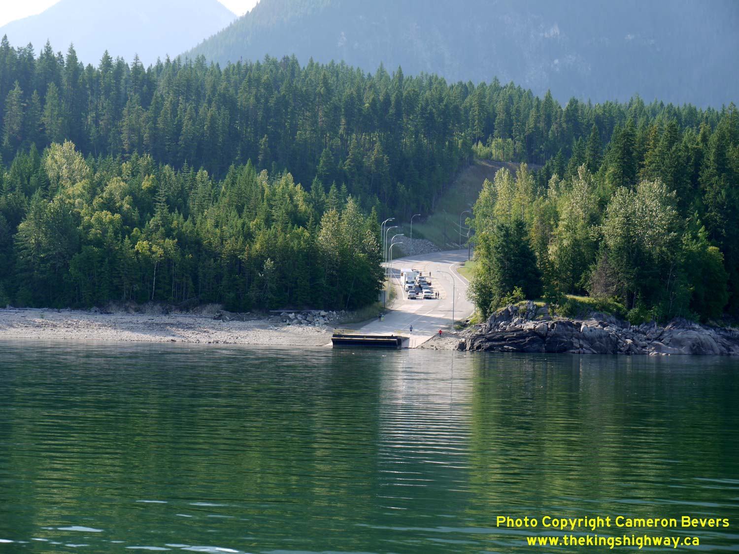
Left - View of the Galena Bay Ferry Dock on the eastern side of Upper Arrow Lake. See an
Enlarged Photo Here. (Photograph taken on June 7, 2015 - © Cameron Bevers) Right - As the ferry pulls away from the Galena Bay Ferry Dock, the size of the mountains on the eastern side of Upper Arrow Lake come into view. Although Hwy 23 turns south towards Nakusp immediately south of the Galena Bay Ferry Dock, the route of Hwy 31 passes through these mountains on its route south towards Kaslo. See an Enlarged Photo Here. (Photograph taken on June 7, 2015 - © Cameron Bevers) 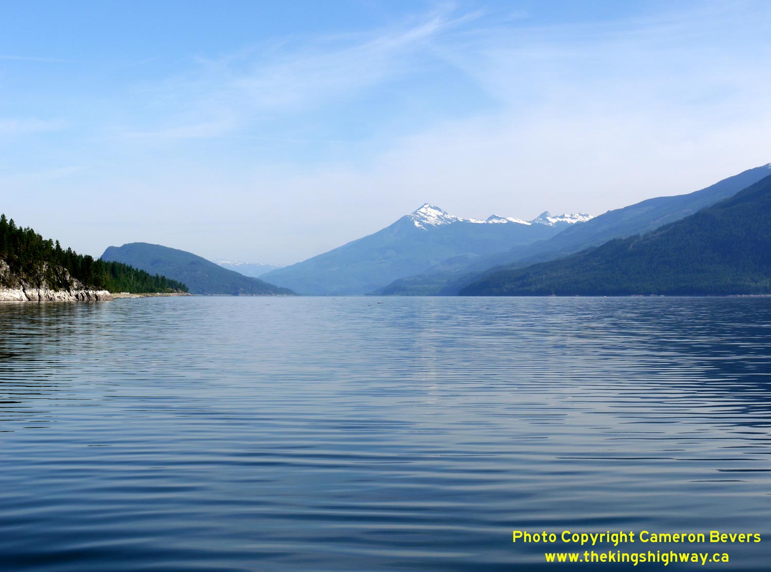

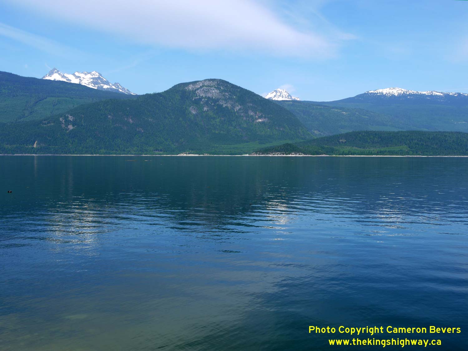
Left - This spectacular view of Mount Cartier can be seen beside Upper Arrow Lake from the Galena Bay-Shelter Bay Ferry. See an
Enlarged Photo Here. (Photograph taken on June 7, 2015 - © Cameron Bevers) Right - View of Upper Arrow Lake, facing south from the Galena Bay-Shelter Bay Ferry on Hwy 23. See an Enlarged Photo Here. (Photograph taken on June 7, 2015 - © Cameron Bevers) 

Left - Approaching the Shelter Bay Ferry Dock on the western side of Upper Arrow Lake. See an
Enlarged Photo Here. (Photograph taken on June 7, 2015 - © Cameron Bevers) Right - The ferry pulls into the Shelter Bay Ferry Dock, carrying northbound Hwy 23 traffic heading to Revelstoke. This is a free ferry service, with no fares charged. See an Enlarged Photo Here. (Photograph taken on June 7, 2015 - © Cameron Bevers) 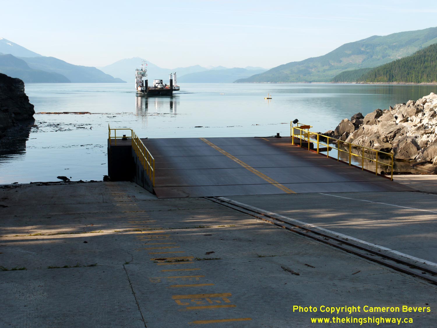

Left - View of the adjustable ramp of the Shelter Bay Ferry Dock. The yellow stripes on the concrete ramp in the foreground indicate the lake levels. The ramp
is towed up and down the grade on tracks embedded into the pavement. See an
Enlarged Photo Here. (Photograph taken on June 7, 2015 - © Cameron Bevers) Right - Facing south along Hwy 23 at the Shelter Bay Ferry Dock. A fantastic view of Upper Arrow Lake can be seen from the approach to the dock. See an Enlarged Photo Here. (Photograph taken on June 7, 2015 - © Cameron Bevers) 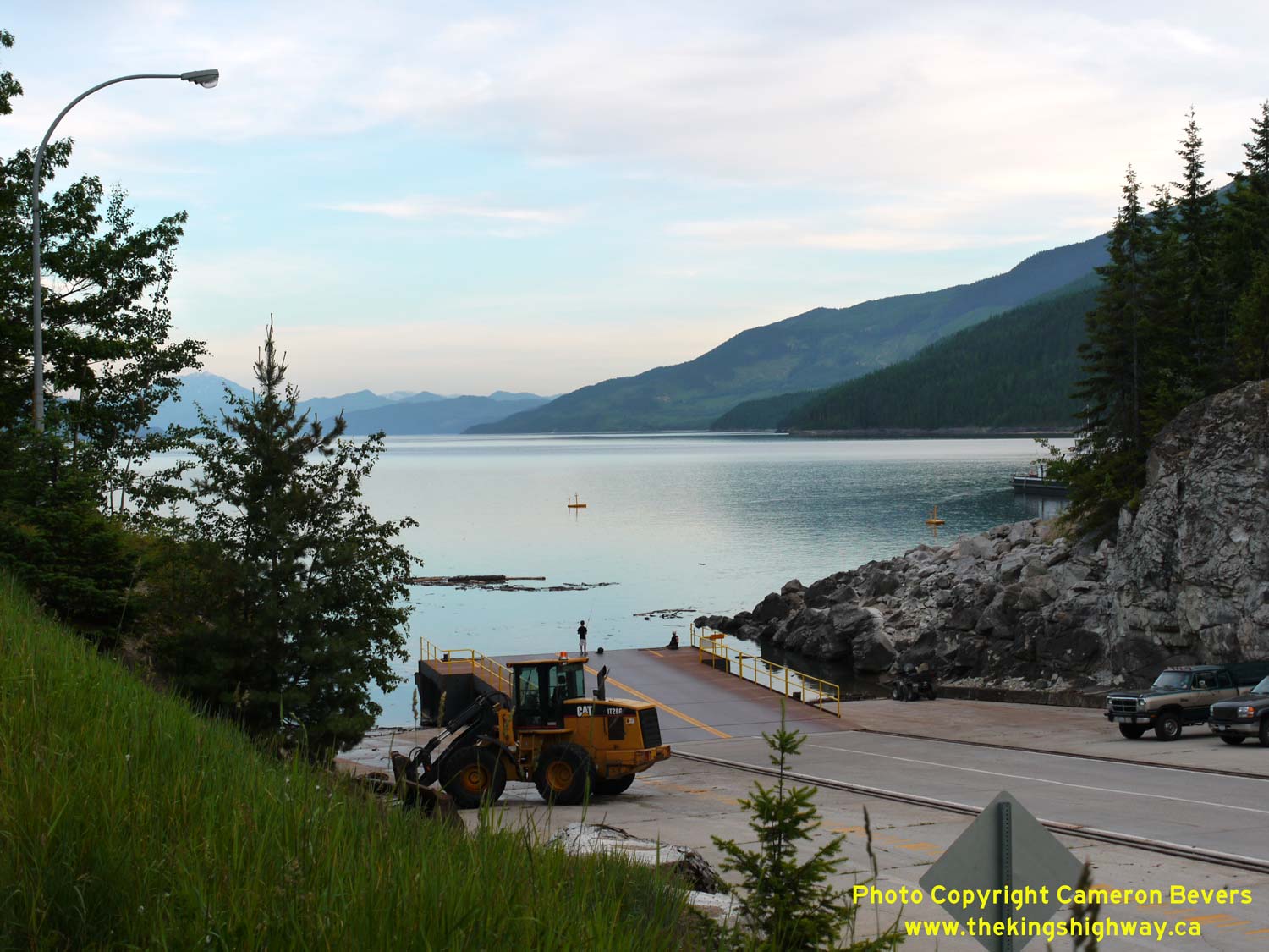

Left - Late evening view of the Shelter Bay Ferry Dock on Upper Arrow Lake. See an
Enlarged Photo Here. (Photograph taken on June 6, 2015 - © Cameron Bevers) Right - Dusk over Upper Arrow Lake. The ferry can be seen crossing over from Shelter Bay to Galena Bay in the background. See an Enlarged Photo Here. (Photograph taken on June 6, 2015 - © Cameron Bevers) 
Left - Sign showing the Upper Arrow Lake Ferry crossing times. Hourly crossings (on the hour, except at 5:10 am) depart from Shelter Bay from 6:00 am to 12:00
am daily. See an Enlarged Photo Here. (Photograph taken on June 6, 2015 - © Cameron Bevers) Right - Departing the Shelter Bay Ferry Dock on northbound Hwy 23. There is no settlement at Shelter Bay, so the next community on Hwy 23 heading north is Revelstoke. See an Enlarged Photo Here. (Photograph taken on June 6, 2015 - © Cameron Bevers) 

Left - Approaching the Shelter Bay Ferry Dock on southbound Hwy 23. There are two traffic lanes provided in the ferry staging area. See an
Enlarged Photo Here. (Photograph taken on June 6, 2015 - © Cameron Bevers) Right - Facing north along Hwy 23 towards Revelstoke near the Shelter Bay Ferry Dock. Hwy 23 briefly widens to a four-lane divided highway as it departs the ferry staging area. See an Enlarged Photo Here. (Photograph taken on June 6, 2015 - © Cameron Bevers) 
Left - Facing south along Hwy 23 approaching the Shelter Bay Ferry Dock. Both Upper Arrow Lake Ferry Docks underwent a substantial reconstruction and capacity
expansion project over the last few years. See an Enlarged Photo Here. (Photograph taken on June 6, 2015 - © Cameron Bevers) Right - Distance guide sign on northbound Hwy 23 departing the Shelter Bay Ferry Dock. See an Enlarged Photo Here. (Photograph taken on June 6, 2015 - © Cameron Bevers) 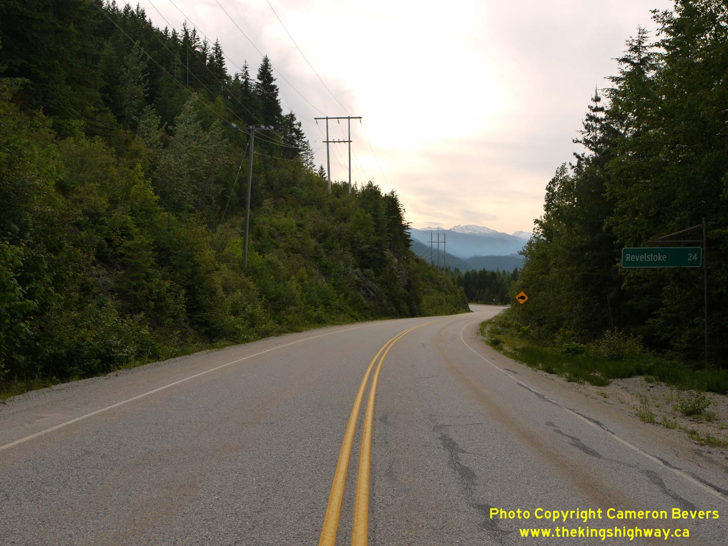

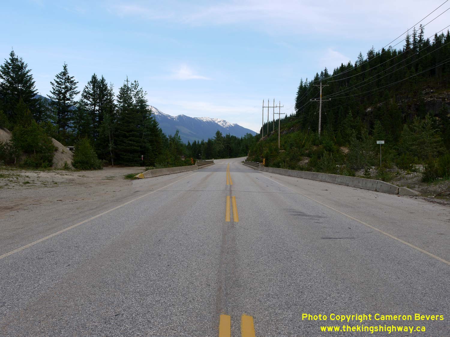
Left - Distance guide sign on northbound Hwy 23, about 24 km north of the Shelter Bay Ferry Dock. See an
Enlarged Photo Here. (Photograph taken on June 6, 2015 - © Cameron Bevers) Right - South approach to the Blanket Creek Bridge on Hwy 23. Mount Copeland can be seen in the distance. See an Enlarged Photo Here. (Photograph taken on June 6, 2015 - © Cameron Bevers) 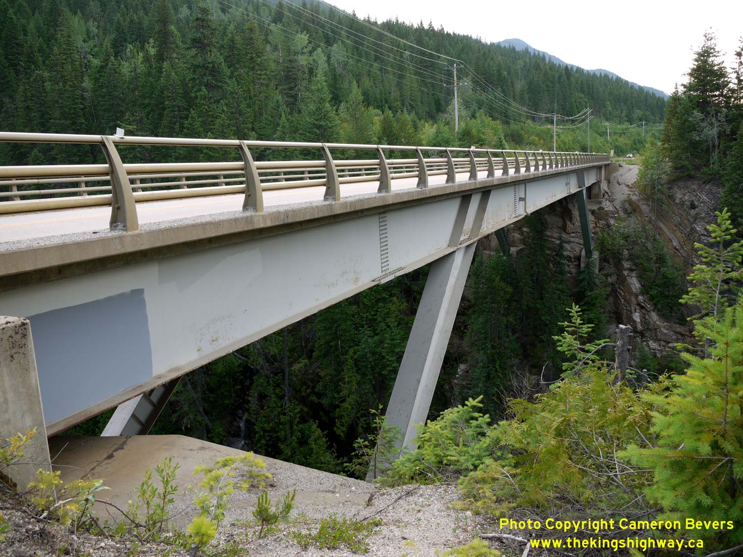
Left - Side view of the impressive Blanket Creek Bridge on Hwy 23. This highway bridge sits roughly 200 feet above the Blanket Creek Canyon. See an
Enlarged Photo Here. (Photograph taken on June 6, 2015 - © Cameron Bevers) Right - Facing south across the Blanket Creek Bridge on Hwy 23, about 23 km south of Revelstoke. See an Enlarged Photo Here. (Photograph taken on June 6, 2015 - © Cameron Bevers) 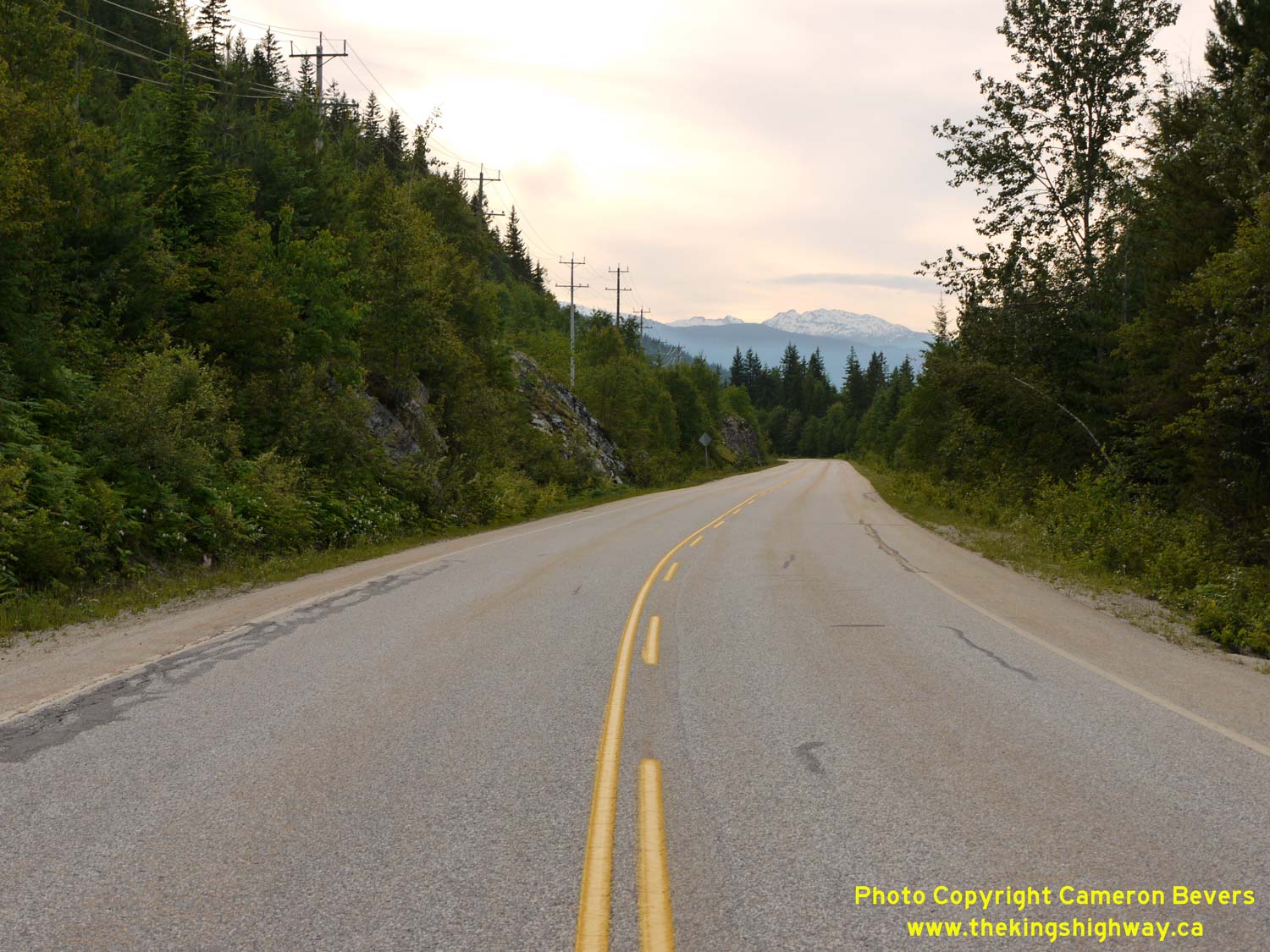

Left - View of Hwy 23 north of the Blanket Creek Bridge, facing north towards Revelstoke. See an
Enlarged Photo Here. (Photograph taken on June 6, 2015 - © Cameron Bevers) Right - Facing north along Hwy 23, about 21 km south of Revelstoke. Mount Copeland can be seen in the background. See an Enlarged Photo Here. (Photograph taken on June 6, 2015 - © Cameron Bevers) 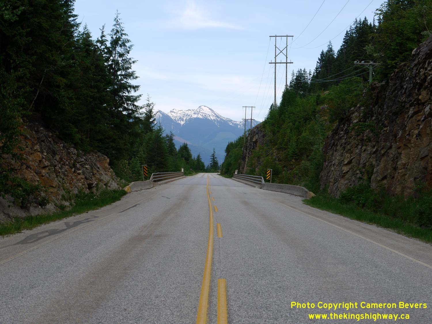

Left - Facing south along Hwy 23 approaching the Mulvehill Creek Bridge. McCrae Peak can be seen in the distance on the eastern side of Upper Arrow Lake. See
an Enlarged Photo Here. (Photograph taken on June 6, 2015 - © Cameron Bevers) Right - This stunning view of Upper Arrow Lake can be seen from the Mulvehill Creek Bridge on Hwy 23. Although the town itself lies just out of sight, Revelstoke is situated on the Columbia River at the northern end of Upper Arrow Lake. See an Enlarged Photo Here. (Photograph taken on June 6, 2015 - © Cameron Bevers) 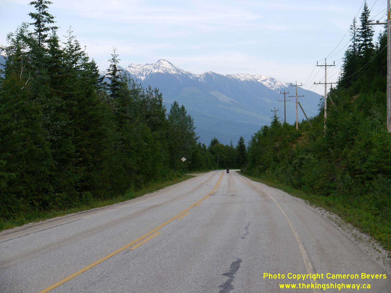

Left - The mountains on the eastern side of Upper Arrow Lake form a nice background along this section of Hwy 23, located about 17 km south of Revelstoke. See
an Enlarged Photo Here. (Photograph taken on June 6, 2015 - © Cameron Bevers) Right - Facing south along Hwy 23 towards Nakusp, about 10 km south of Revelstoke. See an Enlarged Photo Here. (Photograph taken on June 6, 2015 - © Cameron Bevers) 

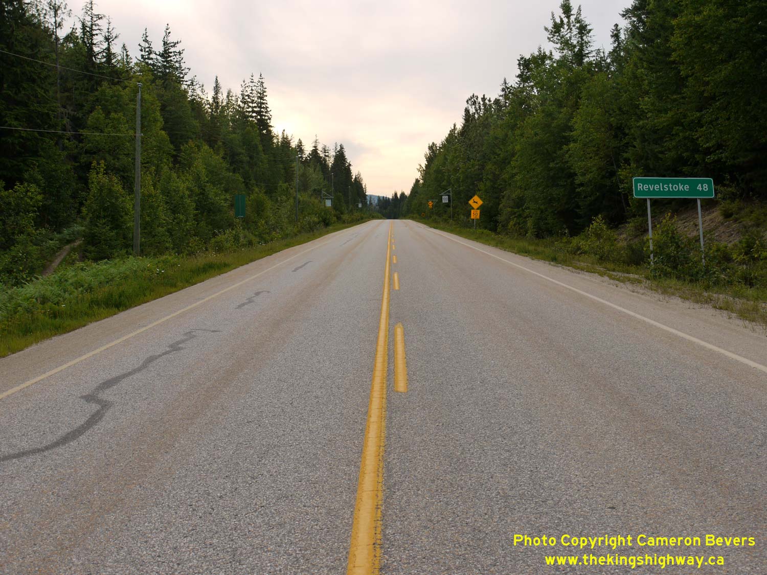
Left - The glaciated peak of Mount Begbie can be seen rising above Hwy 23 in this view, about 3 km south of Revelstoke. See an
Enlarged Photo Here. (Photograph taken on June 6, 2015 - © Cameron Bevers) Right - Distance guide sign on southbound Hwy 23 departing Revelstoke. See an Enlarged Photo Here. (Photograph taken on June 6, 2015 - © Cameron Bevers) 

Left - Sign advising motorists to check their fuel on southbound Hwy 23 departing Revelstoke. Hwy 23 passes through a rather remote and sparsely-populated area
south of Revelstoke. The next services available along Hwy 23 are at the Hwy 6 Junction in Nakusp, located almost 100 km to the south. See an
Enlarged Photo Here. (Photograph taken on June 6, 2015 - © Cameron Bevers) Right - Departing Revelstoke on Hwy 23, facing south towards Nakusp. See an Enlarged Photo Here. (Photograph taken on June 6, 2015 - © Cameron Bevers) 

Left - Facing south along the Nakusp-Revelstoke Highway (Hwy 23 South) from the Hwy 1 Junction near Revelstoke. See an
Enlarged Photo Here. (Photograph taken on June 6, 2015 - © Cameron Bevers) Right - Sign at the Hwy 1 & Hwy 23 Junction, indicating the crossing times for the Arrow Lake Ferry between Galena Bay and Shelter Bay on Hwy 23. See an Enlarged Photo Here. (Photograph taken on June 6, 2015 - © Cameron Bevers) 

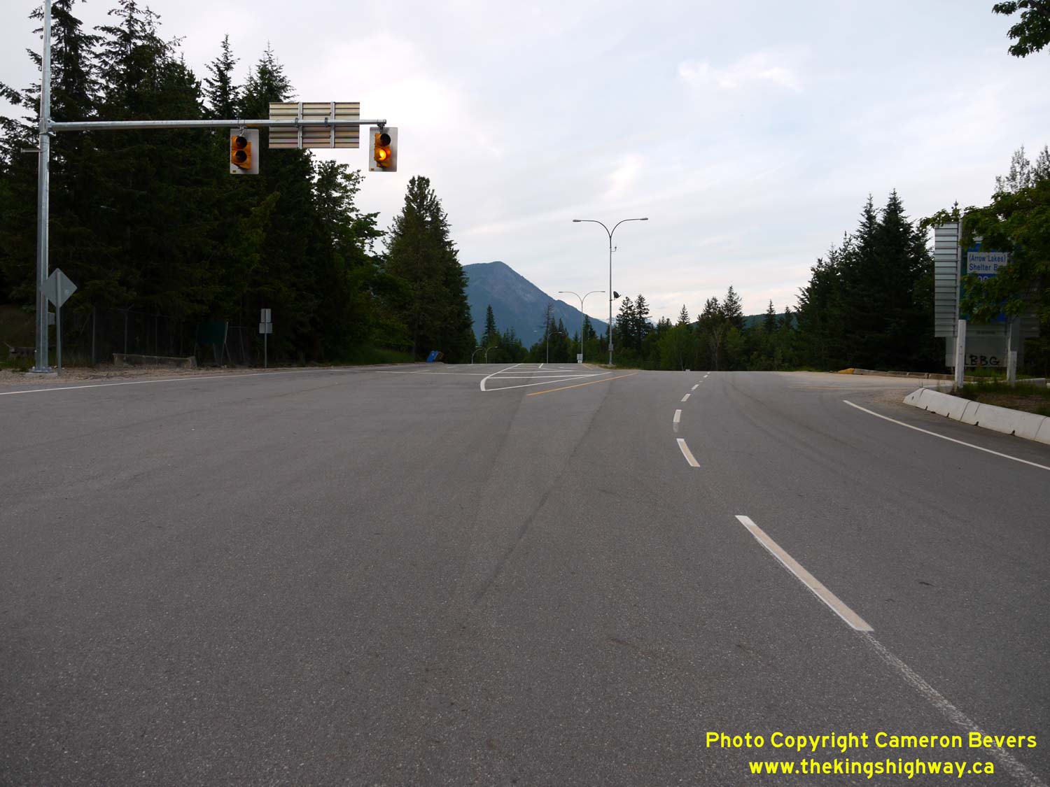
Left - Facing north along Hwy 23 towards the Trans-Canada Highway (Hwy 1) Junction near Revelstoke. The route of Hwy 23 turns right at the traffic signals in
the background and briefly heads east through Revelstoke, concurrently with Hwy 1. Hwy 23 continues north from Revelstoke towards Mica Creek as the Big Bend Highway.
See an Enlarged Photo Here. (Photograph taken on June 6, 2015 - © Cameron Bevers) Right - Junction of Hwy 1 & Hwy 23 near Revelstoke, facing north. The exit from the truck staging area can be seen on the far side of the intersection. See an Enlarged Photo Here. (Photograph taken on June 6, 2015 - © Cameron Bevers) 

Left - Overhead guide sign on the westbound Trans-Canada Highway (Hwy 1 & Hwy 23) approaching the turn-off to Hwy 23 South just west of Revelstoke. Hwy 23
is an important north-south highway link. Apart from Hwy 97 (the Okanagan Highway), Hwy 23 is the only north-south through route in the central part of British
Columbia. The route of Hwy 23 ends at the Hwy 6 Junction in Nakusp. From Nakusp, motorists can either continue south along Hwy 6 towards Nelson and Castlegar, or use
Hwy 6 as an alternate route to the Okanagan Valley via Vernon. See an
Enlarged Photo Here. (Photograph taken on June 6, 2015 - © Cameron Bevers) Right - Facing east along the Trans-Canada Highway (Hwy 1 & Hwy 23) from the Hwy 23 South turn-off to Nakusp. A large parking lot at left was built as a staging area for transport trucks and other vehicles, who are forced to stop in Revelstoke during unexpected road closures in the area. The highway through Rogers Pass is closed from time to time due to poor weather conditions and avalanche risks. See an Enlarged Photo Here. (Photograph taken on June 6, 2015 - © Cameron Bevers) 

Left - Facing west along the Trans-Canada Highway (Hwy 1) from the Hwy 23 South Junction near Revelstoke. West of Revelstoke, Hwy 1 climbs up through the
Monashee Mountains towards Sicamous through Eagle Pass. See an Enlarged Photo Here. (Photograph taken on June 6, 2015 - © Cameron Bevers) Right - Approaching the Hwy 23 South Junction on Hwy 1, facing east towards Revelstoke. See an Enlarged Photo Here. (Photograph taken on June 6, 2015 - © Cameron Bevers) 
Above - Junction sign assembly on eastbound Hwy 1 approaching the Hwy 23 South Junction. See an
Enlarged Photo Here. (Photograph taken on June 6, 2015 - © Cameron Bevers)
Continue north along BC Highway 23 from Revelstoke to Mica Dam |
|---|
Links to Adjacent BC Highway Photograph Pages:
Back to BC Highway 12 Photos /
British Columbia Highways Photo Index /
On to BC Highway 24 Photos
Ontario Highway History - Home / Vacation Highway Photos - Home Website contents, photos & text © 2002-2026, Cameron
Bevers (Webmaster) - All Rights Reserved / Contact Me
|
|---|